Blog
Back in July 2021, we released the capability for others to embed Worldview into their own sites in response to a desire by science and news organizations to provide a mechanism for their readers to interactively explore NASA data as part of their storytelling process. This "embed mode" provided a streamlined interface to focus on specific interactions such as comparing how a forest looks before and after a wildfire.
We unfortunately needed to take this mode offline in December 2022, but we've been working hard with multiple teams to bring it back online since then. The good news: it's back! The caveat is that Worldview embedding on non-NASA sites is disabled by default; you'll need to contact us to enable embedding Worldview on your site by writing to us at support@earthdata.nasa.gov or clicking on the "i" icon in Worldview's upper right corner and selecting "Send Feedback".
We're excited to have this capability again - please get in touch whenever you're ready to use it!
Background information on Embed mode:
- Worldview’s New Embed Feature Makes Telling Data-Driven Stories Easier than Ever
- Examples of Embedded Worldview
- Technical documentation on embedding Worldview
Sample of an embedded Worldview instance from the Worldview Image of the Week: High Aerosol Index from Smoky Canadian Fires. Click the Play button in the lower left corner (or the bottom center of the page depending on the width of your browser window) to view an animation spanning August 1 to September 6, 2023, showing high Aerosol Index values due to continued wildfires in Canada.
Worldview is now providing users with the ability to toggle on/off classifications that were previously hidden to the user as transparent pixel values.
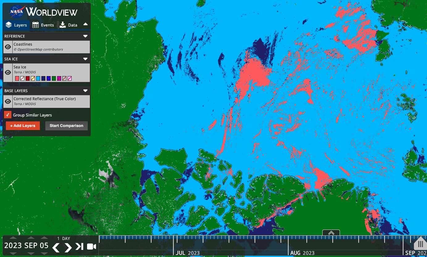
In the example below, the Sea Ice Extent layer previously showed only the sea ice values (Figure 1), but the colormap included other potentially interesting and useful classifications, such as Cloud, Land, Missing Data, etc. Users can now toggle on/off these other classifications (Figure 2) to show relevant information like the location of clouds that may obscure sea ice. Now users have more contextual information to assess these visualizations.
Below is a list of the layers that now show previously hidden pixel classifications.
Figure 1: Sea Ice classification layer from the MODIS instrument aboard the Terra satellite. Sea ice is shown in dark pink, overlaid on a corrected reflectance image from the same satellite and sensor.
Figure 2. Sea Ice classification layer from the MODIS instrument aboard the Terra satellite. Sea ice is shown in dark pink, cloud in light blue, ocean in dark blue, and land in green. With these other classifications displayed, we now have a better idea of what areas that may have had sea ice were actually obscured by cloud, and the areas that are land masses.
Layers that now show previously hidden pixel classifications
| Satellite/Sensor | Layer Name and link to Worldview | Layer ID |
|---|---|---|
| Terra/MODIS | Cloud Phase Infrared (Day) | MODIS_Terra_Cloud_Phase_Infrared_Day |
| Terra/MODIS | Cloud Phase Infrared (Night) | MODIS_Terra_Cloud_Phase_Infrared_Night |
| Aqua/MODIS | Cloud Phase Infrared (Day) | MODIS_Aqua_Cloud_Phase_Infrared_Day |
| Aqua/MODIS | Cloud Phase Infrared (Night) | MODIS_Aqua_Cloud_Phase_Infrared_Night |
| Terra/MODIS | Cloud Phase Optical Properties | MODIS_Terra_Cloud_Phase_Optical_Properties |
| Aqua/MODIS | Cloud Phase Optical Properties | MODIS_Aqua_Cloud_Phase_Optical_Properties |
| Terra/MODIS | Cloud Multi Layer Flag | MODIS_Terra_Cloud_Multi_Layer_Flag |
| Aqua/MODIS | Cloud Multi Layer Flag | MODIS_Aqua_Cloud_Multi_Layer_Flag |
| Terra/MODIS | Areas of No Data (mask) | MODIS_Terra_Data_No_Data |
| Aqua/MODIS | Areas of No Data (mask) | MODIS_Aqua_Data_No_Data |
| Terra and Aqua/MODIS | Flood (2-Day Window) | MODIS_Combined_Flood_2-Day |
| Terra and Aqua/MODIS | Flood (3-Day Window) | MODIS_Combined_Flood_3-Day |
| Terra/MODIS | Sea Ice | MODIS_Terra_Sea_Ice |
| Aqua/MODIS | Sea Ice | MODIS_Aqua_Sea_Ice |
| Terra/MODIS | Sea Ice Extent (L3, Daily) | MODIS_Terra_L3_Sea_Ice_Daily |
| Aqua/MODIS | Sea Ice Extent (L3, Daily) | MODIS_Aqua_L3_Sea_Ice_Daily |
| Terra/MODIS | Land/Water Mask (L3, Annual) | MODIS_Terra_L3_Land_Water_Mask |
| DSWx-HLS | OPERA Dynamic Surface Water Extent Provisional | OPERA_Dynamic_Surface_Water_Extent |
| SMAP/Radiometer | Freeze/Thaw 9 km (L3, Passive, Day) | SMAP_L3_Passive_Enhanced_Day_Freeze_Thaw |
| SMAP/Radiometer | Freeze/Thaw 9 km (L3, Passive, Night) | SMAP_L3_Passive_Enhanced_Night_Freeze_Thaw |
| SMAP/Radiometer | Freeze/Thaw 36 km (L3, Passive, Day) | SMAP_L3_Passive_Day_Freeze_Thaw |
| SMAP/Radiometer | Freeze/Thaw 36 km (L3, Passive, Night) | SMAP_L3_Passive_Night_Freeze_Thaw |
| Aqua/AMSR-E | Freeze/Thaw (Daily Landscape) | MEaSUREs_Daily_Landscape_Freeze_Thaw_AMSRE |
| DMSP/SSMI | Freeze/Thaw (Daily Landscape) | MEaSUREs_Daily_Landscape_Freeze_Thaw_SSMI |
We've recently made some updates and additions to our GIBS API documentation and examples of using GIBS with various web mapping libraries, so If you're interested in retrieving NASA Earth Science imagery visualizations via the Global Imagery Browse Services (GIBS) to use in your own applications, you've come to the right place!
NASA's Global Imagery Browse Services (GIBS) system provides visualizations of NASA Earth Science observations through standardized web services. You can access these via GIS Applications, Map Libraries and GDAL Scripts, and via Python.
The Accessing via Python is our newest addition to the GIBS API documentation. This section covers topics showing you how to connect to GIBS via Web Map Service (WMS) and Web Map Tile Service (WMTS), how to visualize raster and vector data/imagery, and provides examples of simple analyses and applications. All of the examples are also downloadable as a Jupyter Notebook.
We also recently updated our GitHub GIBS Web Examples repository, gibs-web-examples, which has examples of using GIBS with various web mapping libraries, like OpenLayers, Leaflet, Cesium, Mapbox GL, Bing, and Google Maps. We updated all the libraries to the latest working versions and we've also added a MapLibre GL example. All you have to do is clone and install the repo, then you can get started! You can also view Live Examples listed in the README section like a Rolling Seven Day Slider in OpenLayers or Global Web Mercator imagery in Cesium, visit the Live Examples section to see more.
Relevant Links
- GIBS API Documentation: GIBS API for Developers
- GIBS Imagery Visualization Layers: GIBS Visualization Product Catalog
- GitHub GIBS Web Examples repo: GIBS Web Examples
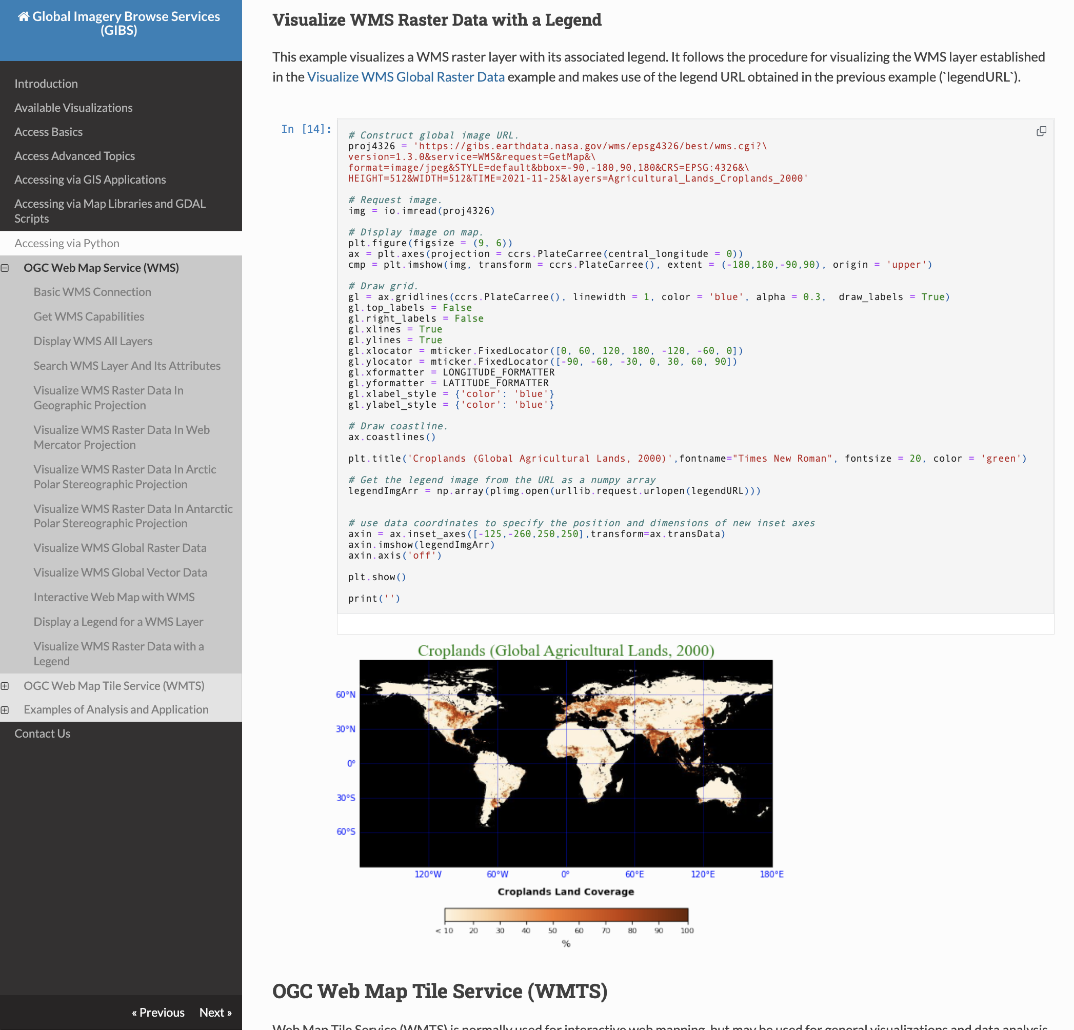
Screenshot of the GIBS API Documentation, Accessing via Python, Visualize WMS Raster Data with a Legend section.
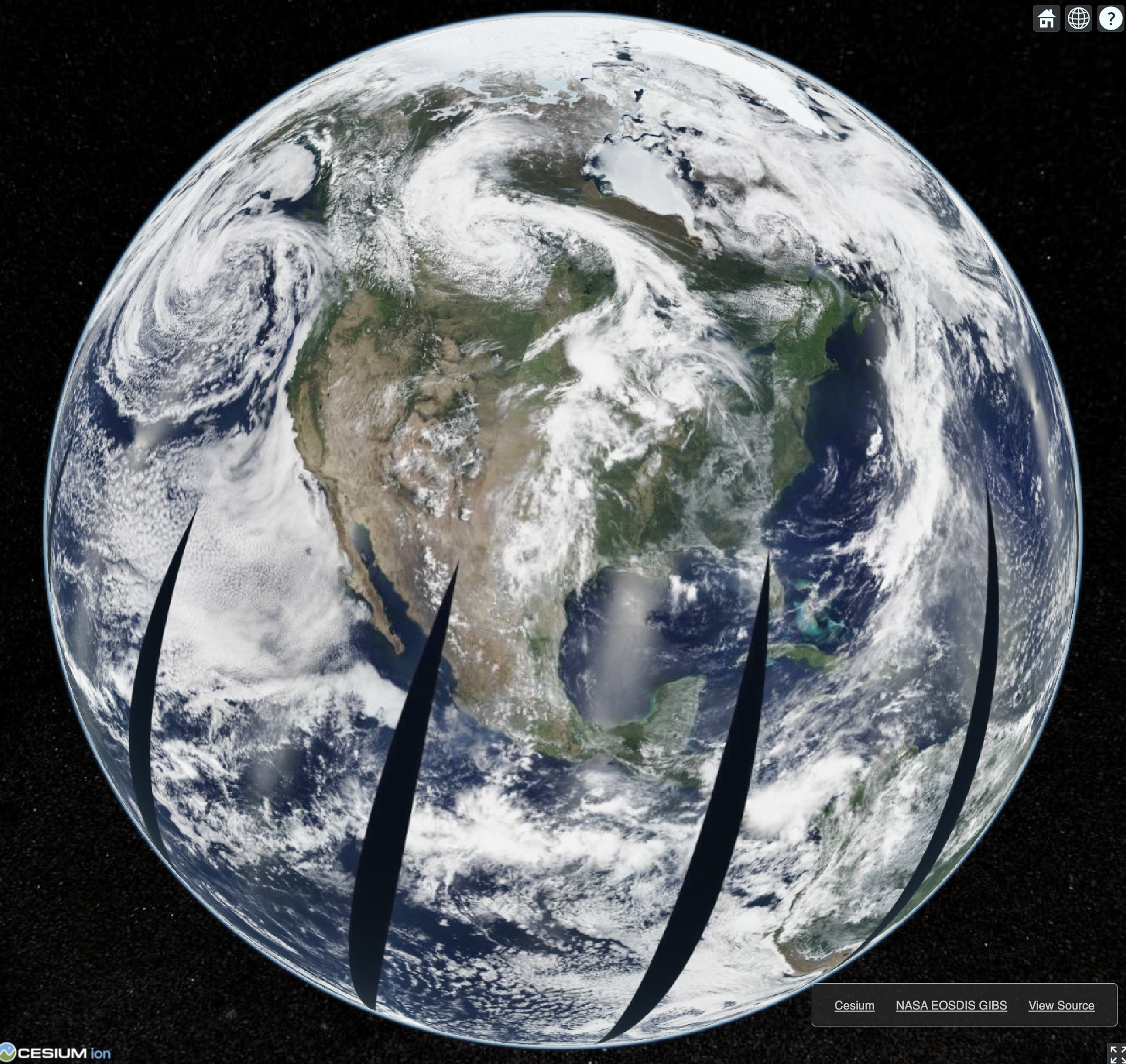
Screenshot of GIBS imagery displayed on a 3D globe in Cesium.
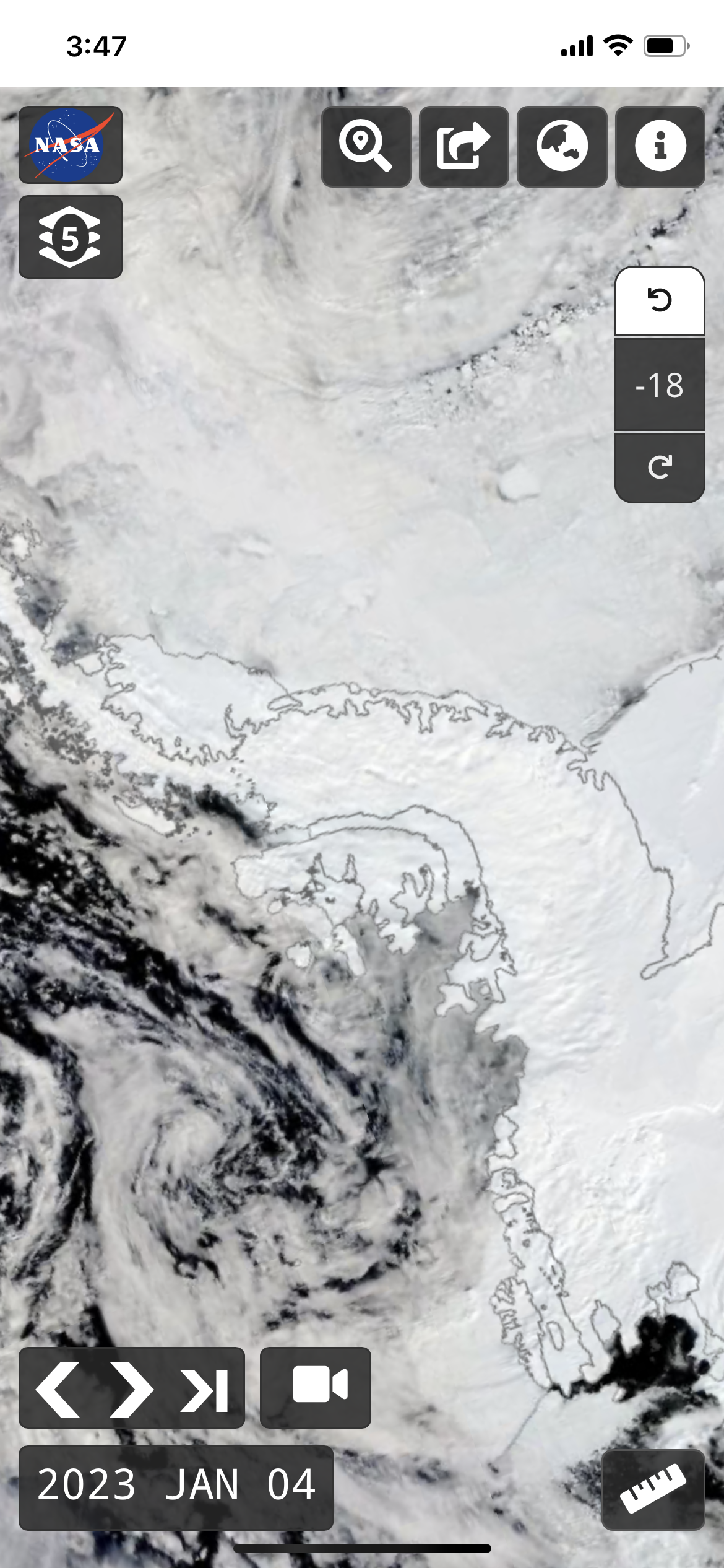
Did you know that NASA Worldview is available for use on mobile devices? While it may not have all of the functionality that is available when you access it via a browser on your desktop computer or laptop, you can still do a lot of the same things!
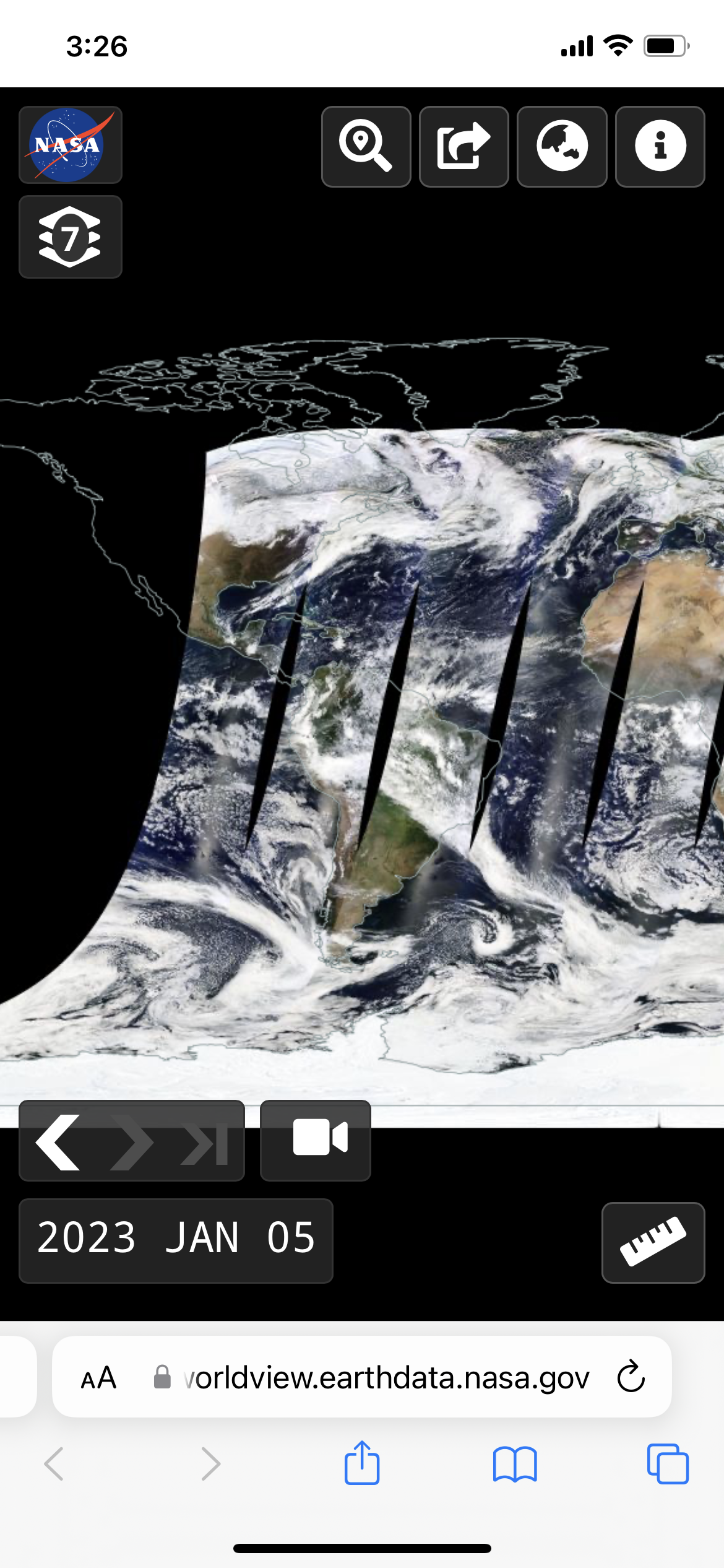
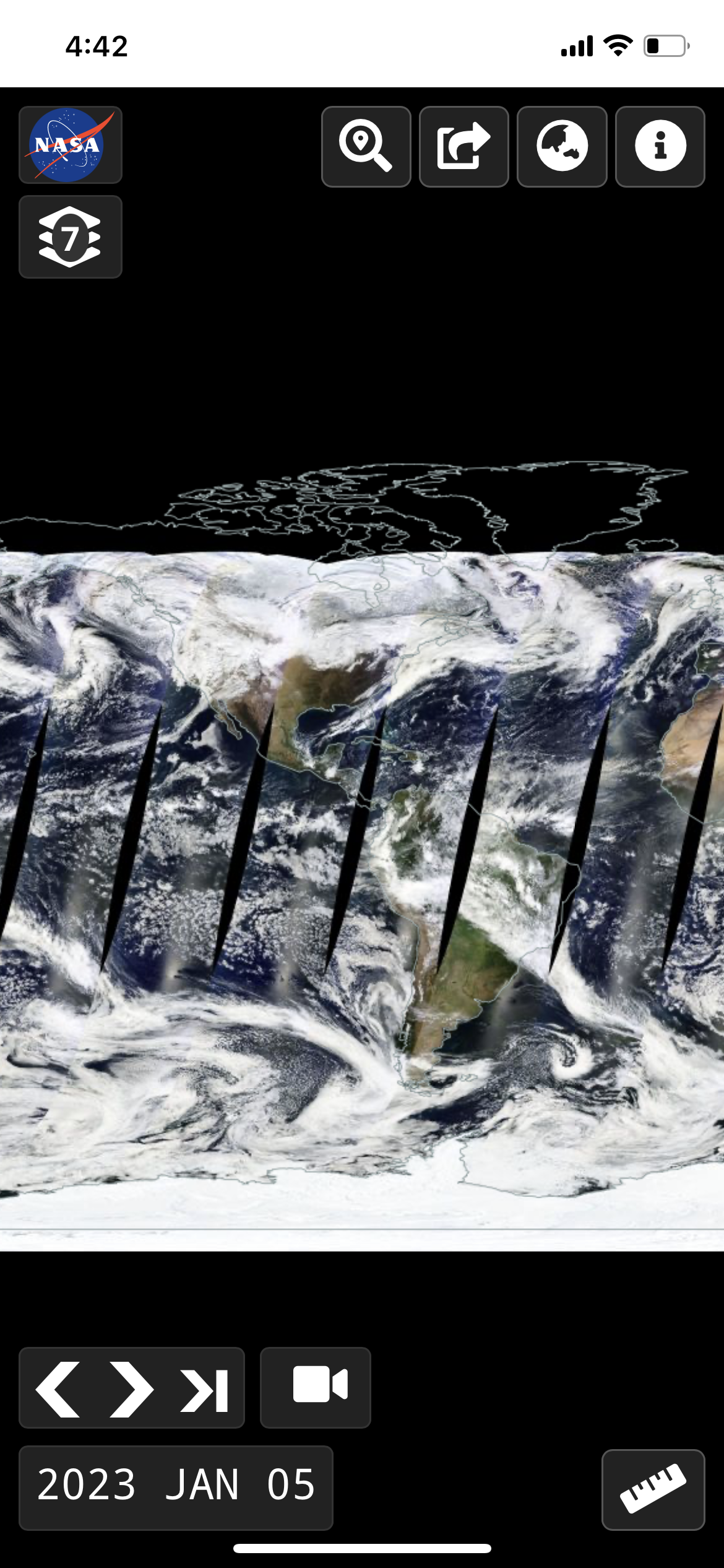
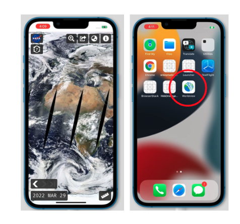
Pull up Worldview, https://worldview.earthdata.nasa.gov on your mobile device and it will look something like this:
To interact with the map, use pinch gestures to zoom in and out. In polar projections, you can also use pinch gestures to rotate the map.
Worldview is also available as a Progressive Web App (PWA). This means you'll have more real estate for interacting with Worldview and the browser URL bar will not be visible! Use the following instructions to add Worldview as a shortcut on your mobile phone to take advantage of the PWA features.
The image above shows Worldview as a PWA where the browser bar is now hidden!
Add Shortcut to Worldview on an iPhone via the Safari browser
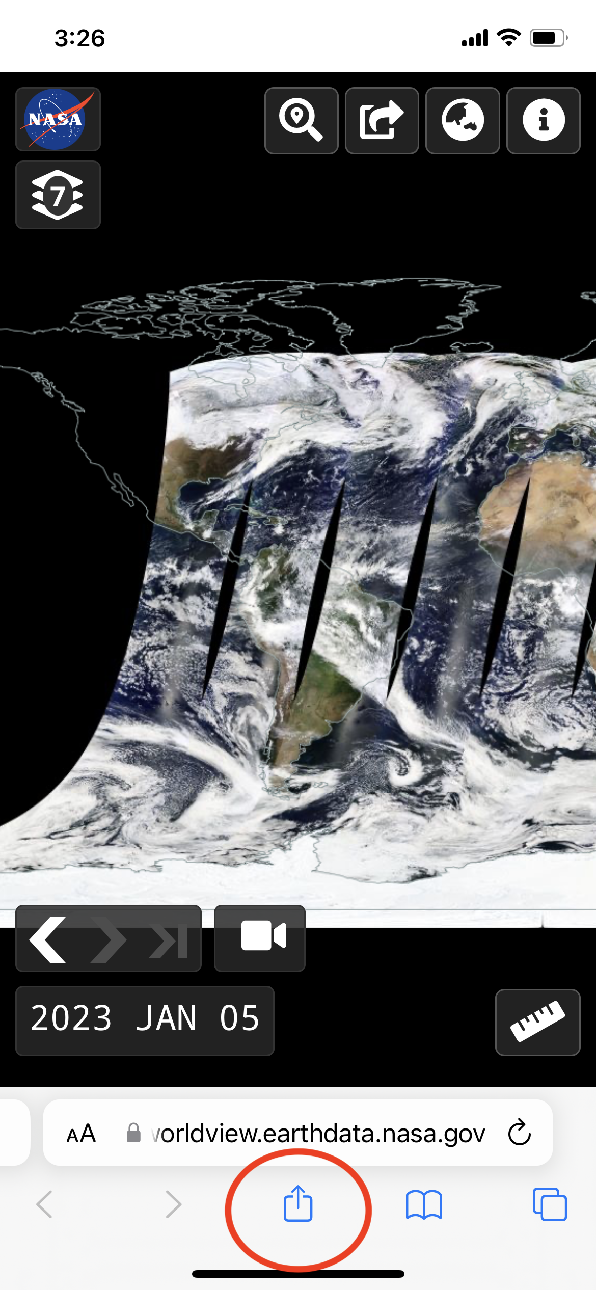
Tap on the icon in the bottom center of the screen (circled in red).
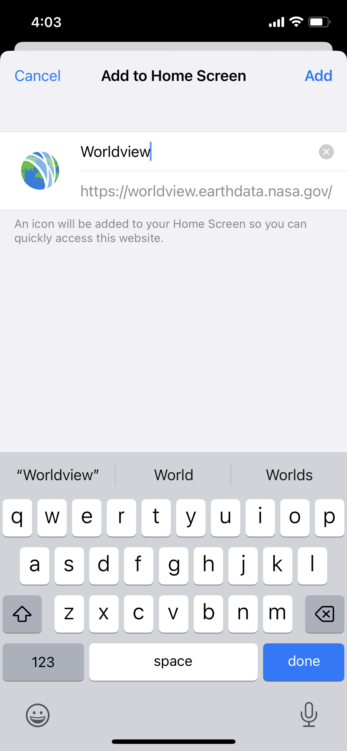
It will bring up the menu below, and select "Add to Home Screen" (circled in red).
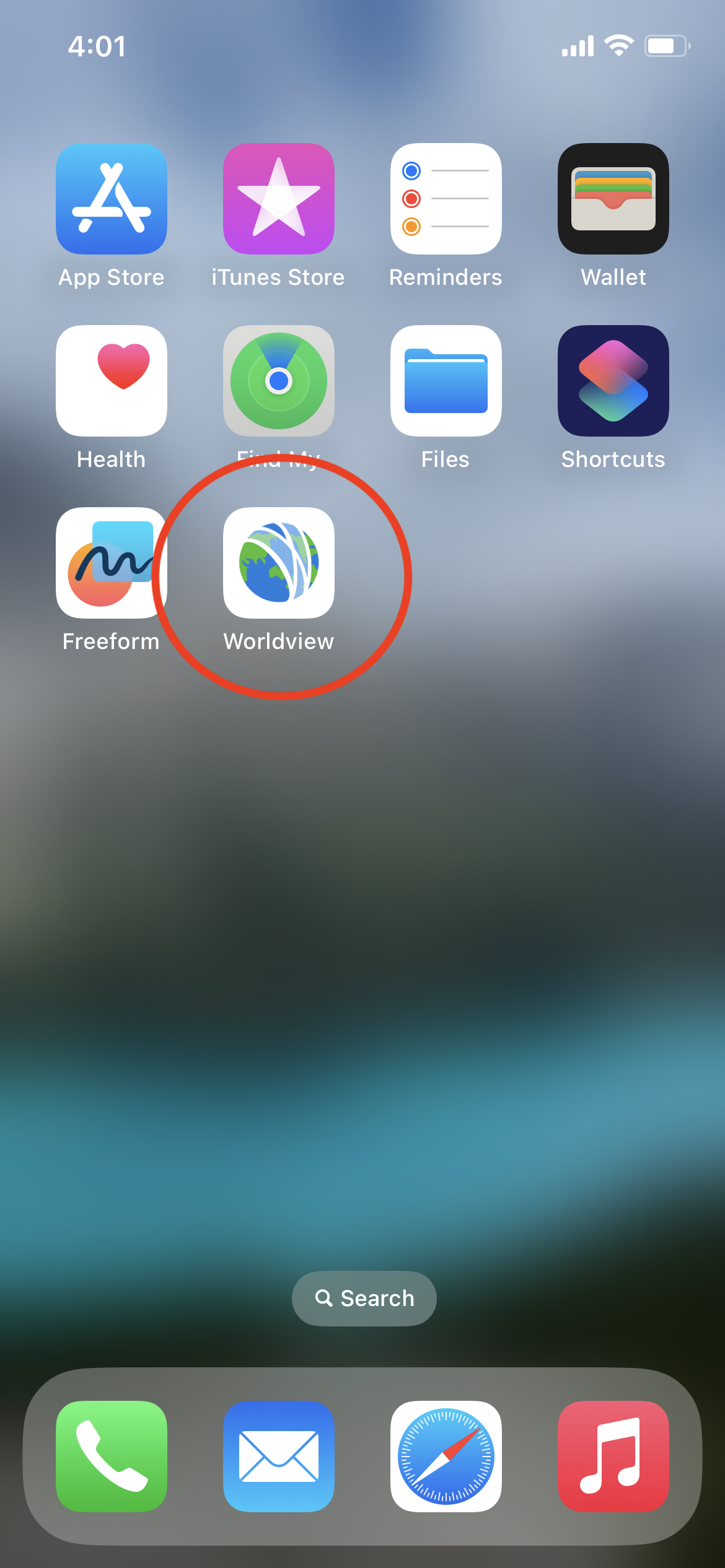
Once added to your home screen, Worldview is accessible via the Worldview icon (circled in red).
Add Shortcut to Worldview via Android phone
Once you access https://worldview.earthdata.nasa.gov in the browser, it will automatically ask you whether you would like to install Worldview. Click on the red "Install" button in the lower left corner.
Access Layer List and Events
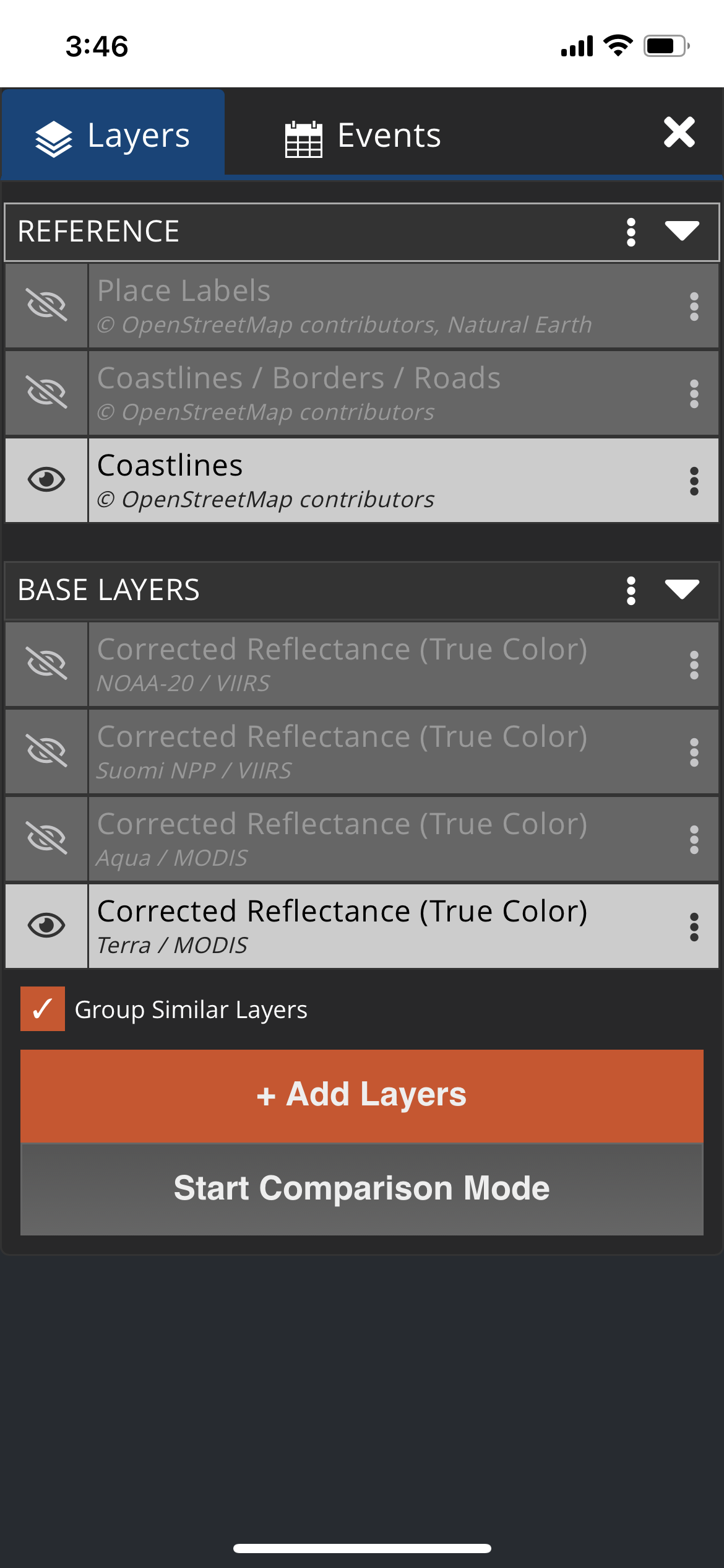
To access the Layer List, tap on the Layer icon in the upper left corner, below the NASA logo.
Once you tap on that icon, you will see the Layer List. The Layer List allows you to show and hide layers, add and remove layers, view layer descriptions, and change relevant options. You can also invoke the comparison mode. Tap on the Events tab to access natural events. Once you've made your choices, tap on the "X" in the upper right corner to close the menu. You may have noticed that the Data tab is not available on mobile devices, you'll have to use your desktop or laptop to access that option!
Change the Date using the Date Picker
To change the date you can either increment the date using the left and right arrows (and the arrow on the far right >| takes you to the latest available date) :
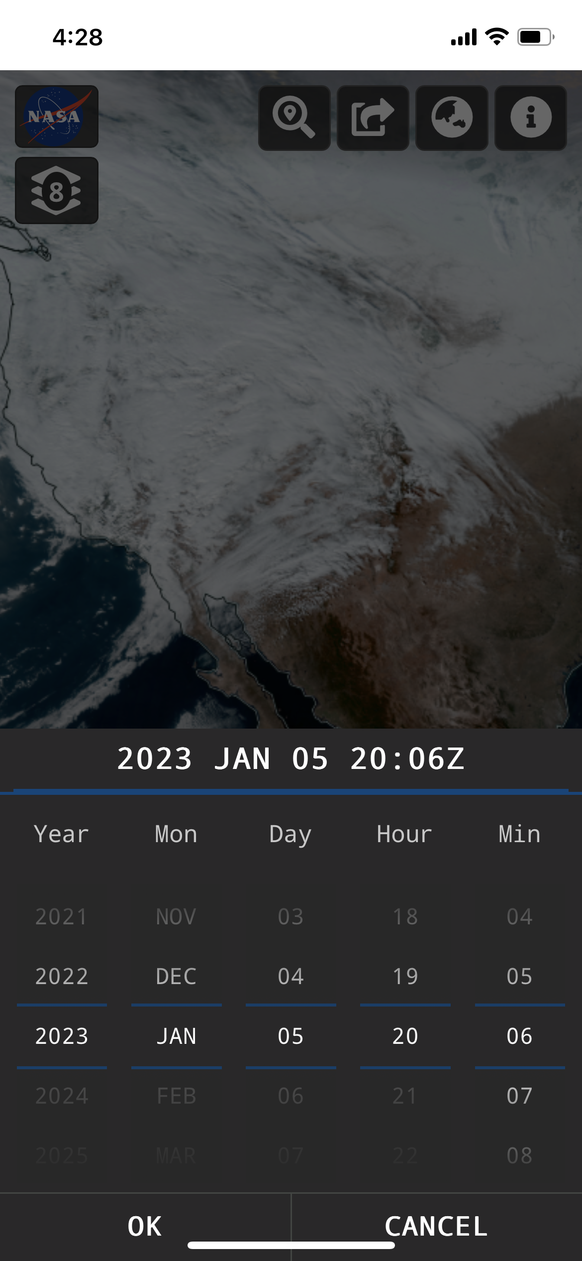
You can also tap on the date in the lower left corner to change the date. If you have a Geostationary layer loaded, you can also change the time here as well.
Animate Imagery over Time
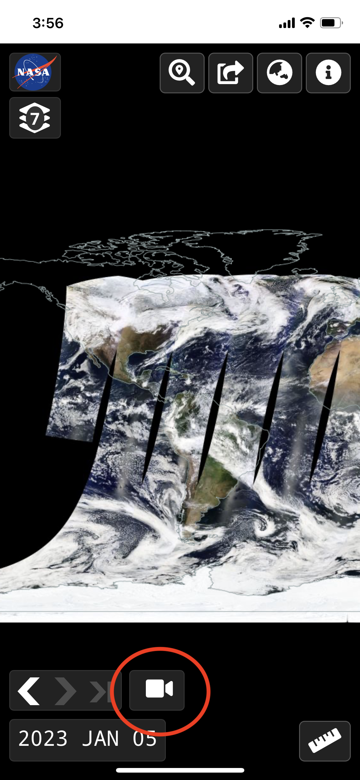
Tap on the video camera icon (circled in red) in the lower left corner above the date and you will be able to change the animation settings.
Tap on the "X" in the upper right corner to close the menu, and you will see a Play button appear at the bottom center part of the screen.
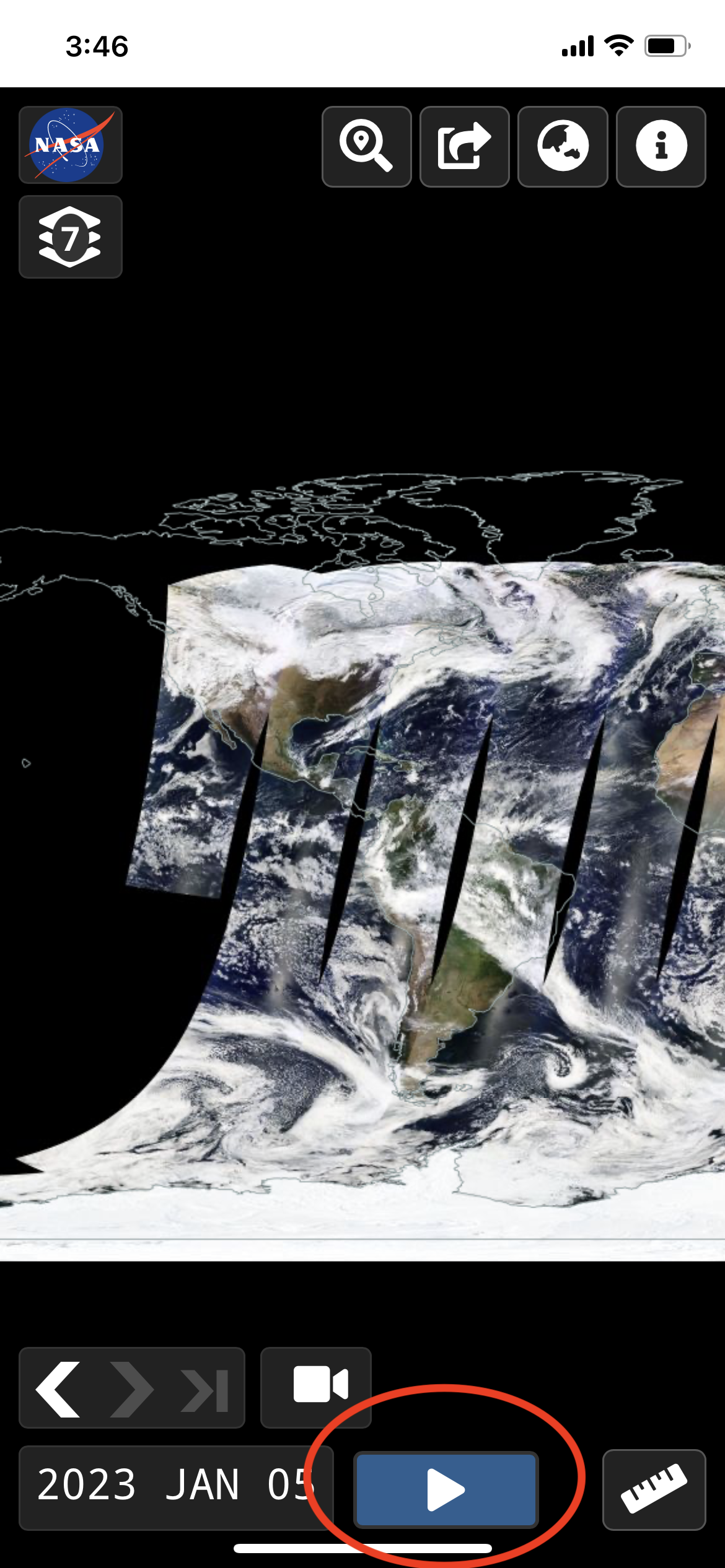
Tap "Play" (circled in red) and the imagery will animate! You won't be able to download animated GIFs on mobile devices though.
Try it out! View Iceberg A76A swirling in the Drake Passage from 20 November - 4 December 2022, https://go.nasa.gov/3VZSh56.
Measure Distance and Area
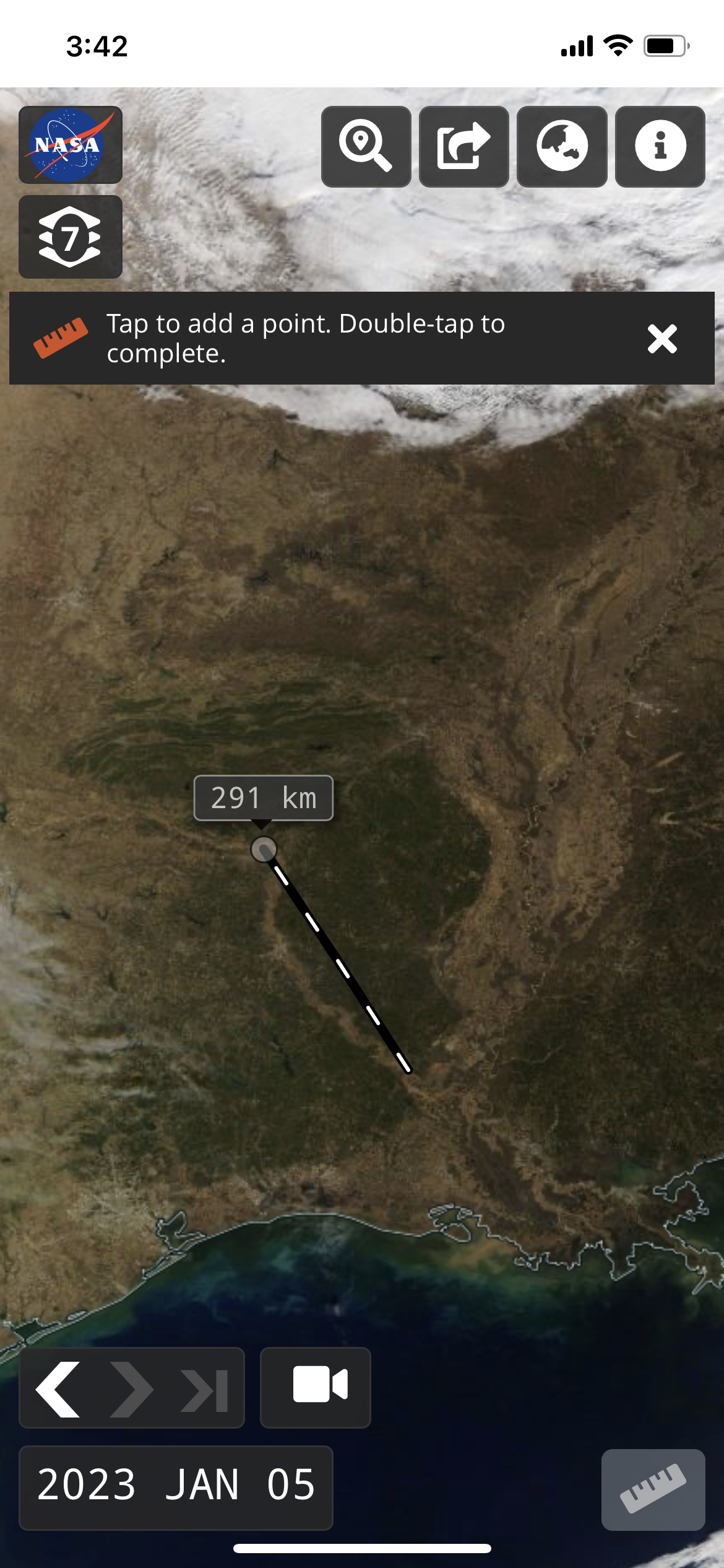
Access the measure tool by tapping on the Ruler icon in the lower right corner. You can select between distance and area measurements and change between metric and imperial units. Tap to add a point, double-tap to complete the measurement.
Search for Places
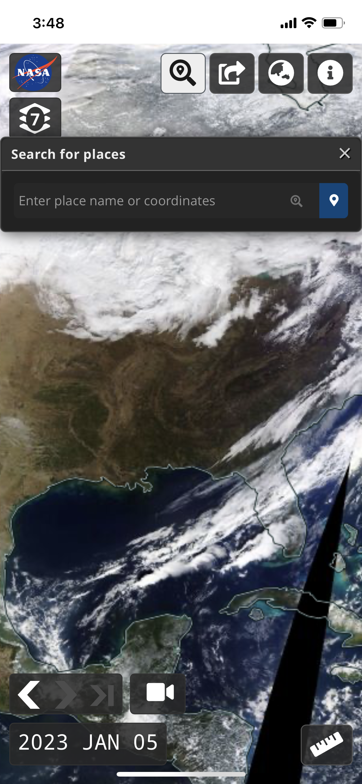
Tap on the magnifying glass icon at the top of the app to either search for places by place name or coordinates.
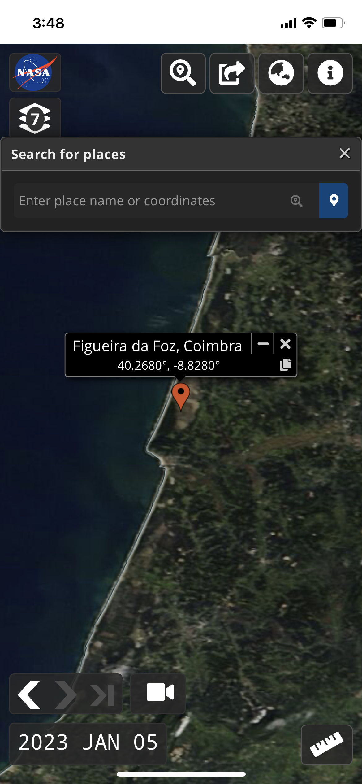
You can also tap on the blue place marker icon to add a place marker on the map.
Try it out! View the place marker for Figueira da Foz, Combria, Portugal, https://go.nasa.gov/3GCLRTD
Change Projections
Tap on the Globe icon in the upper right corner to choose between Arctic, Geographic and Antarctic projections.
You can use the rotate buttons to rotate the map but you can also use pinch gestures to rotate the map in polar views too.
Try it out! View fires burning in British Columbia and the Yukon Territory on 27 July 2022 in the Arctic projection, https://go.nasa.gov/3iBPjGo.
Have you ever wondered what paths storms have taken in the past year? Or where icebergs have originated and moved since they calved from glaciers? Worldview now provides the ability to view multiple event tracks on the map, specifically for "Severe Storm" and "Sea and Lake Ice" events. Natural Events, Hazards, and Disasters are shown in NASA's Worldview via the EONET (NASA Earth Observatory's Natural Event Tracker) API. EONET provides a curated list of natural events occurring around the world. Events go back to 1 January 2000, though not all event types/categories have events populated back to 1 January 2000.
2022 Atlantic Hurricane Season thus far ( 1 June - 1 Nov 2022) - Image above shows Worldview displaying severe storm tracks gleaned from the EONET API (View in Worldview).
The season officially begins on 1 June and ends 22 November 2022. The criteria for displaying "Severe Storms" as defined by EONET is as follows:
Tropical cyclones are added to EONET when they first achieve tropical storm designation—wind speeds of at least 34 knots (39 mph or 17.5 m/s).
Cyclonic events are closed after 5 days of inactivity (i.e., since the last reported location from our sources).
Sources
Try it out!
- Go to https://worldview.earthdata.nasa.gov.
- Click on the “Events” tab.
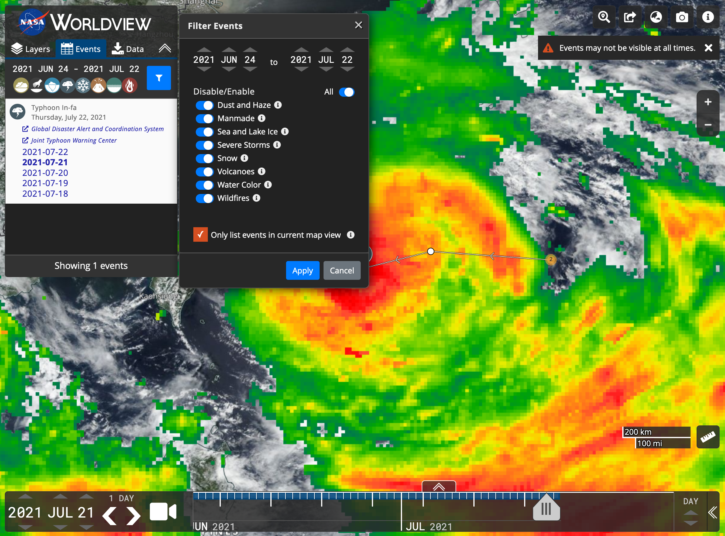
- Click on the blue filter/funnel icon to the right of the date. This opens the “Filter Events” menu.
- Check the box for “Show tracks for all events”. You may also want to check the box for "Only list events in the current map view" to further filter the events. Event tracks are only available for "Severe Storms" and "Sea and Lake Ice" events.
- Pick the date range of interest.
- Click the Apply button and you’ll see all of your requested event tracks!
Worldview has been working to increase the usability and visibility of its features to help users accomplish their goals!
- Wind Speed for Severe Storms and Surface Area for Iceberg Events now Available
- Orbit Tracks now Available as Vectors
- Take an Image Snapshot with Predefined Coordinates
- Right-Click Context Menu
- Global Settings Panel
- Progressive Web Application (PWA)
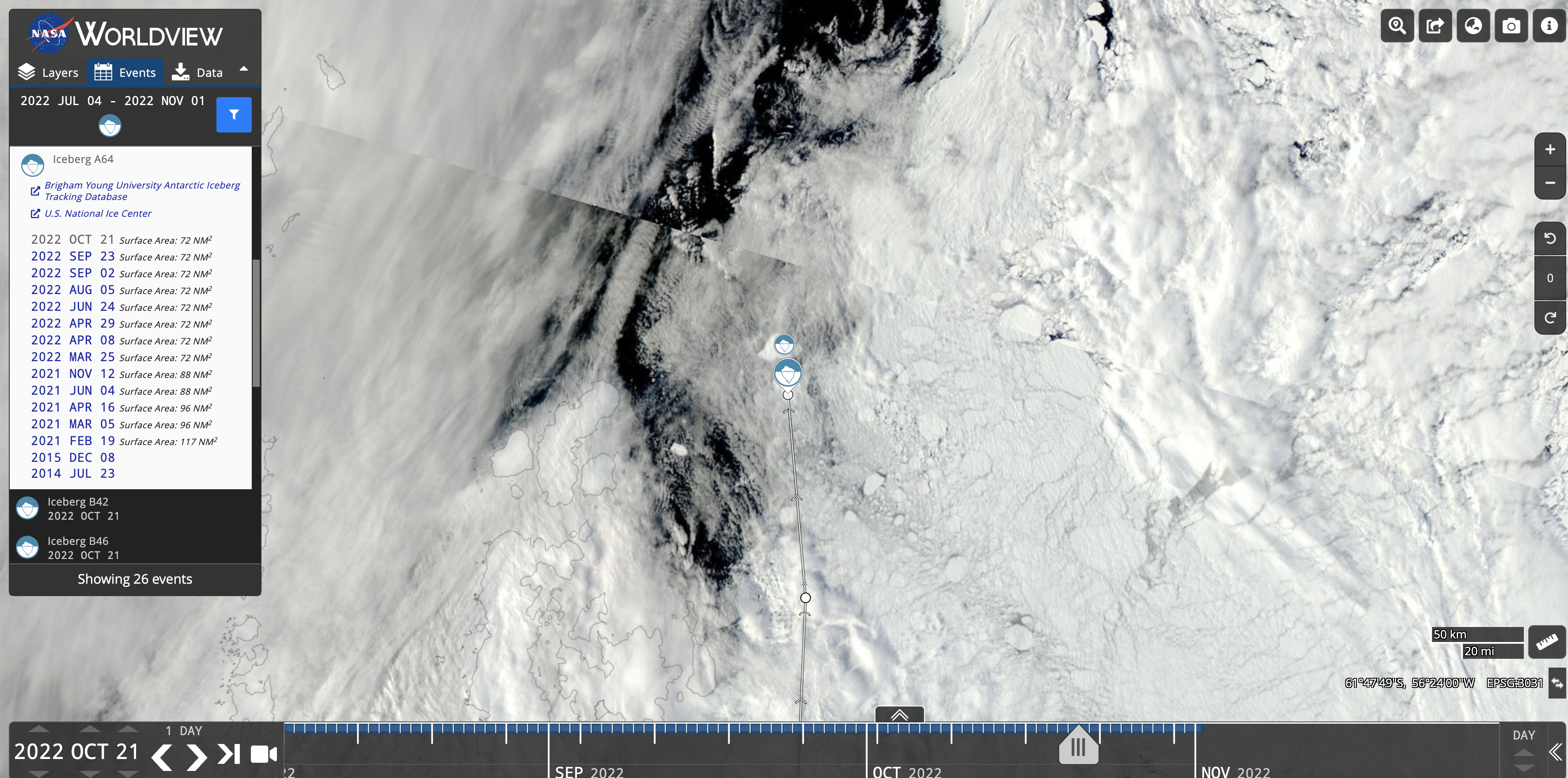
Wind Speed for Severe Storms and Surface Area for Iceberg Events now Available
The wind speed of tropical storms and the surface area of icebergs are now displayed in the Events tab. A listing of Iceberg A64's surface area is shown above using data from the US National Ice Center (view in Worldview).
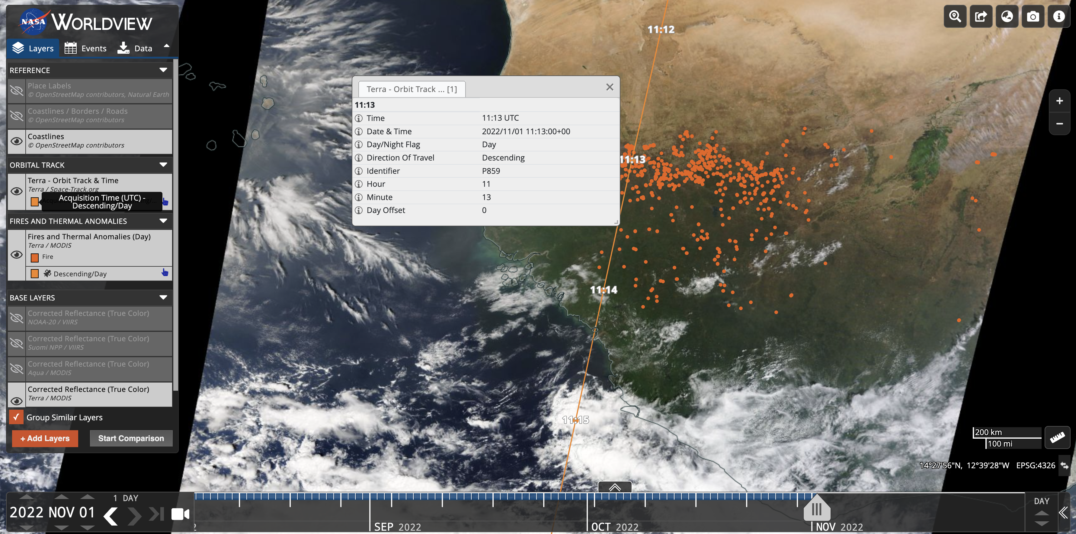
Orbit Tracks now Available as Vectors
Orbit Tracks are now also available as vectors. When you zoom in far enough, you can click on each point on the orbit track to retrieve information like the day/night flag, direction of travel, date and time.
Take an Image Snapshot with Predefined Coordinates
Previously you could only draw a box on the map to take an image snapshot, now we've provided the ability for a user to enter their own bounding box coordinates or a user can "Select Entire Globe".
Right-Click Context Menu
We have made some of the tools that are available around the map interface more easily accessible from the right-click context menu. These include displaying map coordinates (and if you click on the coordinates, they'll be copied to the clipboard), adding multiple place markers, measuring distance, measuring area, and changing the distance/area units between miles and kilometers.
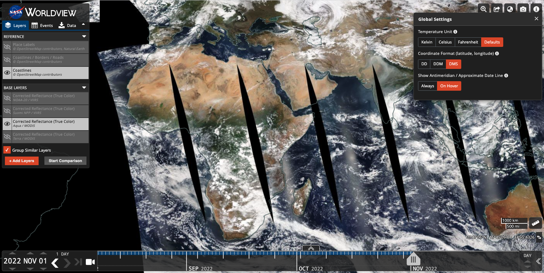
Global Settings Panel
The Global Settings/App-wide Settings Panel now has additional settings that can be configured. In addition to being able to change the Temperature Units for relevant layers, users can also change the coordinate format between 1) Decimal Degrees, 2) Decimal Degree Minutes, and 3) Degrees, Minutes, Seconds. This panel also allows a user to show the antimeridian / approximate date line either on hover or "always on".
Progressive Web Application (PWA)
Worldview is now a Progressive Web App which includes the ability to use it in full screen mode on phones, to launch from your home screen, and to use local caching for faster load times. It's also generally a good compromise to building a native app.
You can also save it as a PWA on your computer desktop as well. In Google Chrome, click the "Install" icon in the URL bar (instructions here) to install Worldview locally.
Terra imagery resumed production on 28 October 2022 after two successive Constellation Exit Maneuvers (CEMs) on October 10 and October 19.
Users are advised not to use any Terra imagery that may be available between 10 - 27 October. Learn more…
Summary
- There will be a data and imagery outage in GIBS and Worldview starting 10 October 2022 and will last 10+ days for layers created from the MODIS, MISR, CERES, and ASTER sensors aboard the Terra satellite.
- MOPITT NRT imagery will be unavailable for a longer period of time, from 3 October to 28 October 2022.
- Worldview will set the Aqua/MODIS Corrected Reflectance layer as the default layer for that period. Note that Aqua has a later overpass time (1:30PM mean local time) than Terra (10:30AM mean local time), so there will be a longer delay for Corrected Reflectance imagery to appear in Worldview.
- We will include notifications in Worldview to remind users of the outage.
Details
The Terra satellite is scheduled to exit the “Morning Constellation” of the Earth Observing System (EOS) satellite program in October 2022. The initial Terra Constellation Exit Maneuver (CEM) is scheduled for 12 October 2022 around 7:30AM EDT and 19 October 2022. All Science and Near Real-Time (NRT) data will not be acquired starting 10 October 2022 until 19 October 2022. Post-CEM, more time will be needed to bring all Terra instruments back up to their nominal states and necessary calibrations and Lookup Table (LUT) updates will occur as needed. Users should exercise caution while using Terra data between 19 - 26 October as all instruments will still be recovering, after the outage. This will impact all sensors aboard Terra including MODIS, MISR, MOPITT, ASTER, and CERES.
Due to onboard fuel shortage, the last Terra mission maneuver was performed on 27 February 2020 to maintain the mean local time (MLT) of 10:30AM. Terra has since been drifting from its MLT, earlier and earlier, where it will reach and exceed 10:15AM MLT by October 2022. The Constellation Exit Maneuver (CEM) will start on 12 October 2022 and when it exits the constellation, it will have a lowered orbit of 694 km, 11 km closer to Earth from its previous 20+ year orbit of 705 km.
Terra is still expected to remain operational for at least another five years, though with earlier crossing times, there may be longer shadows, and being closer to Earth, the sensor views will narrow and data/imagery swath widths may narrow. Despite these changes, the impact to science is expected to be minimal and some of these changes could help with areas of research such as land morphology, surface temperature and climate research.
- Learn more about Terra’s orbital drift: Terra Orbital Drift Information
- Read about Terra’s eventual decommissioning: From Terra to Terra Firma
- Request for Information: NASA’s Terra, Aqua and Aura Drifting Orbits Workshop
We have made some changes to the Chlorophyll a layers in Worldview and GIBS.
We are no longer processing the "Chlorophyll a Terra/MODIS" (MODIS_Terra_Chlorophyll_A) and "Chlorophyll a Aqua/MODIS" (MODIS_Aqua_Chlorophyll_A). Comparable layers are available for Terra/MODIS, Aqua/MODIS and now, Suomi NPP/VIIRS. The table below outlines the changes in the Worldview Title and GIBS Identifiers. Please transition to the new layers as the old layers will not have any imagery past 2022 MAR 28.
In addition to this, the new Terra/MODIS, Aqua/MODIS and Suomi NPP/VIIRS layers are all utilizing a new colormap. The colormap now includes an entry for "< 0.0100 mg/m3" to better reflect the breadth of the Chlorophyll a presence in water (or lack of presence in this case!), and the imagery was reprocessed to match the new colormaps.
New colormap legend now includes "< 0.0100 mg/m3". Previous colormap started at 0.01 mg/m3 and did not include values lower than that.
| Old Worldview Title | Availability | New Worldview Title | Availability | Old GIBS Identifier | New GIBS Identifier |
|---|---|---|---|---|---|
Chlorophyll a Terra/MODIS | 2013 JUL 02 to 2022 MAR 28 | 2013 JUL 02 to Present | MODIS_Terra_Chlorophyll_A | MODIS_Terra_L2_Chlorophyll_A | |
Chlorophyll a Aqua/MODIS | 2013 JUL 02 to 2022 MAR 28 | 2013 JUL 02 to Present | MODIS_Aqua_Chlorophyll_A | MODIS_Aqua_L2_Chlorophyll_A | |
| N/A | N/A | 2020 APR 01 to Present | N/A | VIIRS_SNPP_L2_Chlorophyll_A |
Happy New Year everyone - It's been a few months since we've posted an update, but never fear, we are still always striving to make improvements and add new features to Worldview.
Temperature Unit Conversion
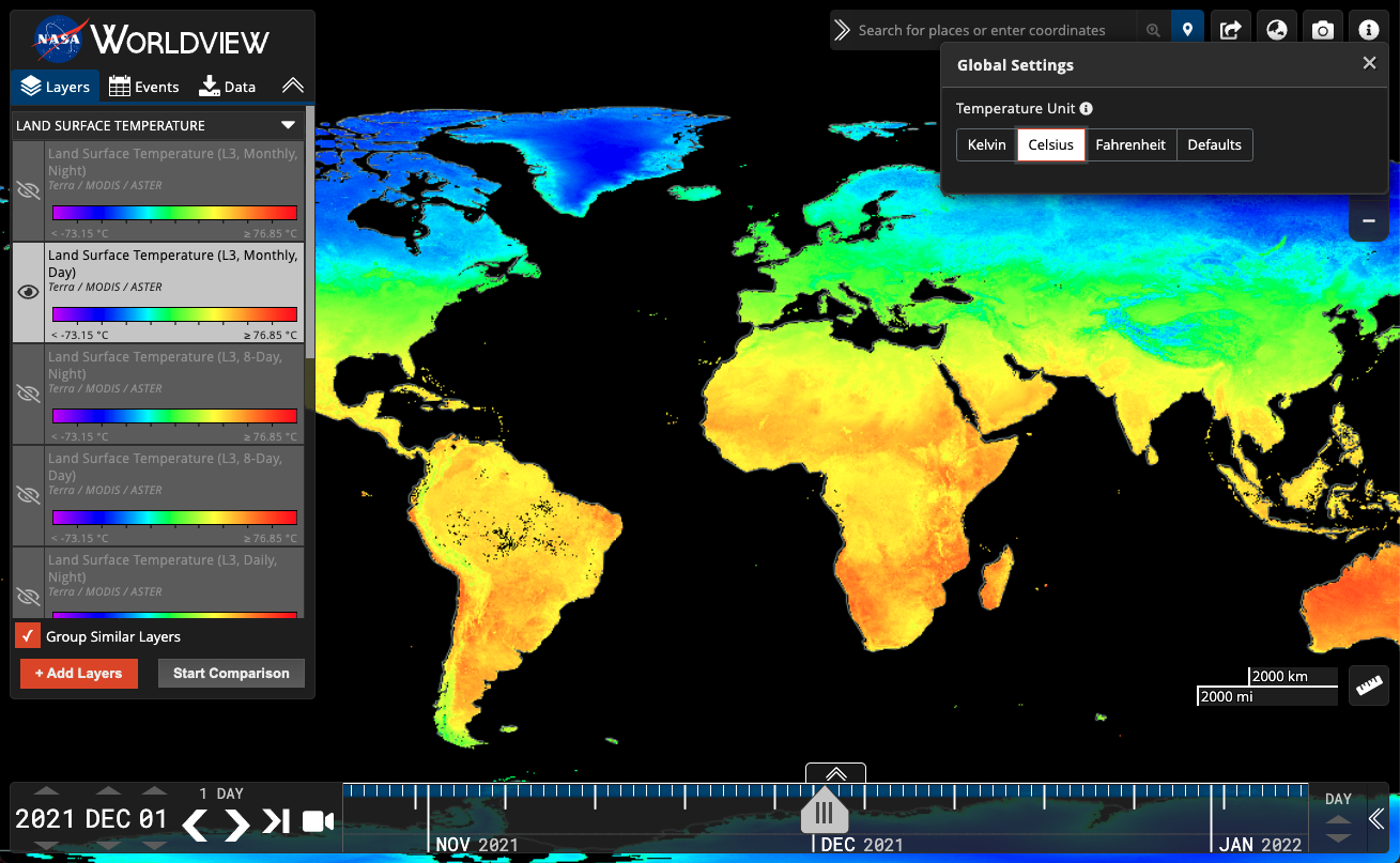
Temperature unit conversions are now available for relevant temperature layers.
We've also added twelve new Land Surface Temperature (LST) layers for you to convert units to your heart's desire! These include the MOD/MYD21 Land Surface Temperature Day | Night, Daily, 8-Day and Monthly layers.
The MOD/MYD21 Temperature/Emissivity Separation (TES) algorithm is a physics-based algorithm used to dynamically retrieve both LST and spectral emissivity simultaneously from the MODIS thermal infrared (TIR) bands 29, 31, and 32. The TES algorithm is combined with an improved Water Vapor Scaling (WVS) atmospheric correction scheme to stabilize the retrieval during warm and humid conditions. The MOD/MYD21 LST&E algorithm differs from the MOD11/MYD11 L2 algorithm in that the MOD21/MYD21 algorithm is based on the ASTER TES technique, whereas the MOD11/MYD11 L2 products uses a generalized split-window (GSW) technique. Learn more about MOD/MYD21 in its User Guide.
- Terra/MODIS LST Day | Night, Daily, 8-Day and Monthly layers: https://go.nasa.gov/3KnArVa
- Aqua/MODIS LST Day | Night, Daily, 8-Day and Monthly layers: https://go.nasa.gov/3KpmhTe
Settings Panel to convert temperature units can be accessed from the "i" menu in the upper right corner. Keep your eyes peeled for other settings that can be changed from this panel in the future!
DAAC/SIPS Facet
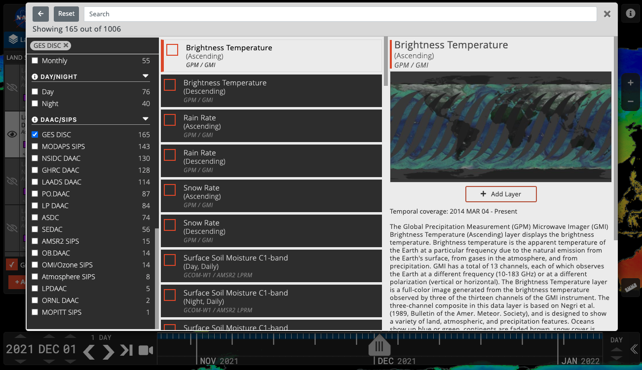
The Layer Picker has a new facet for DAAC/SIPS (that is Distributed Active Archive Centers/Science Investigator-led Processing Systems) who have provided the imagery visualizations.
Click on the orange "+ Add Layers" in the Layer List, then the orange Filter icon in the upper left corner to filter the imagery by facets.
Tour Stories
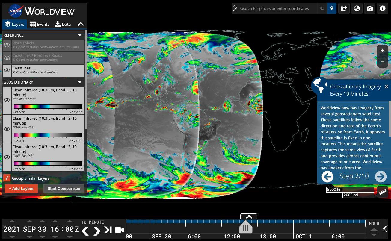
- A new tour story about the Geostationary imagery layers we have from GOES-East, GOES-West and Himawari-8.
- The Satellite Detections of Fire (2021 update) tour story was updated with new events and imagery.
- There's also a new Introduction to Worldview tour story that walks you through all the elements of Worldview.
Screenshot of the second step of the Geostationary Imagery Tour Story.
Moving to the Cloud
- The Global Imagery Browse Services (GIBS) is in the process of migrating its visualization archive into the cloud. Current status:
- 5% of total visualization layers (20% by volume) are actively being forward processed in the cloud.
- 80% of the on-premises visualization archive has been transferred to the cloud.
- The system is expected to be 100% in the cloud in Fall 2022.
- This transition should be transparent to users as all existing visualization layers and URLs will continue to work (but please let us know if you notice any problems support@earthdata.nasa.gov).
- Once fully migrated, we'll be able to more easily scale out the system and provide new features for more flexible visualizations.
AWS Snowball getting loaded up with data from our on-premises servers to its future home in the cloud!
Coming soon...
- Worldview will soon be a progressive web app (PWA), making it "installable" on mobile devices so that more of the map will be visible to the user.
- We're going to add a right-click context menu to the map to access features like copy coordinates to clipboard, start a measurement, and add a place marker.
Worldview's latest release, v3.11.0, contains a few new features and imagery layers that we'd like to share with you!
New Features
Embedded Worldview
Learn how to embed NASA Worldview into a web page, StoryMap, or other web-based product, by following the steps outlined on the Create an embedded Worldview page. Compared to the full application, the embedded version of Worldview has intentionally limited functionality to give users a more streamlined experience.
Learn more: Worldview’s New Embed Feature Makes Telling Data-Driven Stories Easier than Ever. Also, check out the Worldview embed examples page to see how you might embed Worldview onto your own web page.
Historical Events
Worldview now provides access to the entire curated list of archived events from the NASA Earth Observatory Natural Event Tracker (EONET).
Click on the "Events" tab in the sidebar and you will be presented with the first 50 events from the past few months. Just click on the blue filter icon to start narrowing down the events. You can filter events by date, event type, and events in the current map view. Events go back to 1 January 2000, though not all event types/categories have events populated back to 1 January 2000. Event types include Dust and Haze, Manmade, Sea and Lake Ice, Severe Storms, Snow, Volcanoes, Water Color and Wildfires. You can also check the box to "Only list events in current map view" to further filter your search results.
New Imagery Layers
GeoColor, GOES-East and GOES-West
Worldview has added GeoColor imagery from the geostationary satellites, GOES-East and GOES-West along with the existing Red Visible, Clean Infrared and Air Mass layers.
All geostationary imagery are available in Worldview on a rolling 90-day window.
The GeoColor (True Color (Day), Multispectral blended infrared (IR; at Night)) layer from the GOES-East and GOES-West Advanced Baseline Imager (ABI) provides an approximation to daytime True Color imagery. The combination of spectral bands yields an appearance similar to what the human eye would perceive for land surface, oceanic and atmospheric features, with atmospheric correction used to make the appearance of these features sharper. Thus it is used primarily for the intuitive interpretation of meteorological and surface-based features such as smoke, blowing dust, and vegetation types (forests, deserts, croplands, etc.). At night, the true color imagery gives way to IR-based blended multispectral imagery that provides differentiation between low liquid water clouds (shown in light-blue) and higher ice clouds (shown in gray/white). It also includes a static city lights/night lights database derived from the VIIRS Day/Night Band, which aids in geo-referencing and can help determine the proximity of clouds (such as fog) or weather hazards (such as thunderstorms or tropical cyclones) to population centers. Please note that as these lights are static, they will not change even if, for example, a weather-induced power outage occurs.
Learn more: NASA Worldview Adds GeoColor Imagery from the joint NASA/NOAA GOES-East and GOES-West Satellites.
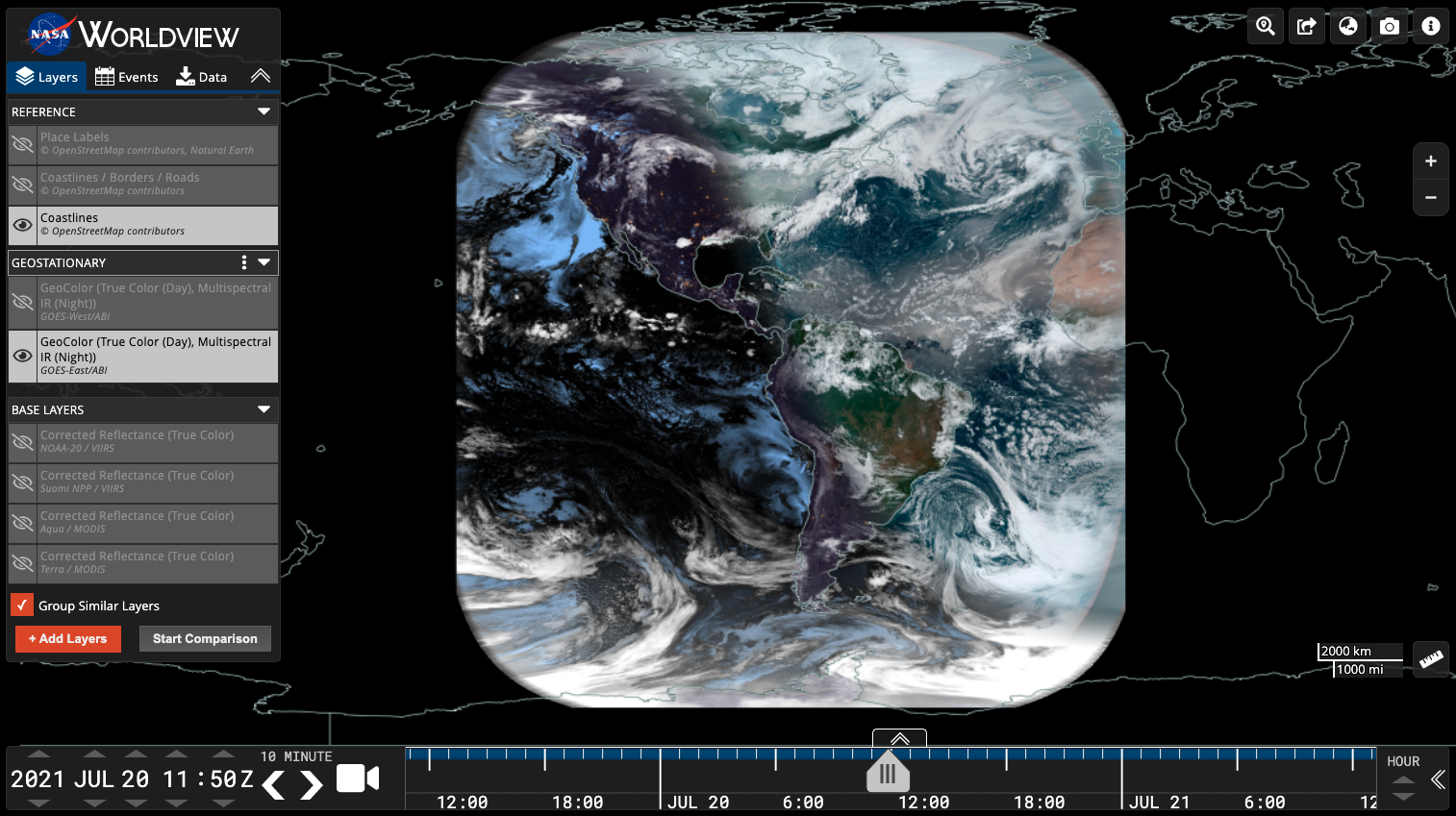
Screenshot of GeoColor from ABI aboard the GOES-East satellite on 20 July 2021 at 11:50Z. https://go.nasa.gov/3eJNvWu
Wind Speed (CDR, Daily), CYGNSS/DDMI
The CYGNSS/DDMI Level 3 Wind Speed (CDR, Daily) layer is the daily ocean surface wind speed in meters per second (m/s) as provided by the Delay Doppler Mapping Instrument (DDMI) on board the CYGNSS spacecraft constellation. The layer provides high resolution wind speed data that allows for global tropical ocean observation. The primary mission objective for CYGNSS is to provide frequent space‐based measurements of ocean surface wind speed in the inner core of tropical cyclones. The orbital asynchronicity with respect to the local solar daytime/nighttime patterns may provide additional scientific opportunity to study wind speed variations and patterns due to the diurnal cycle. The data imagery is provided by the CYGNSS Version 1.0 CYGNSS Level 3 Climate Data Record (CDR). The Version 1.0 CDR represents the first climate-quality release and is a collection of reanalysis products derived from the Science Data Record v2.1 Level 1 data.
Sea Surface Height Anomalies (GDR Cycles), TOPEX/POSEIDON, JASON-1, OSTM/Jason-2, and Jason-3
The Sea Surface Height Anomalies (GDR Cycles) layer displays along track Sea Surface Height Anomalies (SSHA) for individual 10-day cycles from the TOPEX/Poseidon, Jason-1, OSTM/Jason-2, and Jason-3 missions geo-referenced to a mean reference orbit.
Deep Blue Aerosol Type, Suomi NPP / VIIRS
The VIIRS Deep Blue Aerosol Type layer provides information related to the aerosol composition over land and ocean. Types include Dust, Smoke, High Altitude Smoke, Pyrocumulonimbus Clouds, Non-Smoke Fine Mode, Mixed, Background and Fine Dominated.
The Deep Blue (DB) algorithm is employed for over-land use and the Satellite Ocean Aerosol Retrieval (SOAR) algorithm is used over water to determine atmospheric aerosol type for day time cloud-free snow-free scenes. The combined Aerosol Type over land and ocean layer is derived from pixels that pass high-quality assurance tests. Over water, aerosol type is retrieved via the aerosol type optical model that yields the best fit. Over land, aerosol type is classified based on Aerosol Optical Depth (AOD), Ångström exponent, Lambert Equivalent Reflectivity (LER), and brightness temperature.
Land Surface Temperature, MODIS/Aqua | Terra/ASTER
The Land Surface Temperature (Day | Night) layers are from the new Land Surface Temperature and Emissivity (LST&E) product (MOD/MYD21), which is in addition to the heritage MOD11/MYD11 Land Surface Temperature (LST) product. These layers show the temperature of the land surface in Kelvin (K).
Black Sky Albedo, MODIS/Terra and Aqua
The Black Sky Albedo (L3, Daily) layer is created from the Moderate Resolution Imaging Spectroradiometer (MODIS) MCD43A3 Albedo Model dataset is produced daily using 16 days of Terra and Aqua MODIS data at 500 meter (m) resolution. Data are temporally weighted to the ninth day of the 16 day.
The MCD43A3 provides black-sky albedo (directional hemispherical reflectance) and white-sky albedo (bihemispherical reflectance) data at local solar noon.
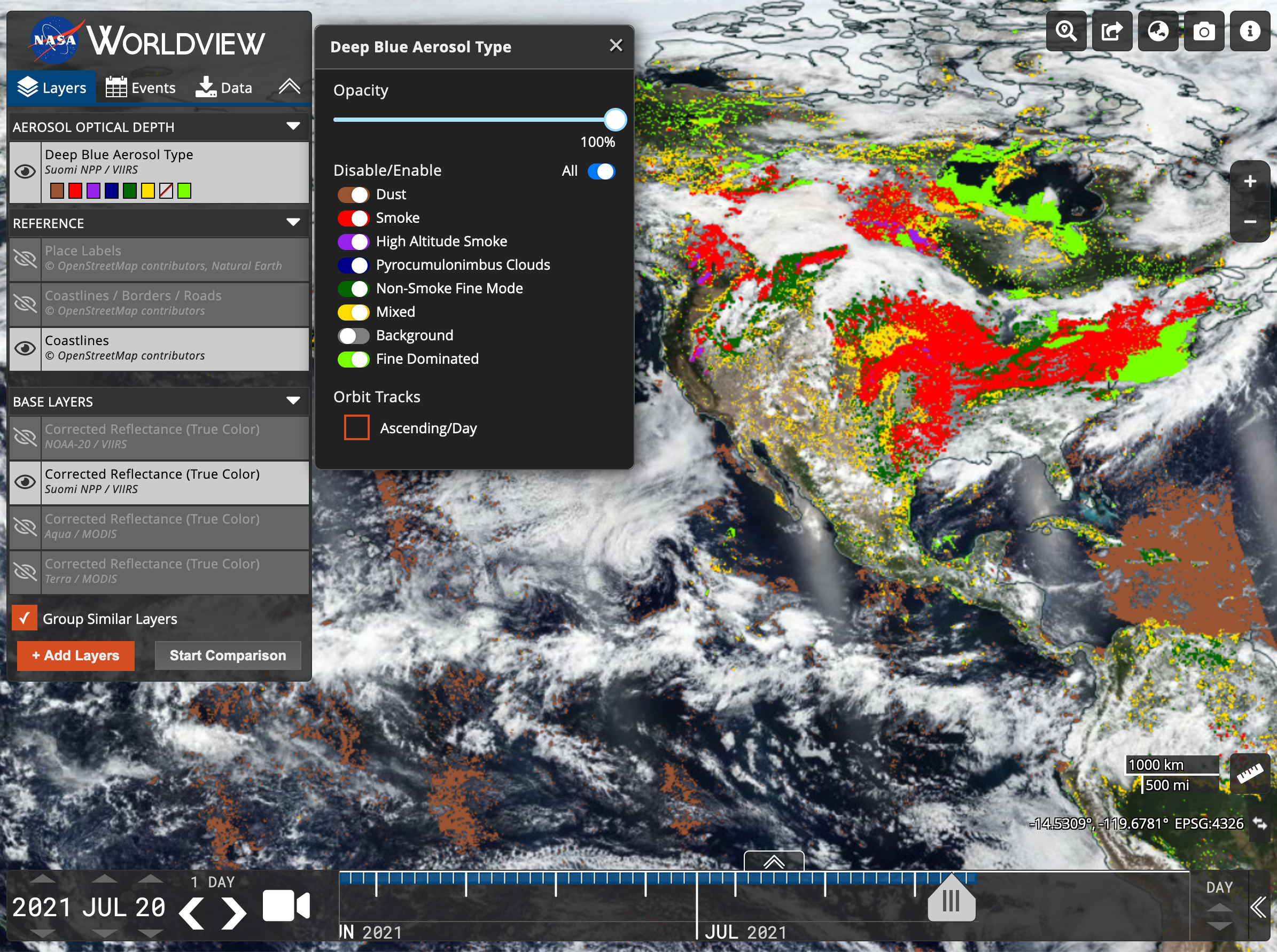
Screenshot of Aerosol Type from VIIRS aboard the joint NASA/NOAA Suomi NPP satellite on 20 July 2021. https://go.nasa.gov/3By9wl2
Updated and Removed Layers
- All MODIS Land NRT and STD layers are in the process of being updated to collection 6.1. It will currently be a mix of v6.0 and 6.1.
- Snow Water Equivalent, AMSR-2 (Daily, 5-Day, Monthly) have been updated to v2 for NRT and vB02 for STD.
- Deep Blue Aerosol Optical Thickness and Aerosol Angstrom Exponent from Suomi NPP/VIIRS have been updated to v1.1.
- G1SST Sea Surface Temperature from GHRSST has been retired.
- Cloud Liquid Water, Columnar Water Vapor, Surface Precipitation Rate, Rain Rate and Wind Speed from AMSR-2 (Rain Ocean Products) have been retired.
Worldview and GIBS recently released new imagery in version 3.9.1 including MODIS Flood Product, and CYGNSS Soil Moisture.
The beta version of the Moderate Resolution Imaging Spectroradiometer (MODIS) Near Real-Time (NRT) Global Flood Product (MCDWD) provides a daily global map of flooding. It is derived from the NRT MODIS Surface Reflectance (MOD09) datasets from both the Terra and Aqua satellites. The Flood Product is available for 3 compositing periods: 1-day, 2-day, and 3-day. A pixel is marked as water when water detections from all observations from Terra/MODIS and Aqua/MODIS are gathered for each compositing period, with the 3-day window accumulating 3 days worth of observations thereby most likely to include the least number of false positive detections. (Note: 1-day product not yet available in Worldview). Users are advised to compare the flood product against the contributing MODIS reflectance imagery (such as 7-2-1 Corrected Reflectance; search for “721” after clicking “+ Add Layers”) for the compositing period to ensure reported flood areas do not correspond to areas of cloud shadow and other obscurations. Imagery is available starting 1 January 2021. Learn more about the MODIS Flood Product in the User Guide and the FAQs.
Image of flooding in a river flood plain in northwestern Australia as highlighted by the Flood 3-Day Window layer in red. Visit Worldview to interact with the layers: https://go.nasa.gov/2Qm9dq7
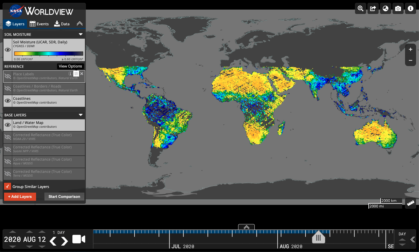
Worldview and GIBS also added the Cyclone Global Navigation Satellite System (CYGNSS) Soil Moisture layer which provides volumetric water content estimates for soils between 0-5 cm depth in units of cm3/cm3 for most of the subtropics. The data were produced by CYGNSS investigators at the University Corporation for Atmospheric Research (UCAR) and the University of Colorado at Boulder (CU), and derived from version 2.1 of the CYGNSS L1 Science Data Record (SDR). The soil moisture algorithm uses collocated soil moisture retrievals from Soil Moisture Active Passive (SMAP) satellite to calibrate CYGNSS observations from the same day. For a given location, a linear relationship between the SMAP soil moisture and CYGNSS reflectivity is determined and used to transform the CYGNSS observations into soil moisture. The spatial resolution is 36km and temporal resolution is daily. The temporal coverage is 18 March 2017 - 16 August 2020. Dataset doi: 10.5067/CYGNU-L3SM1
As always, more exciting updates are coming soon including updated and higher resolution reference labels, coastlines, borders and roads that will work well with the 30 meter resolution Harmonized Landsat Sentinel 2 imagery!
Worldview v3.9.0 was released in early March including new features like Location Search, Data download via Earthdata Search and layer grouping in the Layer List.
Location Search allows users to type in a location name, or coordinates and a marker will be placed on the map. Conversely, a marker can be placed on the map to retrieve the coordinates and place name (if available). Location Search is in the upper right corner of Worldview.
Data Download via Earthdata Search: While Worldview has had a data download capability before, in the past it had been limited to only about a third of the layers. We have now extended this capability to almost all of the layers available in Worldview and provided a more robust method of getting users into Earthdata Search, EOSDIS' data discovery and access tool.
Layer Grouping: Layers in the Layer List can now be grouped to more effectively place similar layer visualization types together in the same category making it easier to manipulate a group than individual layers.
Read more about these updates in the Earthdata article, "EOSDIS Worldview Version 3.9.0 Makes Finding, Viewing, and Downloading NASA Earth Data Easier than Ever".
Screenshot of Worldview directing the user to download data via Earthdata Search. In Worldview, users select their desired layer, desired date and can set their area of interest. They are then directed to Earthdata Search with those options selected and can then access data download options.
Happy New Year GIBS and Worldview users! With a challenging 2020 behind us, we hope that some of the things we've been working on over the past year will help you with your work, research and plain old curiosity!
Worldview's mainstay has been the workhorse daily, global 250 meter resolution imagery from the Moderate Resolution Imaging Spectrometer (MODIS) instrument aboard the Terra and Aqua satellites. With the long awaited release of the provisional Harmonized Landsat and Sentinel-2 version 1.5 data from the Land Process Distributed Active Archive Center (LP DAAC) and the Interagency Implementation and Advanced Concepts Team (IMPACT), GIBS and Worldview has also worked hard to get this 30 meter imagery into Worldview for you to use!
The latest release, version 3.8.5, includes:
- Reflectance (Nadir, BRDF-Adjusted, v1.5) from Sentinel 2A & 2B/MSI, currently available 29 September 2020 - present
- Reflectance (Nadir, BRDF-Adjusted, v1.5) from Landsat 8/OLI, currently available 20 January 2021 - present
- Military Grid Reference System (MGRS)/HLS Grid
The imagery will be back processed and will be available starting 2013 for Landsat 8 and 2015 for Sentinel 2A and 2B in the near future.
Learn more about the imagery by going through the Harmonized Landsat Sentinel-2 Tour Story in Worldview and read the Earthdata article "A Harmonious New Dataset".
Screenshot of Worldview displaying 250 meter Terra/MODIS reflectance imagery on the left and 30 meter HLS reflectance imagery from Sentinel 2A & 2B/MSI of the Palm Islands in Dubai. Check out the comparison in Worldview: https://go.nasa.gov/2Mss8hm
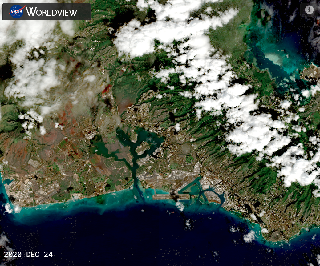
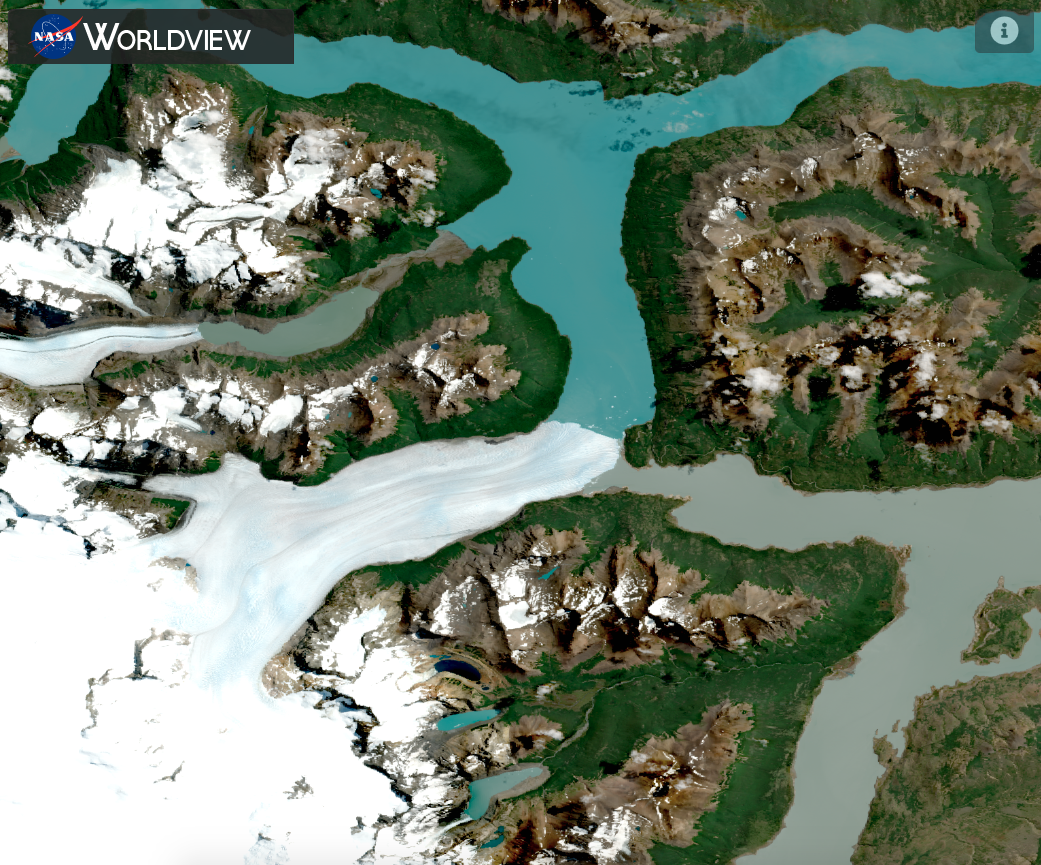
A sampling of some of this high resolution imagery!
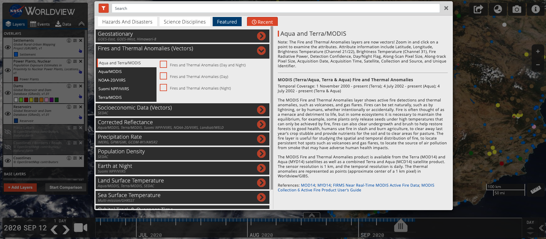
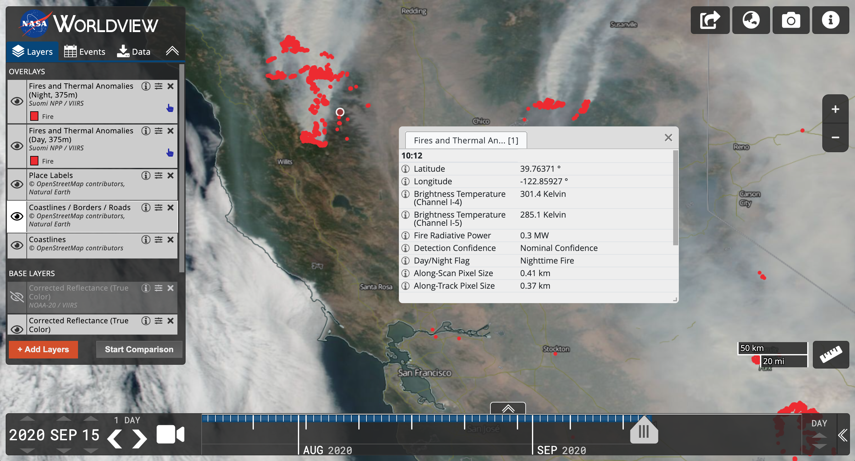
With our latest release, version 3.8.2, vector capabilities have been extended to the Fire and Thermal Anomalies layers! A total of 5 sets of layers from Terra/MODIS, Aqua/MODIS, Terra and Aqua combined/MODIS, Suomi NPP/VIIRS and NOAA-20/VIIRS.
This means that when you zoom into any fire point, you can click on an individual fire point and retrieve attribute information about that fire/thermal anomaly and most notably, you will be able to find out what time the fire was detected.
These attributes include:
- Latitude
- Longitude
- Brightness Temperature (Channel 21/22) (For MODIS)/ Brightness Temperature (Channel I-4) (For VIIRS)
- Brightness Temperature (Channel 31) (For MODIS)/ Brightness Temperature (Channel I-5) (for VIIRS)
- Fire Radiative Power
- Detection Confidence
- Day/Night Flag
- Along-Scan Pixel Size
- Along-Track Pixel Size
- Acquisition Date
- Acquisition Time (in UTC)
- Satellite
- Collection and Source
Detailed descriptions of the attributes: VIIRS and MODIS.
Other vector layers in Worldview include Dams, Reservoirs, Nuclear Power Plants and Settlements.
You can access the layers by clicking on "Add Layers", selecting the "Featured" tab and selecting layers listed under "Fires and Thermal Anomalies (Vectors) and Socioeconomic Data (Vectors) or simply typing "vectors" in the search box!
Go to Worldview and investigate the fire points in Northern California on 15 September 2020.
Developers and DIY-ers!
You may be thinking, I really just want to take these vectors and display them in my own client, so check out the GIBS API for Developers: Vector Visualizations documentation and visit the gibs-web-examples GitHub repo to find some live examples!
The Fires and Thermal Anomalies layers are also available via web services from the Fire Information for Resource Management System (FIRMS).

