We've recently made some updates and additions to our GIBS API documentation and examples of using GIBS with various web mapping libraries, so If you're interested in retrieving NASA Earth Science imagery visualizations via the Global Imagery Browse Services (GIBS) to use in your own applications, you've come to the right place!
NASA's Global Imagery Browse Services (GIBS) system provides visualizations of NASA Earth Science observations through standardized web services. You can access these via GIS Applications, Map Libraries and GDAL Scripts, and via Python.
The Accessing via Python is our newest addition to the GIBS API documentation. This section covers topics showing you how to connect to GIBS via Web Map Service (WMS) and Web Map Tile Service (WMTS), how to visualize raster and vector data/imagery, and provides examples of simple analyses and applications. All of the examples are also downloadable as a Jupyter Notebook.
We also recently updated our GitHub GIBS Web Examples repository, gibs-web-examples, which has examples of using GIBS with various web mapping libraries, like OpenLayers, Leaflet, Cesium, Mapbox GL, Bing, and Google Maps. We updated all the libraries to the latest working versions and we've also added a MapLibre GL example. All you have to do is clone and install the repo, then you can get started! You can also view Live Examples listed in the README section like a Rolling Seven Day Slider in OpenLayers or Global Web Mercator imagery in Cesium, visit the Live Examples section to see more.
Relevant Links
- GIBS API Documentation: GIBS API for Developers
- GIBS Imagery Visualization Layers: GIBS Visualization Product Catalog
- GitHub GIBS Web Examples repo: GIBS Web Examples
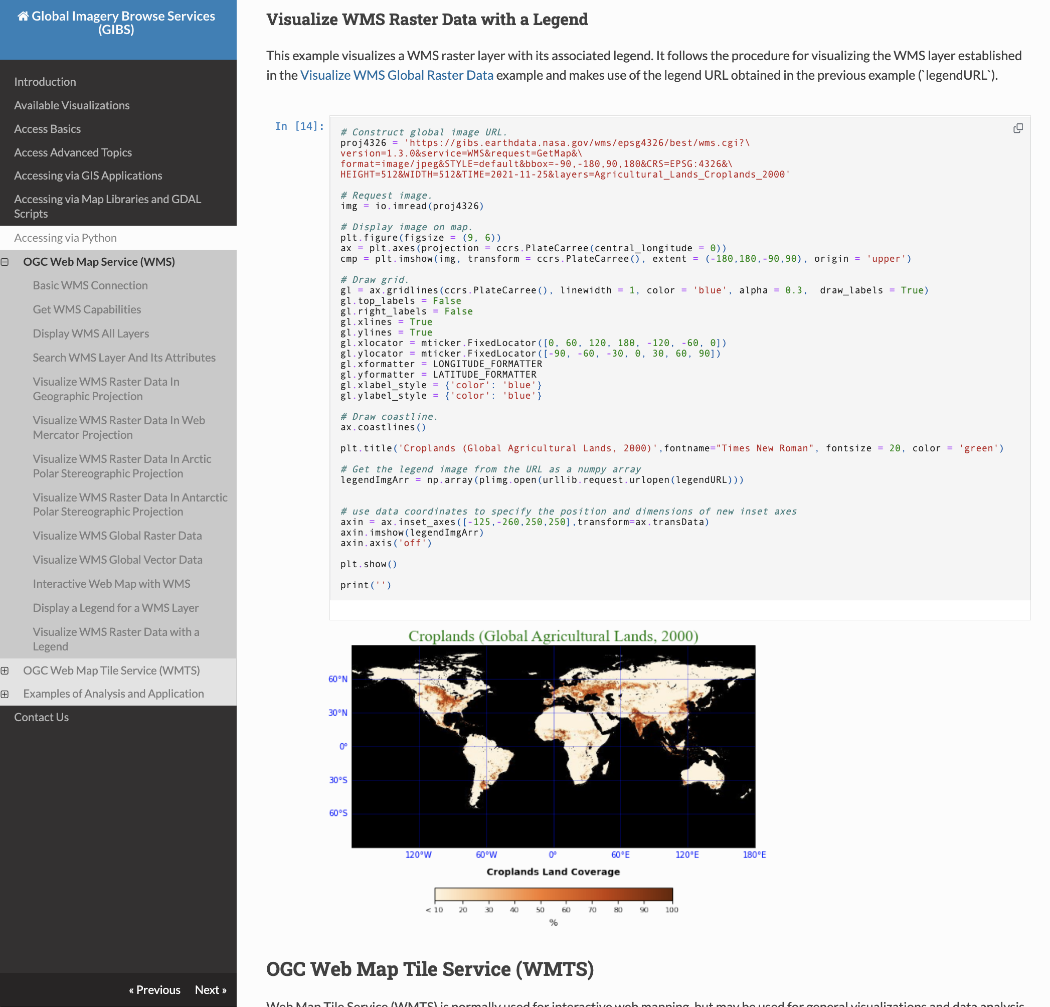
Screenshot of the GIBS API Documentation, Accessing via Python, Visualize WMS Raster Data with a Legend section.
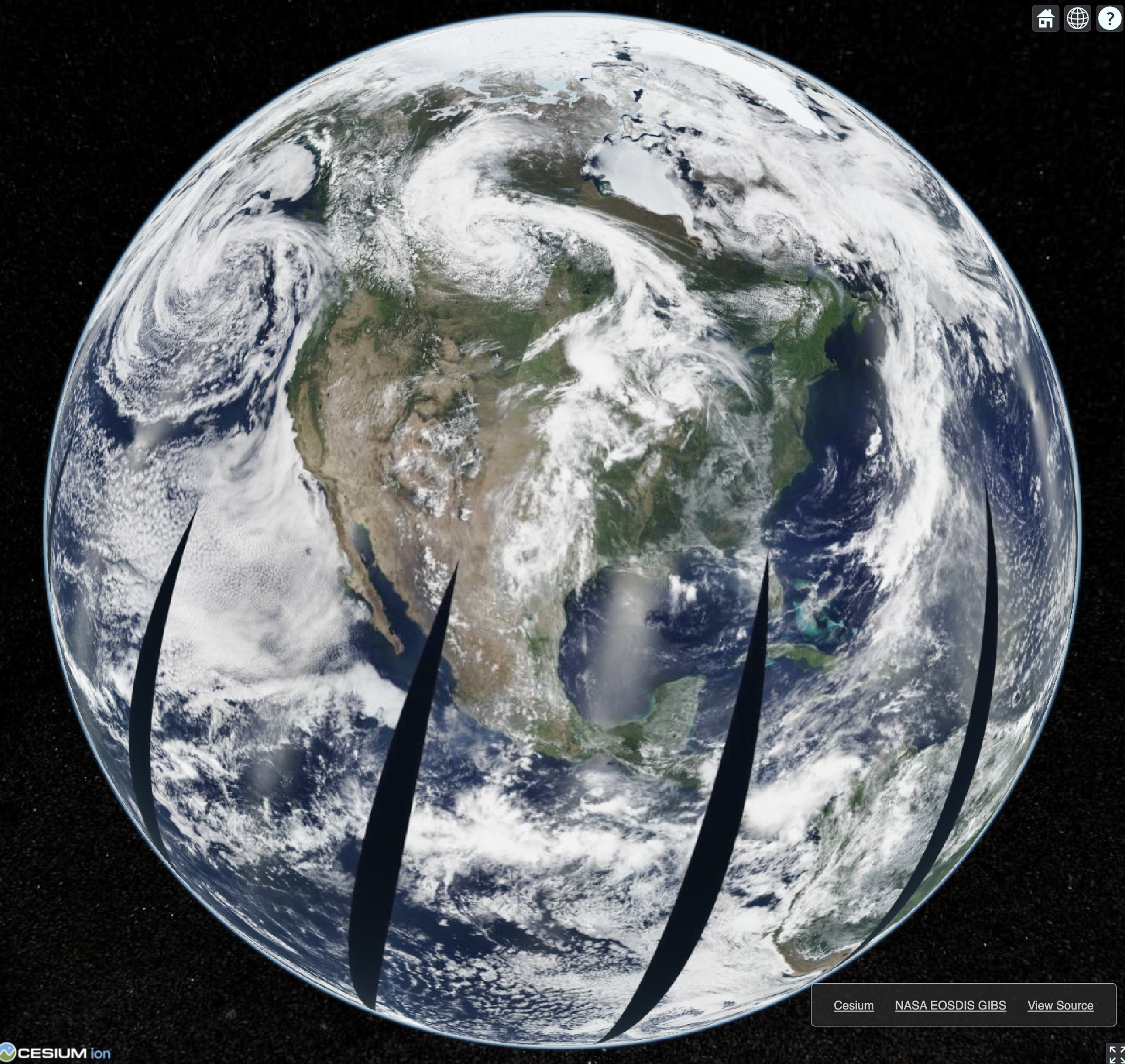
Screenshot of GIBS imagery displayed on a 3D globe in Cesium.
Overview
Content Tools