Page History
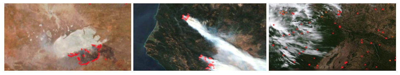
FIRMS delivers global MODIS hotspots / fire locations in easy to use
Comments from Users
| Hide comments |
|---|
| Hide comments |
|---|
Recent space activity
| Recently Updated | ||||||||
|---|---|---|---|---|---|---|---|---|
|
Space contributors
| Contributors | |
|---|---|
| mode | list |
| scope | descendants |
| limit | 5 |
| showLastTime | true | order | update
| Hide child pages |
|---|
Overview
Content Tools