FIRMS fire map users have always had the opportunity to compile a map view using desired layers and then capture a screenshot and save it as a JPG, PNG or GIF file to use or share. Users now have the option of capturing a FIRMS map view as a GeoTIFF image file. The GeoTIFF format includes spatial (georeferencing) information embedded in the .tif file so it can be integrated and viewed with other geospatial data. The GeoTIFF standard is in the public domain and can be readily imported and displayed in many GIS applications.
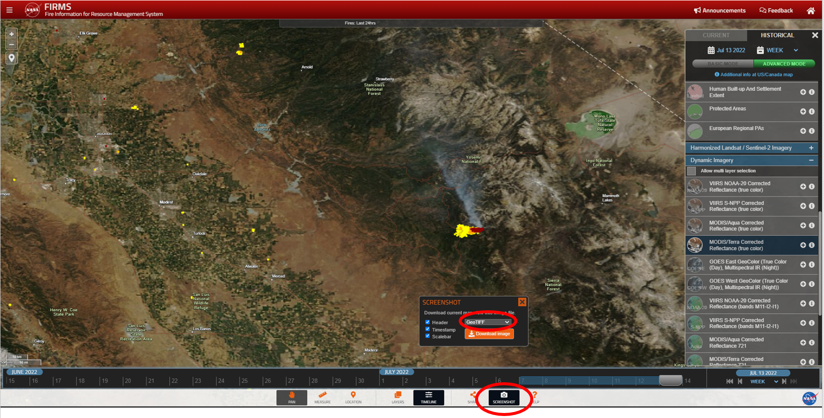
To create a GeoTIFF, click on the "screenshot" icon from the lower right of the FIRMS user interface and select "GeoTIFF" from the dropdown option in the screenshot window.
Overview
Content Tools