| Name
|
Size
|
Creator |
Creation Date
|
Last Modification Date
|
Labels |
Attached To |
|
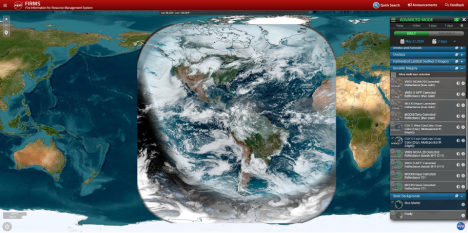
PNG File geostationary in FIRMS.png |
770 kB |
Diane Davies |
Jun 25, 2024 09:35 |
Jun 25, 2024 09:45 |
|
Blog: Geostationary Active Fire Detection Data in FIRMS
|
|
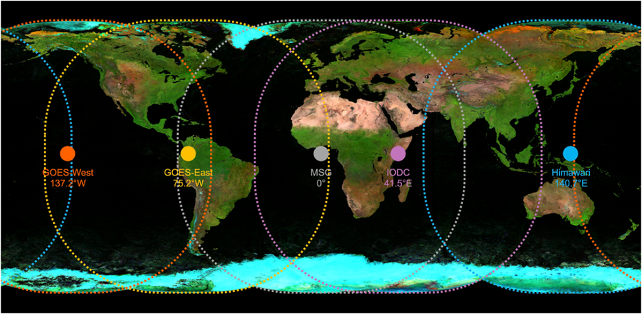
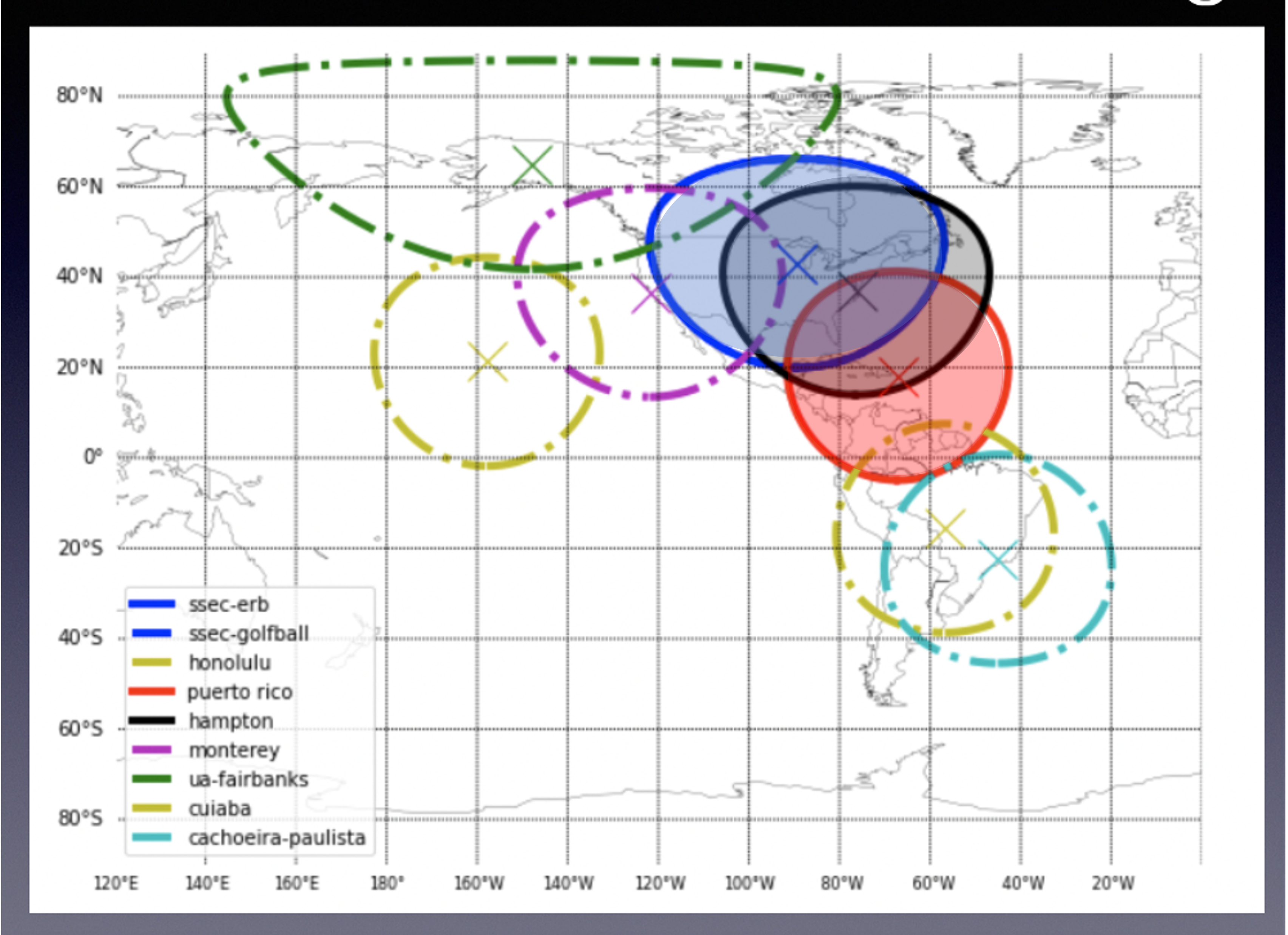
PNG File Spatial coverage of Geostationary.png |
724 kB |
Diane Davies |
Jun 25, 2024 09:36 |
Jun 25, 2024 09:45 |
|
Blog: Geostationary Active Fire Detection Data in FIRMS
|
|
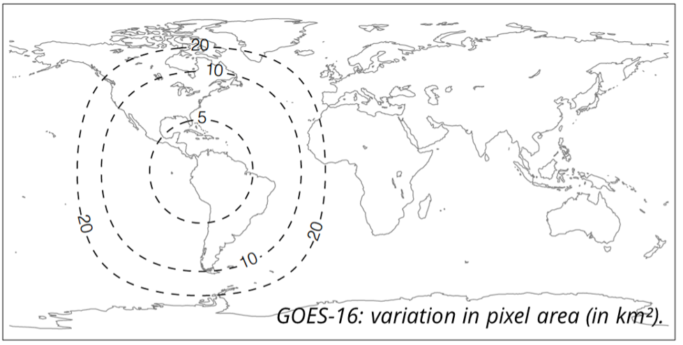
PNG File GOES-16.png |
148 kB |
Diane Davies |
Jun 25, 2024 09:38 |
Jun 25, 2024 09:45 |
|
Blog: Geostationary Active Fire Detection Data in FIRMS
|
|
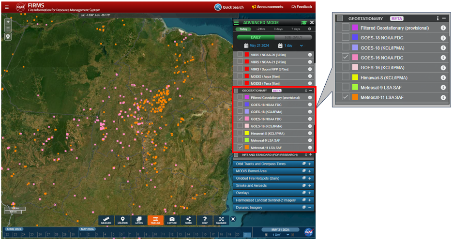
PNG File Geostationary FIRMS Map.png |
672 kB |
Diane Davies |
Jun 25, 2024 09:44 |
Jun 25, 2024 09:45 |
|
Blog: Geostationary Active Fire Detection Data in FIRMS
|
|
PNG File Screenshot 2024-05-17 at 9.19.18 AM.png |
5.06 MB |
Diane Davies |
May 17, 2024 09:25 |
May 17, 2024 09:26 |
|
Page: Bracing for another year of pyrocumulonimbus “fire thunderstorms” in Canada.
|
|
PNG File Screenshot 2024-05-17 at 9.25.11 AM.png |
1.76 MB |
Diane Davies |
May 17, 2024 09:26 |
May 17, 2024 09:26 |
|
Page: Bracing for another year of pyrocumulonimbus “fire thunderstorms” in Canada.
|
|
PNG File Screenshot 2024-05-17 at 9.25.20 AM.png |
1.55 MB |
Diane Davies |
May 17, 2024 09:26 |
May 17, 2024 09:26 |
|
Page: Bracing for another year of pyrocumulonimbus “fire thunderstorms” in Canada.
|
|
PNG File image-2024-2-7_22-51-37-1.png |
57 kB |
Brad Quayle |
Feb 08, 2024 00:51 |
Feb 08, 2024 01:04 |
|
Blog: NOAA-21 VIIRS Active Fire Detection Data Now Available
|
|
PNG File image-2024-2-7_22-51-46-1.png |
189 kB |
Brad Quayle |
Feb 08, 2024 00:51 |
Feb 08, 2024 01:04 |
|
Blog: NOAA-21 VIIRS Active Fire Detection Data Now Available
|
|
PNG File image-2024-2-7_22-55-17-1.png |
2.06 MB |
Brad Quayle |
Feb 08, 2024 00:55 |
Feb 08, 2024 01:04 |
|
Blog: NOAA-21 VIIRS Active Fire Detection Data Now Available
|
|
PNG File image-2024-2-7_22-57-14.png |
410 kB |
Brad Quayle |
Feb 08, 2024 00:57 |
Feb 08, 2024 01:04 |
|
Blog: NOAA-21 VIIRS Active Fire Detection Data Now Available
|
|
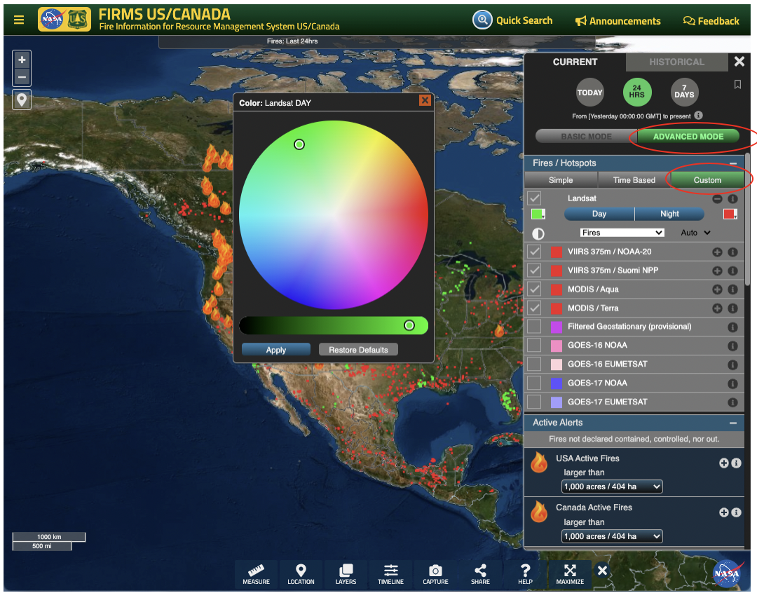
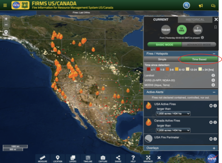
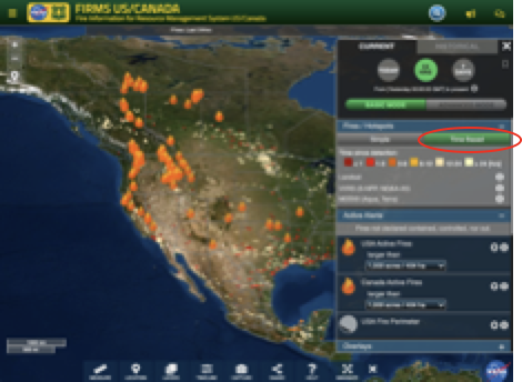
PNG File Screenshot 2024-01-03 at 12.11.40 PM.png |
137 kB |
Diane Davies |
Jan 03, 2024 12:12 |
Jan 03, 2024 12:14 |
|
Blog: FIRMS Updated User Interface
|
|
Microsoft Powerpoint Presentation FIRMS Porto IWFC May 23 final.pptx |
21.61 MB |
Diane Davies |
May 04, 2023 05:47 |
May 04, 2023 05:47 |
|
Home page: Fire Information for Resource Management System (FIRMS)
|
|
PNG File URT vs RT.png |
6.18 MB |
Diane Davies |
Apr 14, 2023 06:17 |
Apr 14, 2023 06:17 |
|
Blog: Wildfire detection in the US and Canada within a minute of satellite observation
|
|
PNG File Screen Shot 2022-10-31 at 10.46.45 AM.png |
1.28 MB |
Diane Davies |
Oct 31, 2022 06:47 |
Oct 31, 2022 06:47 |
|
Blog: New Near Real-Time Product in FIRMS – Landsat Active Fire Data
|
|
PNG File image-2022-10-31_10-25-10.png |
2.04 MB |
Diane Davies |
Oct 31, 2022 06:25 |
Oct 31, 2022 06:25 |
|
Blog: New Near Real-Time Product in FIRMS – Landsat Active Fire Data
|
|
PNG File Screen Shot 2022-10-31 at 10.20.02 AM.png |
2.45 MB |
Diane Davies |
Oct 31, 2022 06:24 |
Oct 31, 2022 06:24 |
|
Blog: New Near Real-Time Product in FIRMS – Landsat Active Fire Data
|
|
PNG File image-2022-10-31_10-13-30.png |
2.22 MB |
Diane Davies |
Oct 31, 2022 06:13 |
Oct 31, 2022 06:13 |
|
Blog: New Near Real-Time Product in FIRMS – Landsat Active Fire Data
|
|
PNG File image-2022-10-31_10-12-59.png |
629 kB |
Diane Davies |
Oct 31, 2022 06:13 |
Oct 31, 2022 06:13 |
|
Blog: New Near Real-Time Product in FIRMS – Landsat Active Fire Data
|
|
JPEG File Landsat-MODIS Active Fire Detection Comparison.jpg |
107 kB |
Brad Quayle |
Sep 29, 2022 20:52 |
Sep 29, 2022 20:52 |
|
Blog: Characteristics of VIIRS, MODIS and OLI Sensors and Their Effects on the Spatial Extent of Daily Active Fire Data
|