Blog from July, 2022
This blog shows you how to:
- change the colors of the fires/thermal anomalies
- change the fire pixel size
- show only day or night detections
- color code fires by Fire Radiative Power (FRP), Confidence or Time Since Detection
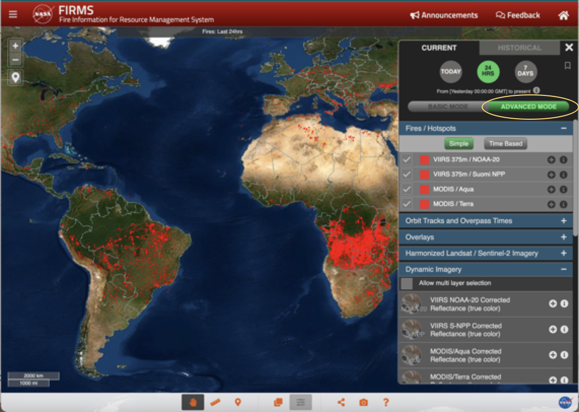
CHANGE FIRE COLOR BY INSTRUMENT
The default color for the MODIS and VIIRS thermal anomalies is red. There are times when it is useful to be able to distinguish between instruments (MODIS/VIIRS) or day/night detections. To do this Select ADVANCED MODE in the Layer List on the right of the map (see image below)
Select the "+" icon next to the fire detections you want to change.
Select the drop down arrow to the right of the color and a color wheel will appear. Select a color and press apply.
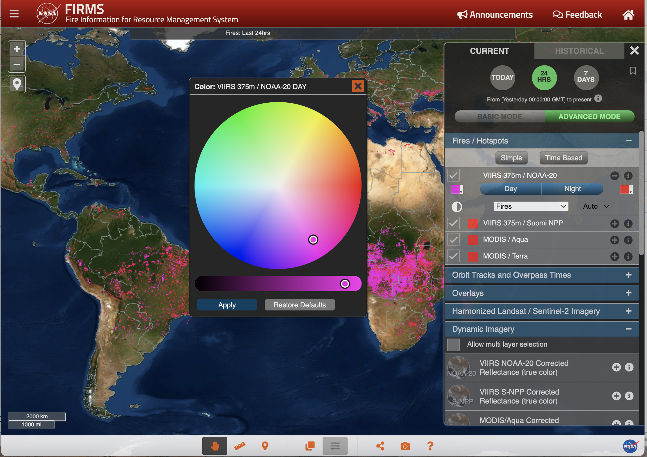
This step can be repeated for other fire detection categories.
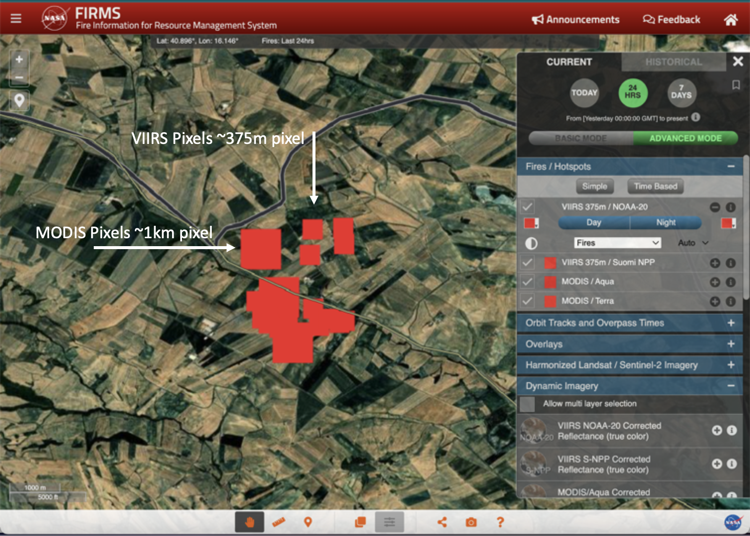
CHANGE FIRE PIXEL SIZE
The fire pixel size defaults to the optimal display for the zoom level. When zoomed into the highest zoom levels, MODIS pixels maintain a size of approximately 1km and VIIRS approximately 375m
To change the pixel size, make sure ADVANCED MODE is selected (as shown above). Click the "+" icon and then click the drop down arrow next to the word "Auto"
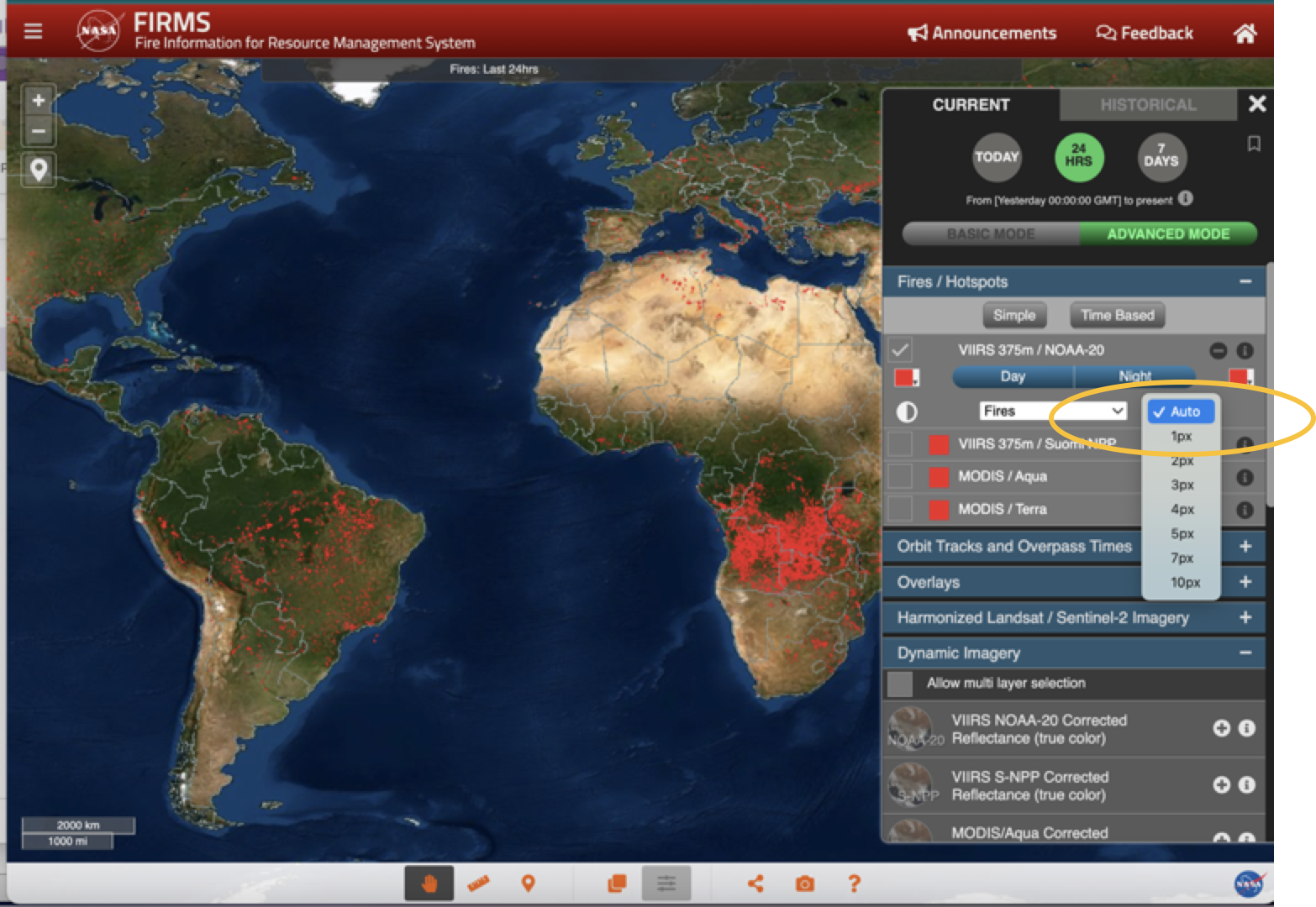
Adjust the pixel size from the drop down list
SHOW ONLY DAY / NIGHT FIRES
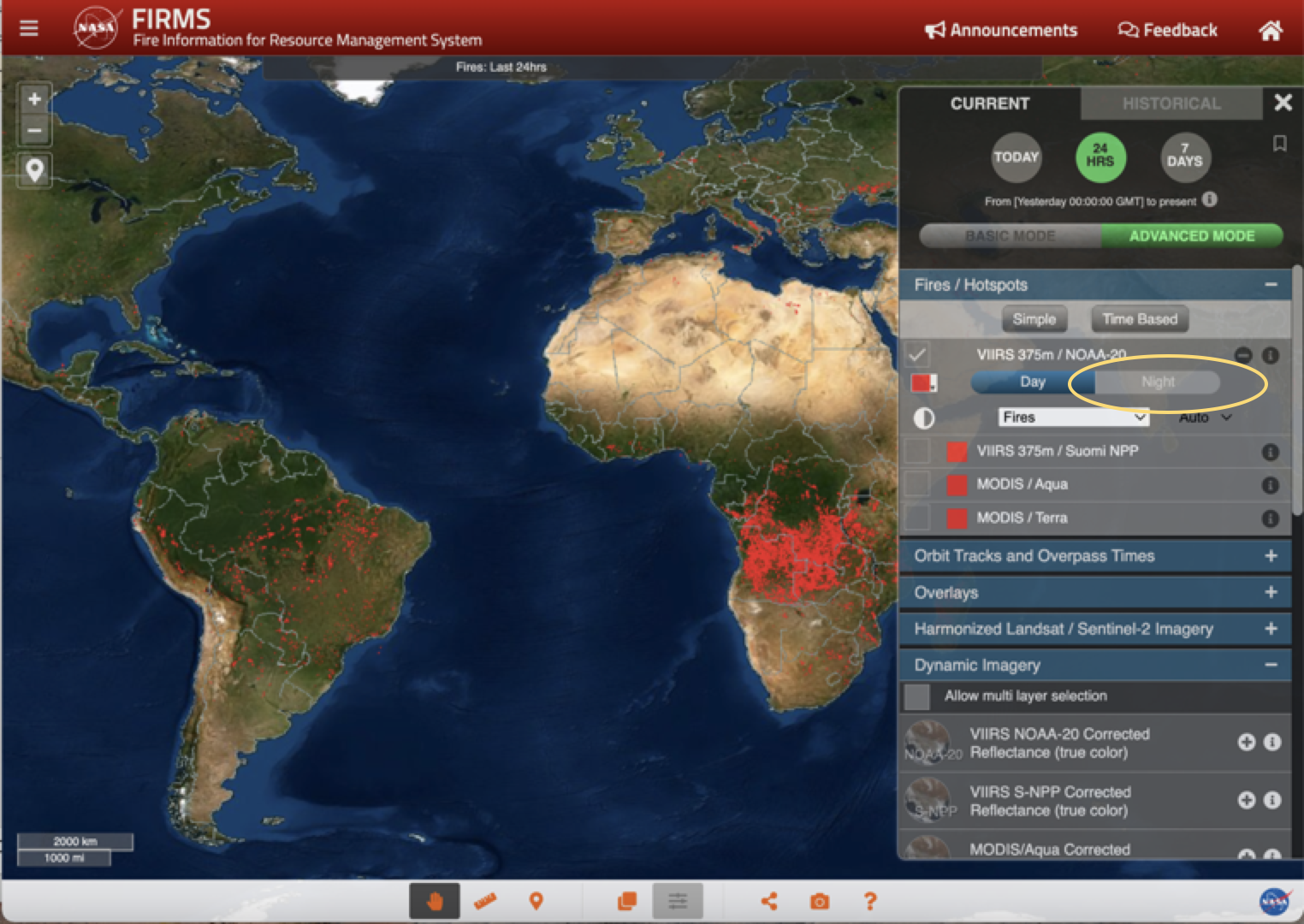
By default, the map shows both Day time and night time fires, to view only day time fires, may sure ADVANCED MODE is selected (as shown above). Click the "+" icon then click on "Night" to deselect it and it is greyed out. To view only nighttime fires, click on "Night" to turn both back on and then click on "Day" so it is greyed out.
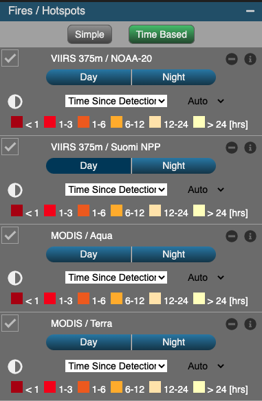
VIEW FIRES BY FRP, CONFIDENCE or TIME SINCE DETECTION
To view fires using Fire Radiative Power (FRP), Confidence or Time Since Detection, select "ADVANCED MODE" in the Layer List, then select the drop down arrow next to the word "Fires" for the fire detections you want to change.
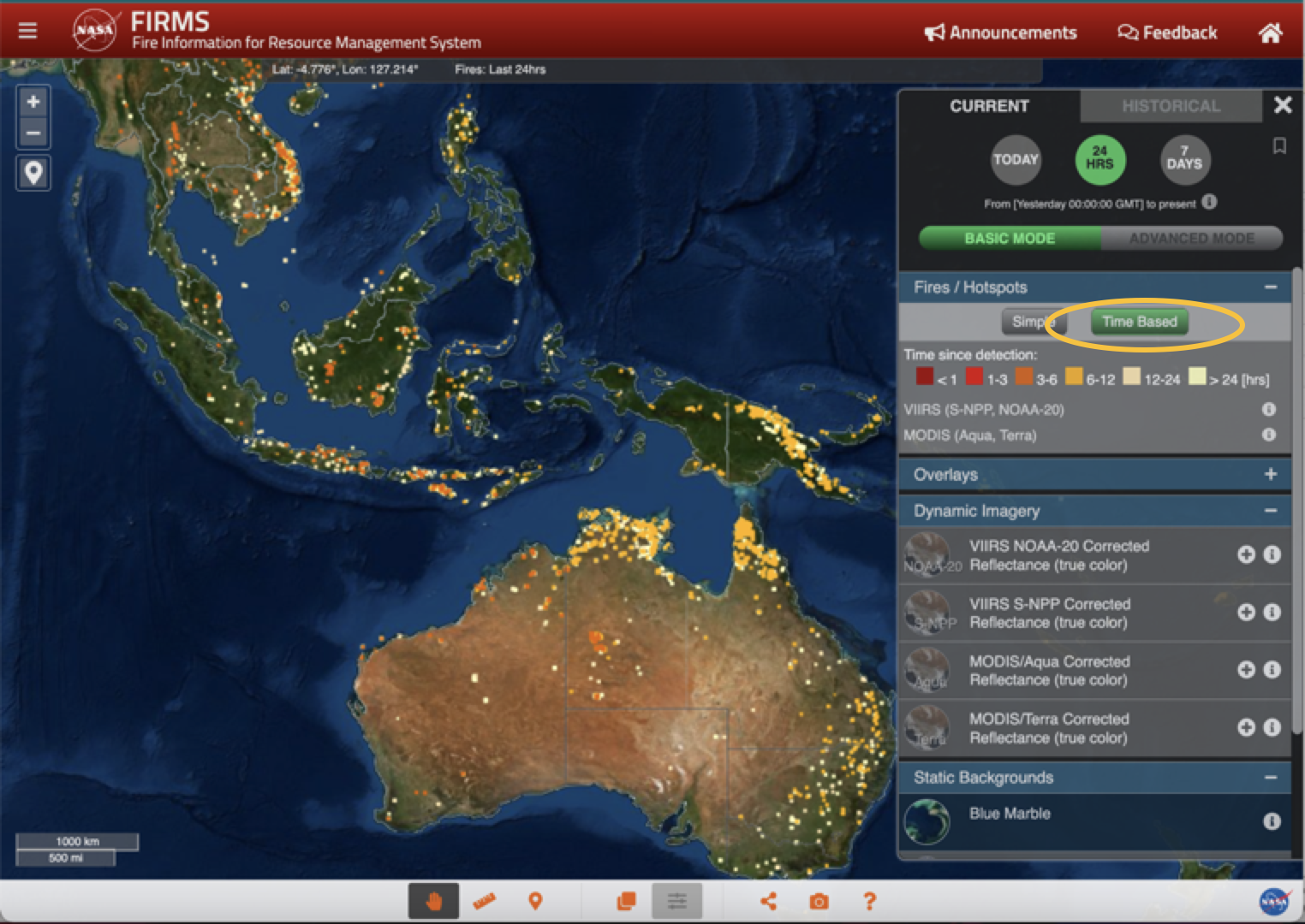
Time Since Detection shows the fires < 1, 1-3, 3-6, 6-12, 12-24, and >24 Hours since the fires were detected by the satellite. Enable this by selecting "Time Based" in either Basic or Advanced Mode.
FIRMS recently integrated ultra real-time (URT) MODIS and VIIRS active fire data, within a minute of satellite observation, from multiple direct readout ground stations in the continental US (CONUS).
See "FIRMS Adds Ultra Real-Time Data from MODIS and VIIRS" article on Earthdata.nasa.gov
This is the first routine service provided by FIRMS for detecting wildfires over the continental United States from NASA and NOAA low-Earth orbit satellites with a latency of less than 60 seconds from Earth observation to wildfire detection. The ultra real-time processing has been made possible by the Space Science and Engineering Center (SSEC) at the University of Wisconsin-Madison with funding from NASA's WildFireSense program. Software systems enable the SSEC to stream direct broadcast data in real-time from each antenna to a central collection point at the University of Wisconsin–Madison, which then ingests and merges the data, including de-duplication of overlapping data, in real-time.
Currently URT data are received from Madison, Wisconsin (2 antennas), Hampton, Virginia and Mayaguez, Puerto Rico. In addition to the URT, Real-Time (RT) data are received from Honolulu, Hawaii and Monterey, California (after the pass is complete). Latency for RT data is 20—30 minutes. It is anticipated that the real-time data will be expanded to include additional CONUS stations and stations in Alaska and Hawaii.
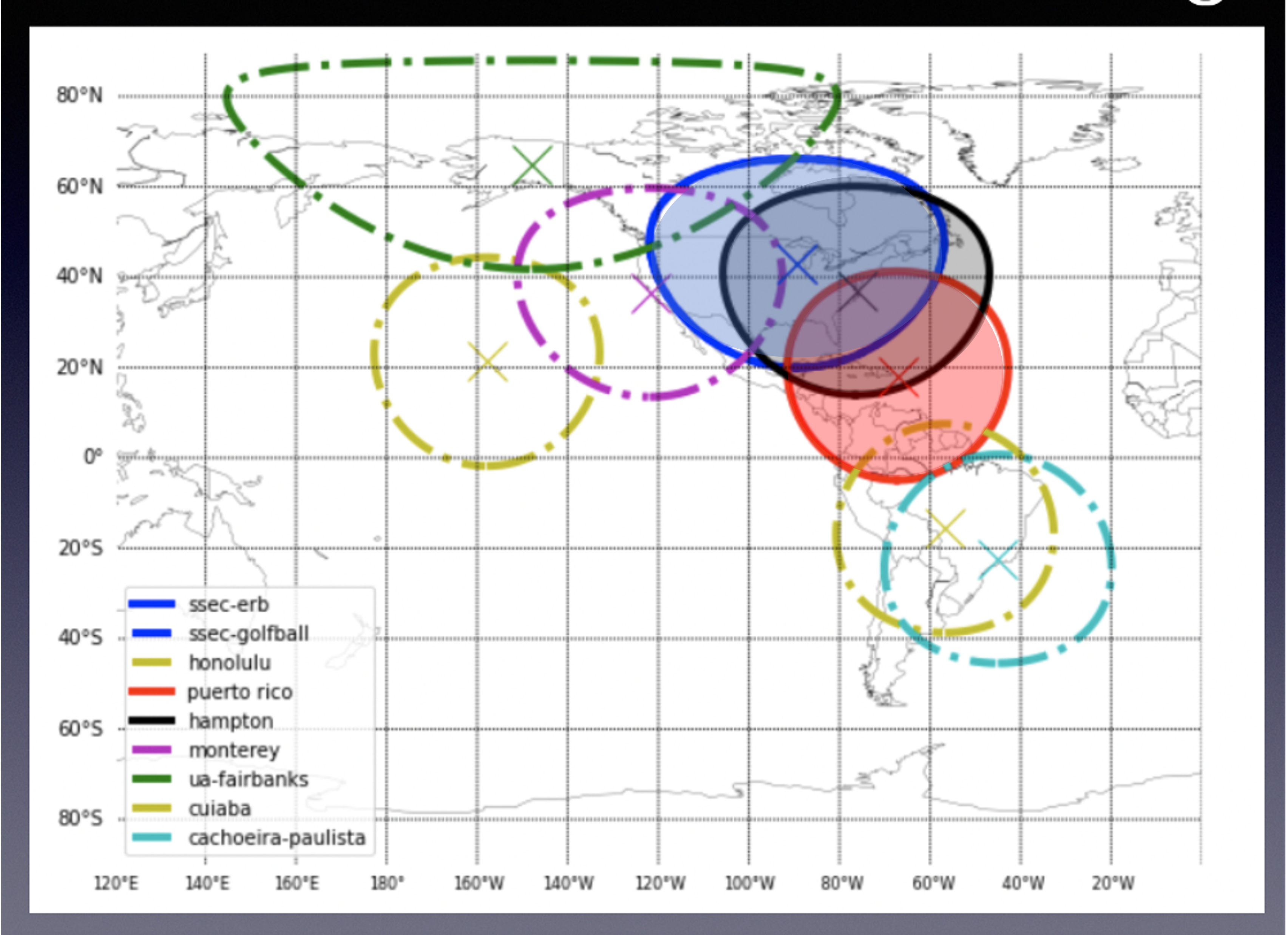
Figure showing current and planned coverage of Direct Broadcast
stations collecting ultra real-time and real-time data
URT and RT thermal anomaly / fire detections are processed using the LANCE FIRMS active fire algorithms, so the data are comparable with the NRT data from LANCE.
- URT and RT data are available in both FIRMS and FIRMS US/Canada Fire maps and can be identified by the URT or RT suffix in the "version" - found by clicking on the fires to view the attributes.
- URT and RT data are also available in the WMS and WFS map services and KMZs.
- URT and RT data will roll off the system within six hours as the NRT data becomes available.
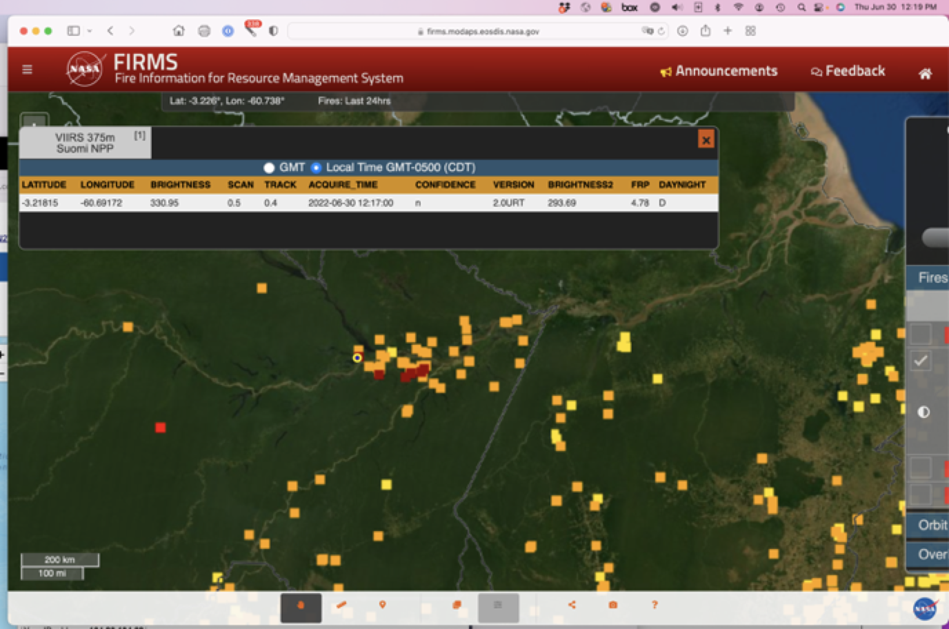
Screenshot showing URT fire detected on 2022/06/30.
The fire was observed at 12:17 CDT and displayed in FIRMS at 12:19 CDT
(as shown by computer time on top right of screen)
Users can see the real-time fire detections by selecting the Time Based option which color codes fires by Time Since Detection. However it is important to note that the URT and RT fires only show up within a minute of satellite fly-over so users need to know when the satellite passes overhead. To find our what time the satellite overpass is you can load the orbit tracks. (see next screenshot)
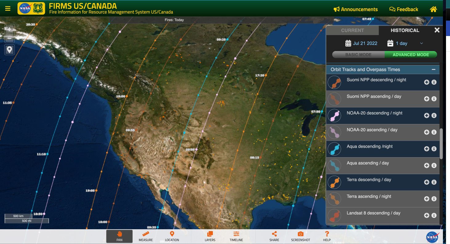
Screenshot showing descending overpass times from Suomi-NPP, NOAA-20, Aqua and Terra. These can be added by going to Advanced Mode and then selecting tracks from the Orbit Tracks and Overpass Times.
Once you have the Orbit tracks loaded, make sure the fires display using the "Time-Based" option and the look for the deep red colored squares.
FIRMS fire map users have always had the opportunity to compile a map view using desired layers and then capture a screenshot and save it as a JPG, PNG or GIF file to use or share. Users now have the option of capturing a FIRMS map view as a GeoTIFF image file. The GeoTIFF format includes spatial (georeferencing) information embedded in the .tif file so it can be integrated and viewed with other geospatial data. The GeoTIFF standard is in the public domain and can be readily imported and displayed in many GIS applications.
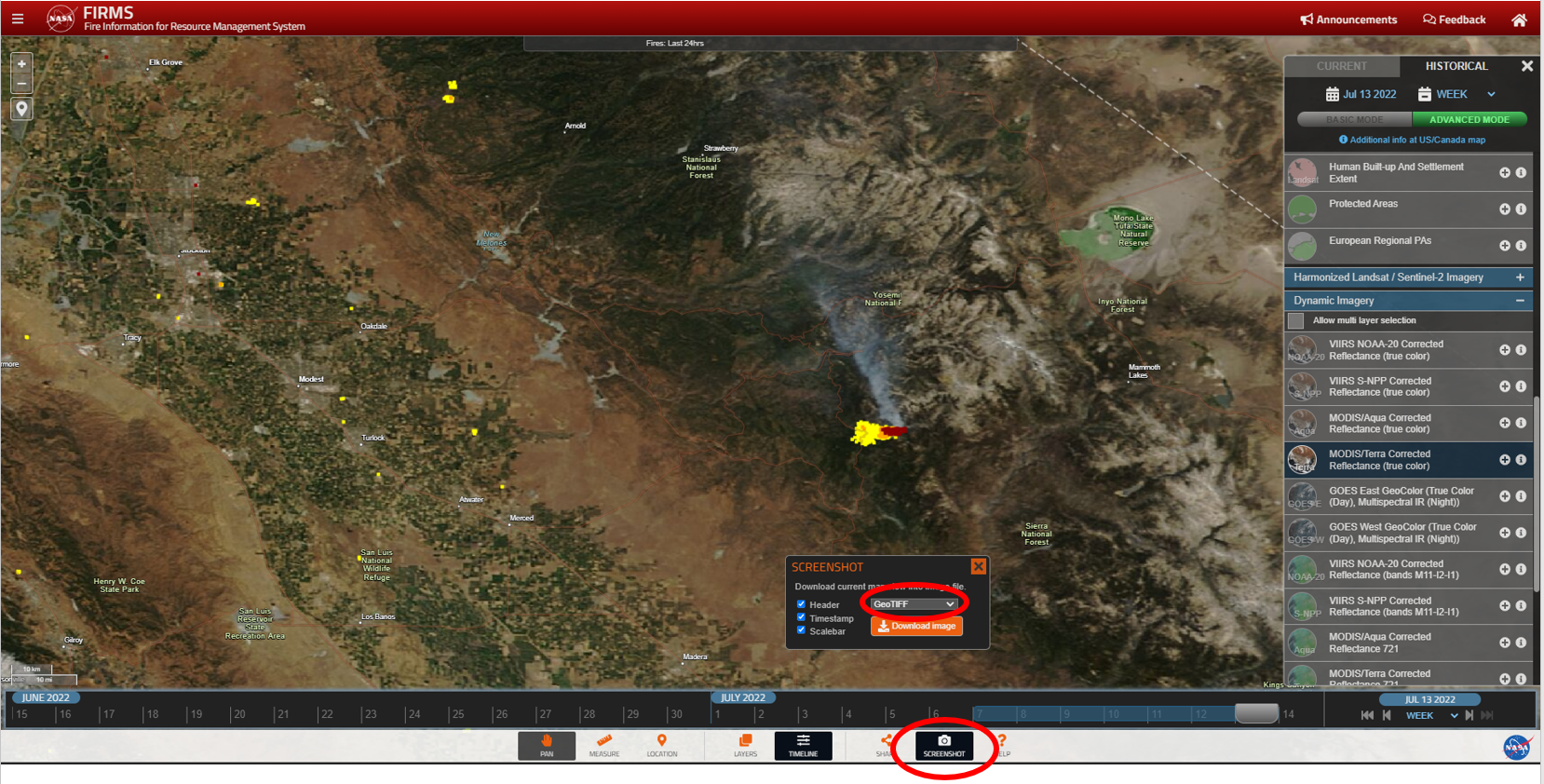
To create a GeoTIFF, click on the "screenshot" icon from the lower right of the FIRMS user interface and select "GeoTIFF" from the dropdown option in the screenshot window.