Blog from June, 2021
The FIRMS team has introduced several new features and capabilities to both FIRMS Global and FIRMS US/Canada. We’ll continue to highlight these new additions over several future posts.
In this post, we would like to highlight the Time Since Detection classification for MODIS and VIIRS active fire detection data that is available in the fire map for FIRMS Global and FIRMS US/Canada. This classification symbolizes active fires based on their time of detection relative to the current time. This enables users to visualize recent fire progression and currently active fire fronts for wildland fires. The temporal classification displays active fire detections occurring in the past 0 to 6 hours (deep red), detections occurring 6 to 12 hours earlier (red) and 12 to 24 hours earlier (orange), and detections occurring previous to the last 24 hour period (yellow).
Setting the Time Since Detection Classification in FIRMS
- Open the fire map viewer for FIRMS Global or FIRMS US/Canada
- Select the Time Since Detection choice from the pick list associated for a particular satellite/sensor source in the FIRMS display control window to apply this classification to the active fire detection data for that source layer
- To apply it for all the MODIS and VIIRS active fire detection layers, click the Time Based button at the top of in the FIRMS display control window
Examples of active fire data displayed with the time since detection classification:
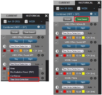
Examples for setting the time since detection classification in FIRMS

SNPP and NOAA-20 VIIRS active fire detection locations in Northern California symbolized by their time since detection at ~17:00 PDT June 30, 2021
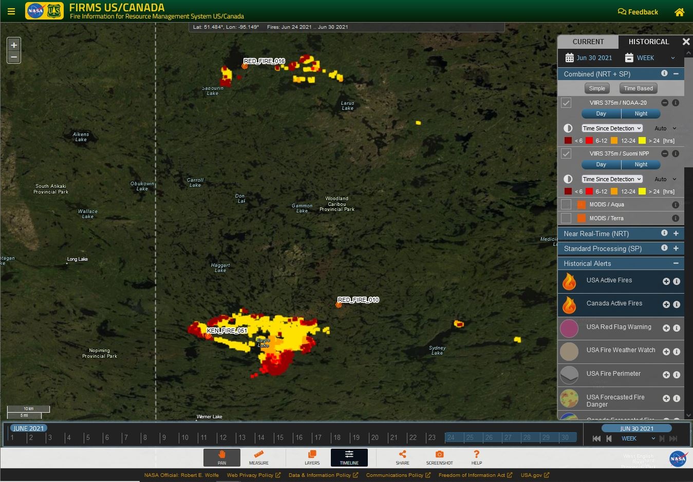
SNPP and NOAA-20 VIIRS active fire detection locations in Western Ontario symbolized by their time since detection at ~19:00 CDT June 30, 2021
FIRMS has added additional capability to integrate satellite active fire detection data as streaming web services. Several new geospatial web services are now available to meet the needs of end users in visualizing and analyzing these data in the context of geospatial information in desktop or web mapping applications.
New Web Map Services
In addition to legacy FIRMS Web Map Services (WMS) that provide MODIS and VIIRS active fire detection data for the past 24, 48, 72 hours or the past 7 days, new services are provided that display these data relative to their time since detection. New WMS options enable visualization of cumulative MODIS and VIIRS active fire data for the current calendar year in two temporal classifications that depict the data in its relative time since detection. Please see the WMS information page for FIRMS US/Canada and FIRMS Global for service connection information and tutorials on how to access the services.

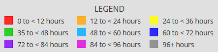 Temporal classifications for the new MODIS and VIIRS active fire detection web map services available in FIRMS.
New Web Feature Services
FIRMS has also introduced new regional Web Feature Services (WFS) that stream the centroids of active fire detection pixels for MODIS and VIIRS as geographic point features. The services allow end users to manipulate and analyze features in the services using a geospatial client. These services are configured to enable access to MODIS or VIIRS active fire data for the past 24 hours or the past 7 days. Please see the WFS information page for FIRMS US/Canada and FIRMS Global for service connection information and tutorials on how to access the services.