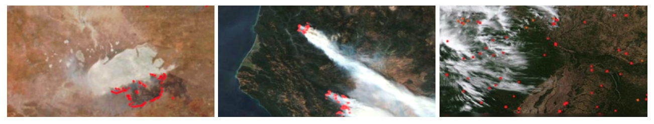
FIRMS delivers global MODIS hotspots / fire locations in easy to use formats
The near real-time (NRT) active fire locations are processed by LANCE using the standard MODIS MOD14/MYD14 and VIIRS 375m Fire and Thermal Anomalies algorithms. For more information and active fire data go to: http://earthdata.nasa.gov/firms
New: FIRMS US/Canada - a joint effort by NASA and the USDA Forest Service
FIRMS Blog: Stay up to date with FIRMS developments
Background
FIRMS was developed by the University of Maryland, with funds from NASA’s Applied Sciences Program and the UN Food and Agriculture Organization, to provide near real-time active fire locations to natural resource managers that faced challenges obtaining timely satellite-derived fire information.
An operational version of FIRMS, known as the Global Fire Information Management System (GFIMS) was running at the United Nations Food and Agriculture Organization (UN FAO) where it complemented the FAO’s existing suite of projects that deliver near-real time information to ongoing monitoring and emergency projects, to other UN organizations as well as providing information to the general public. This is no longer supported.
For more information on the MODIS fire products, visit the UMD MODIS Active Fire and Burned Area products website.
Blog Posts
Blog Posts
Product User Manual
Fire Radiative Power Products: GOES-R and Himawari Satellites - Provided by Martin Wooster Feb 2002
NASA Earthdata Articles on FIRMS
The Big and Small of Fire in Africa
Landsat Fire and Thermal Anomaly Data Added to FIRMS
FIRMS Adds Ultra Real-Time Data from MODIS and VIIRS
New HLS False Color Composite Layer Added to FIRMS
NASA, Forest Service Partnership Expands Active Fire Mapping Capabilities
Wildfires Can't Hide from Earth Observing Satellites
NASA FIRMS Helps Fight Wildland Fires in Near Real-Time
Communication Material
FIRMS Flyers (Nov 2022):
FIRMS Postcard (March 2023):
Presentations and Posters
- FIRMS compressed
- FIRMS AGU 2024
- FIRMS Poster for IWFC, Porto
- LANCE FIRMS for NOAA VIIRS User meeting
- LANCE FIRMS AMS Annual Conference, Jan 2023
- LANCE FIRMS AGU Annual Meeting, Dec 2022
- LANCE FIRMS 610 Directors Seminar Oct 2022
- FIRMS GOFC-Fire June 2022
- LANCE FIRMS - USFS_final.pptx
- FIRMS EARSel 2019