| Name
|
Size
|
Creator |
Creation Date
|
Last Modification Date
|
Labels |
Attached To |
|
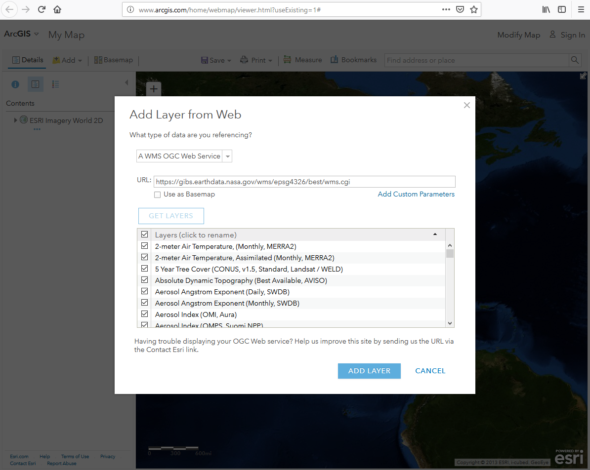
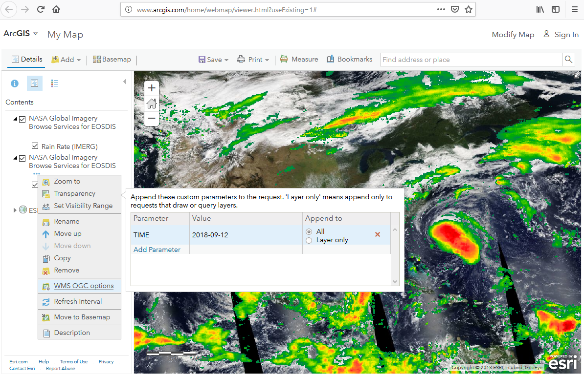
PNG File AGOL-AddLayerDialog.png |
443 kB |
Ryan Boller |
Mar 05, 2019 20:22 |
Mar 05, 2019 20:22 |
|
Page: Geographic Information System (GIS) Usage
|
|
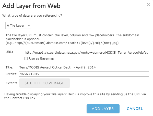
PNG File AGOL-AddTileLayer.png |
49 kB |
user-c667d |
Jul 07, 2016 15:55 |
Jul 07, 2016 15:55 |
|
Page: Geographic Information System (GIS) Usage
|
|
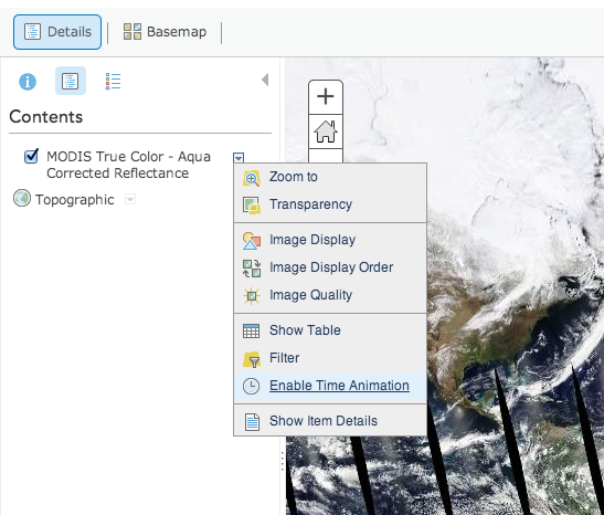
PNG File AGOL-EnableTime.png |
168 kB |
user-c667d |
Jul 07, 2016 15:55 |
Jul 07, 2016 15:55 |
|
Page: Geographic Information System (GIS) Usage
|
|
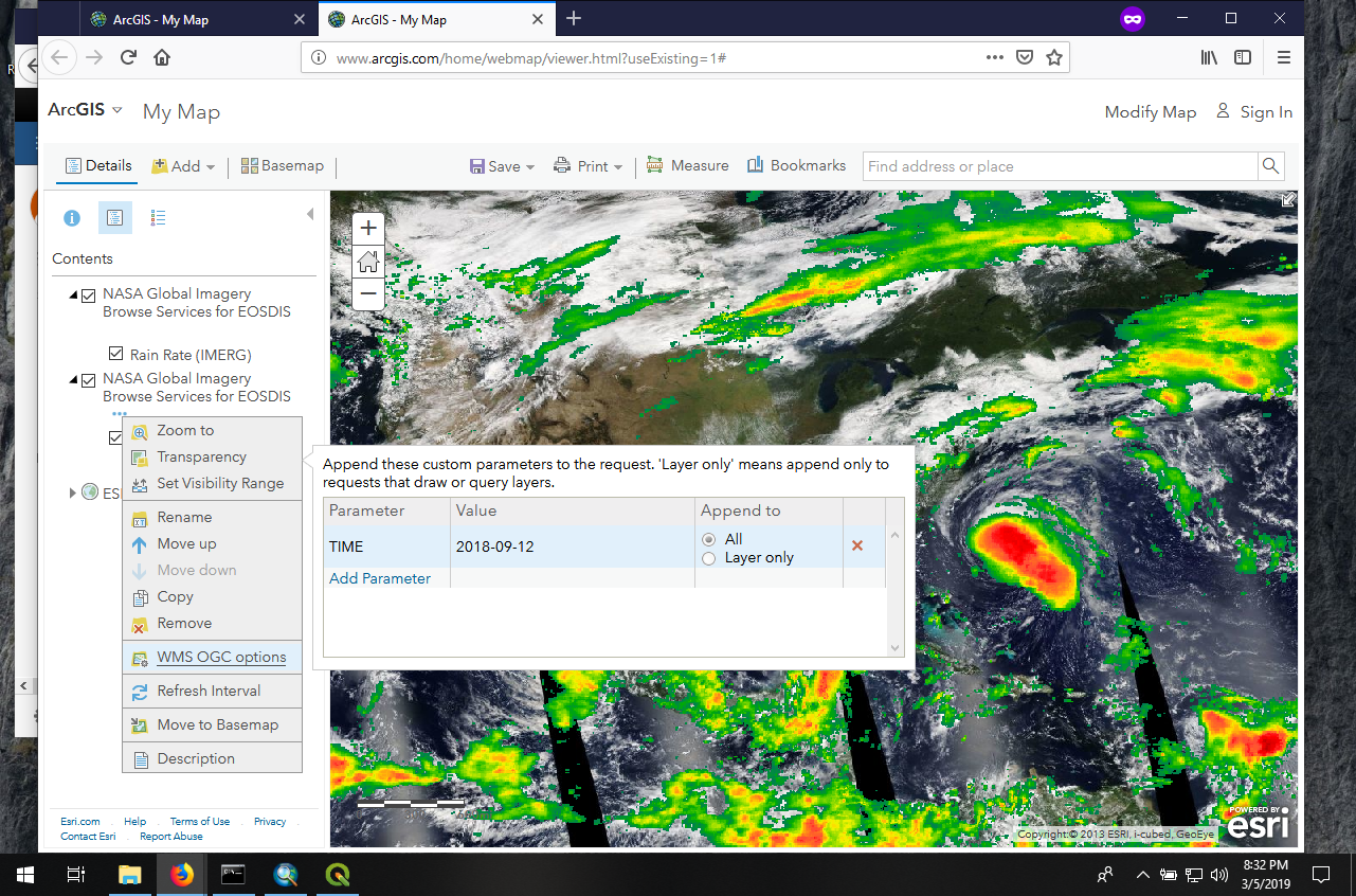
PNG File AGOL-TimeAdjust.png |
1.00 MB |
Ryan Boller |
Mar 05, 2019 20:33 |
Mar 05, 2019 20:33 |
|
Page: Geographic Information System (GIS) Usage
|
|
PNG File AGOL-TimeAdjust2.png |
946 kB |
Ryan Boller |
Mar 05, 2019 20:34 |
Mar 05, 2019 20:34 |
|
Page: Geographic Information System (GIS) Usage
|
|
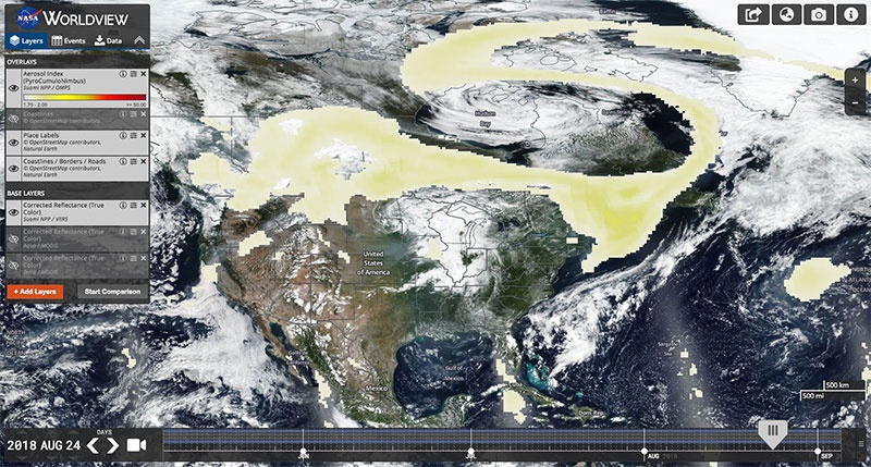
JPEG File AI_PyroCumuloNimbus_WV1.jpg |
137 kB |
Minnie Wong |
Mar 11, 2019 09:50 |
Mar 11, 2019 09:51 |
|
Blog: New Tour and Imagery Roundup
|
|
PNG File AMSR-palette.png |
4 kB |
Ryan Boller |
Apr 24, 2014 18:33 |
Apr 24, 2014 18:34 |
|
Blog: New Products: AMSR-E Brightness Temperature and MEaSUREs Freeze-Thaw
|
|
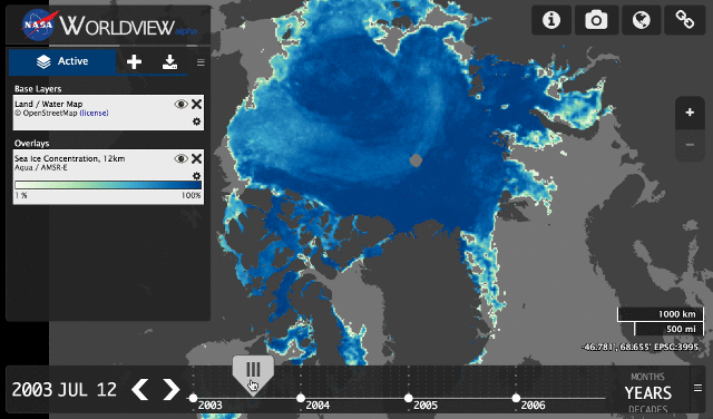
GIF File animated_amsr.gif |
1.00 MB |
user-c667d |
Sep 23, 2014 10:48 |
Sep 23, 2014 10:48 |
|
Blog: New Products: AMSR-E Sea Ice and Blue Marble: Next Generation
|
|
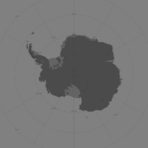
PNG File antarctic-sm.png |
33 kB |
user-c667d |
Jul 07, 2016 19:16 |
Jul 07, 2016 19:16 |
|
Page: GIBS API for Developers
|
|
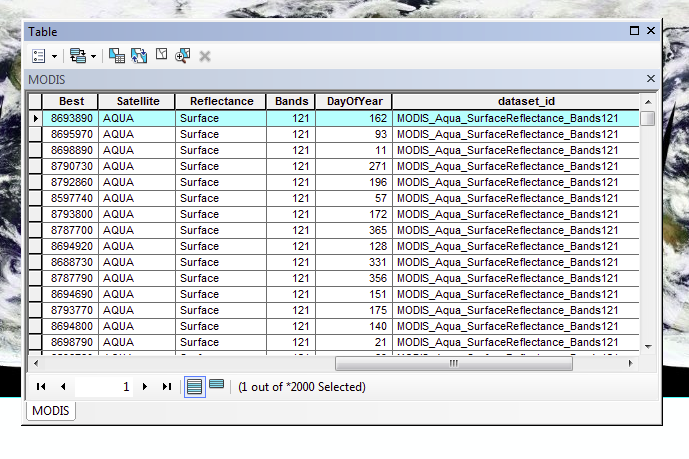
PNG File ArcMap-AttributeTable.png |
119 kB |
user-c667d |
Jul 07, 2016 15:55 |
Jul 07, 2016 15:55 |
|
Page: Geographic Information System (GIS) Usage
|
|
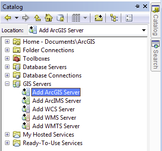
PNG File ArcMap-CatalogWindow.png |
30 kB |
user-c667d |
Jul 07, 2016 15:55 |
Jul 07, 2016 15:55 |
|
Page: Geographic Information System (GIS) Usage
|
|
PNG File ArcMap-CatWindow.png |
124 kB |
Ryan Boller |
Mar 05, 2019 19:29 |
Mar 05, 2019 19:29 |
|
Page: Geographic Information System (GIS) Usage
|
|
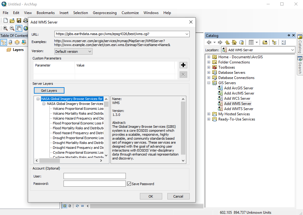
PNG File ArcMap-GIBS-Catalog.png |
122 kB |
Ryan Boller |
Mar 05, 2019 19:32 |
Mar 05, 2019 19:32 |
|
Page: Geographic Information System (GIS) Usage
|
|
JPEG File ArcMap-LockToSelectedRasters.jpg |
71 kB |
user-c667d |
Jul 07, 2016 15:55 |
Jul 07, 2016 15:55 |
|
Page: Geographic Information System (GIS) Usage
|
|
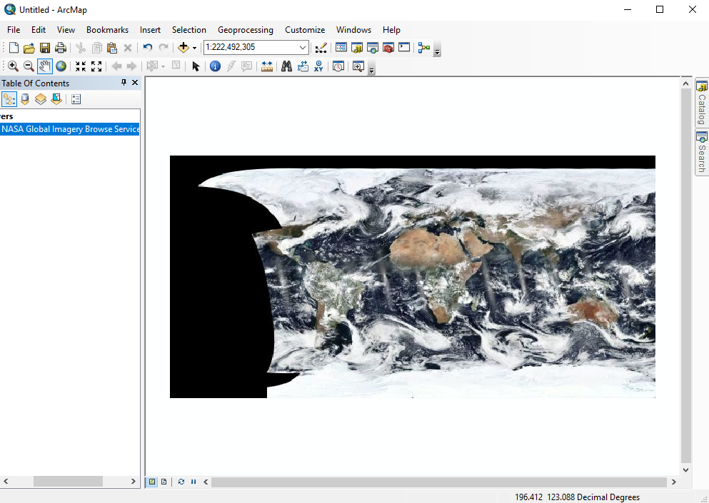
JPEG File ArcMap-ModisAsLayer-sm.jpg |
72 kB |
user-c667d |
Jul 07, 2016 15:55 |
Jul 07, 2016 15:55 |
|
Page: Geographic Information System (GIS) Usage
|
|
PNG File ArcMap-ModisServer.png |
12 kB |
user-c667d |
Jul 07, 2016 15:55 |
Jul 07, 2016 15:55 |
|
Page: Geographic Information System (GIS) Usage
|
|
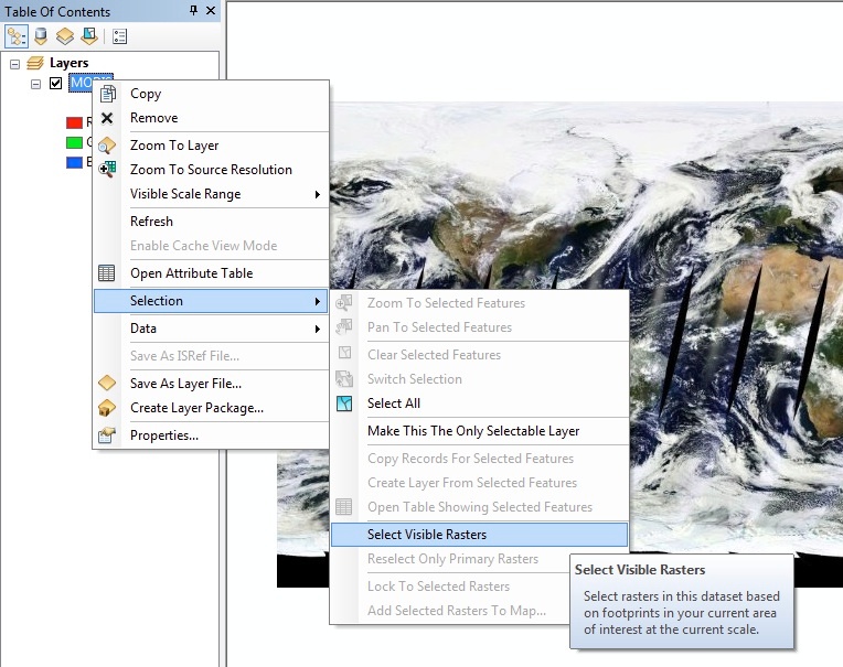
JPEG File ArcMap-SelectVisibleRasters.jpg |
156 kB |
user-c667d |
Jul 07, 2016 15:55 |
Jul 07, 2016 15:55 |
|
Page: Geographic Information System (GIS) Usage
|
|
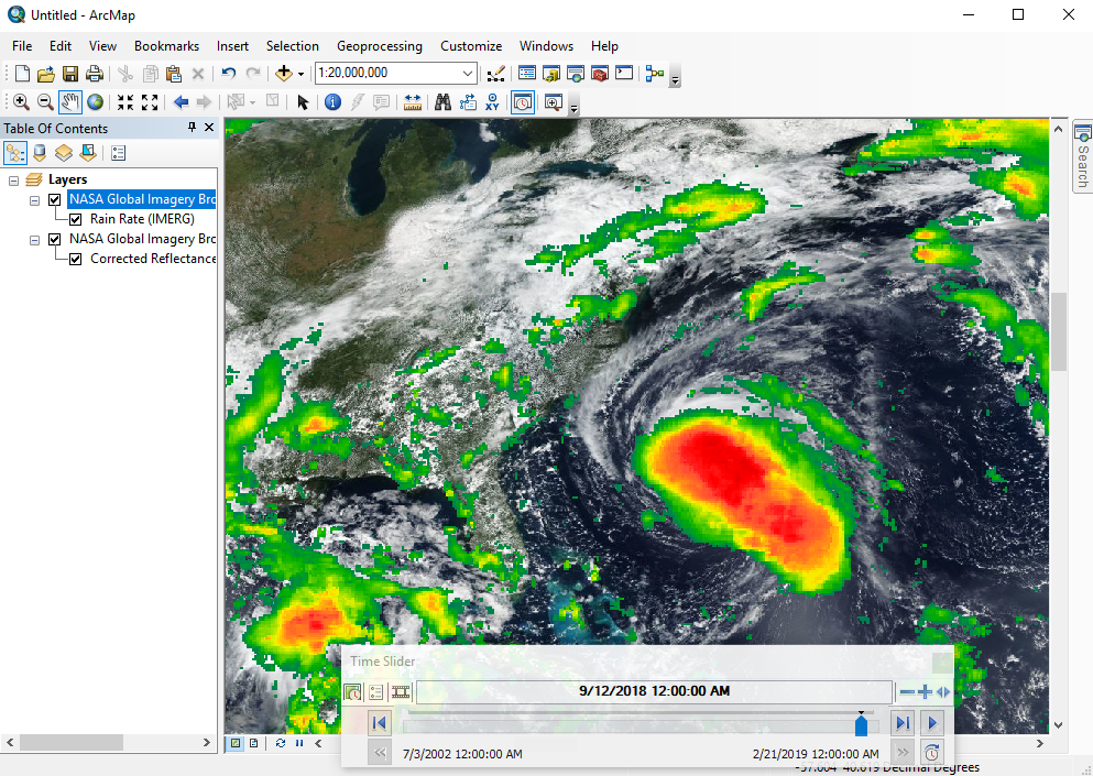
PNG File ArcMap-TimePanel.png |
788 kB |
Ryan Boller |
Mar 05, 2019 19:37 |
Mar 05, 2019 19:37 |
|
Page: Geographic Information System (GIS) Usage
|
|
PNG File ArcMap-VIIRS-CR.png |
393 kB |
Ryan Boller |
Mar 05, 2019 19:35 |
Mar 05, 2019 19:35 |
|
Page: Geographic Information System (GIS) Usage
|
|
PNG File arctic-sm.png |
63 kB |
user-c667d |
Jul 07, 2016 19:16 |
Jul 07, 2016 19:16 |
|
Page: GIBS API for Developers
|