Worldview and the Global Imagery Browse Services (GIBS) are now offering near real-time true/natural color (RGB) and infrared color (NGB) imagery from the Multi-angle Imaging Spectro-Radiometer (MISR) instrument on the Terra satellite. The imagery are available for the nadir, four fore and four aft views provided by MISR's nine cameras.
That's looking at the earth from 9 different angles in two different band combinations - a total of 18 imagery products!
- An (A Nadir) Natural Color (RGB) | Infrared Color (NGB)
- Af (A Forward) Natural Color (RGB) | Infrared Color (NGB)
- Bf (B Forward) Natural Color (RGB) | Infrared Color (NGB)
- Cf (C Forward) Natural Color (RGB) | Infrared Color (NGB)
- Df (D Forward) Natural Color (RGB) | Infrared Color (NGB)
- Aa (A Aft) Natural Color (RGB) | Infrared Color (NGB)
- Ba (B Aft) Natural Color (RGB) | Infrared Color (NGB)
- Ca (C Aft) Natural Color (RGB) | Infrared Color (NGB)
- Da (D Aft) Natural Color (RGB) | Infrared Color (NGB)
The true/natural color imagery use the Red-Green-Blue (RGB) band wavelength combination to produce images that is similar to what the human eye would see, providing natural-looking images of land surface, oceanic and atmospheric features. The infrared color imagery uses the Near Infrared-Green-Blue (NGB) band wavelength combination to produce images that make it easier to differentiate between types of vegetation and shows vegetation in red, it's also good for identifying surface water.
The spatial resolution of the natural color imagery is 250m. Imagery for the infrared color radiance is at 1 km for the eight off-nadir views and 250m for the nadir view.
The imagery is produced from the MISR Level 1 ellipsoid-projected radiance data products by NASA’s Land, Atmosphere Near real-time Capability for EOS (LANCE) MISR Element at NASA’s Atmospheric Science Data Center (ASDC). These products are generally accessible within two to three hours of a satellite overpass, and are available for viewing through NASA’s Worldview or similar GIBS client systems. Imagery for these products is available from 1 September 2017 to present.
While LANCE near real-time products are not intended to take the place of data products generated by the detailed processing necessary for scientific research, they are an invaluable resource for users needing rapid, continually updated views of ongoing Earth processes.
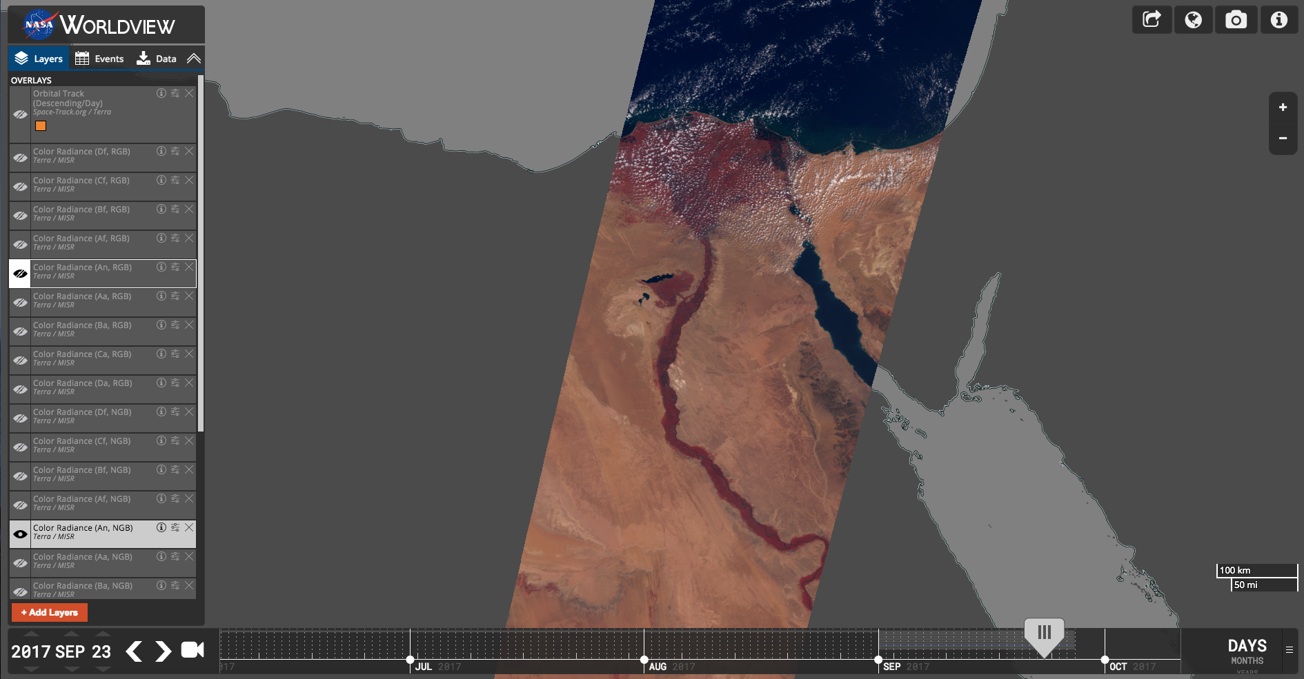
MISR A Nadir, Infrared color (Color Radiance (An, NGB)) image of the Nile River Delta on the 23rd September 2017.

Download the corresponding data in Worldview!

Hurricane Irma on the 7th of September 2017. This animation shows the storm from different angles as imaged by MISR's 9 cameras, in the following order: Df, Cf, Bf, Af, An, Aa, Ba, Ca, Da - viewing forward, downward, and backward along the Terra satellite flight path (overlaid on MODIS/Terra imagery).
Overview
Content Tools