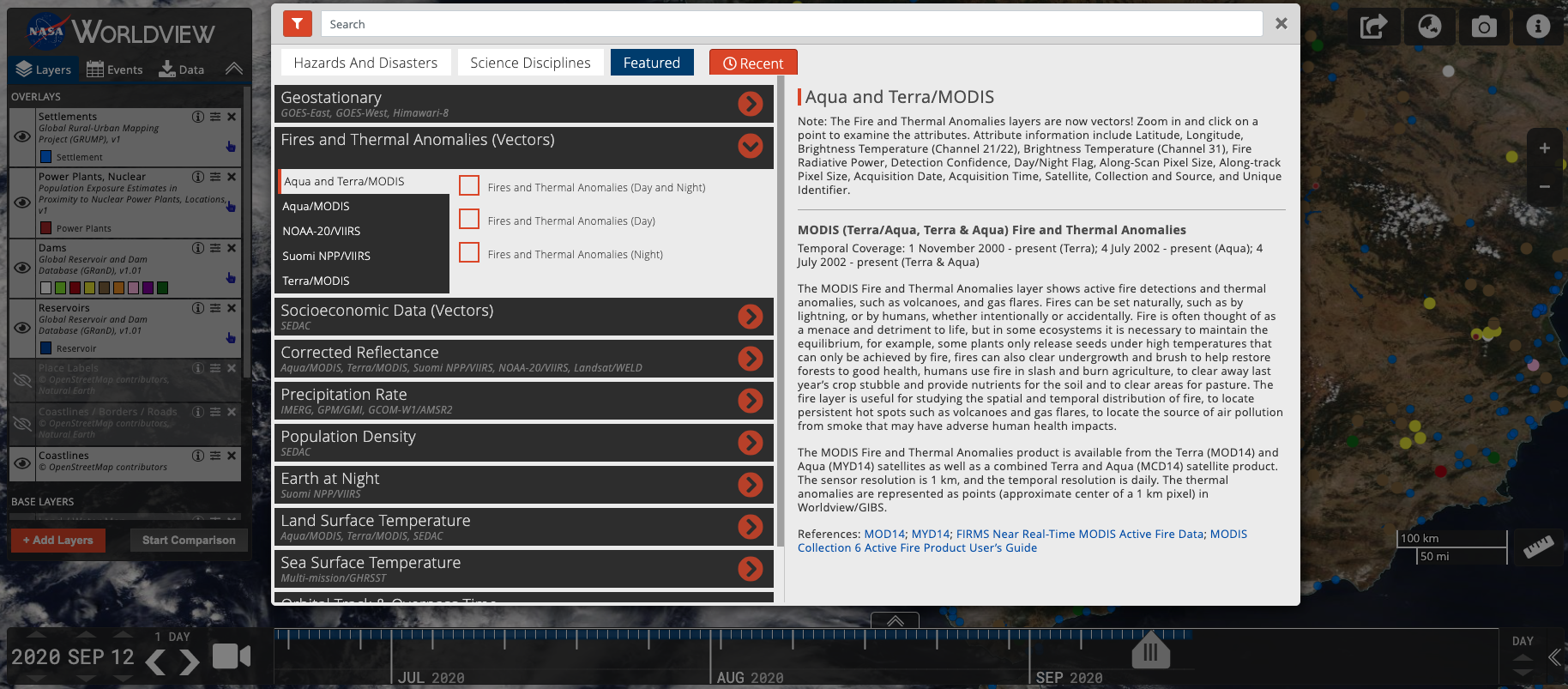
With our latest release, version 3.8.2, vector capabilities have been extended to the Fire and Thermal Anomalies layers! A total of 5 sets of layers from Terra/MODIS, Aqua/MODIS, Terra and Aqua combined/MODIS, Suomi NPP/VIIRS and NOAA-20/VIIRS.
This means that when you zoom into any fire point, you can click on an individual fire point and retrieve attribute information about that fire/thermal anomaly and most notably, you will be able to find out what time the fire was detected.
These attributes include:
- Latitude
- Longitude
- Brightness Temperature (Channel 21/22) (For MODIS)/ Brightness Temperature (Channel I-4) (For VIIRS)
- Brightness Temperature (Channel 31) (For MODIS)/ Brightness Temperature (Channel I-5) (for VIIRS)
- Fire Radiative Power
- Detection Confidence
- Day/Night Flag
- Along-Scan Pixel Size
- Along-Track Pixel Size
- Acquisition Date
- Acquisition Time (in UTC)
- Satellite
- Collection and Source
Detailed descriptions of the attributes: VIIRS and MODIS.
Other vector layers in Worldview include Dams, Reservoirs, Nuclear Power Plants and Settlements.
You can access the layers by clicking on "Add Layers", selecting the "Featured" tab and selecting layers listed under "Fires and Thermal Anomalies (Vectors) and Socioeconomic Data (Vectors) or simply typing "vectors" in the search box!
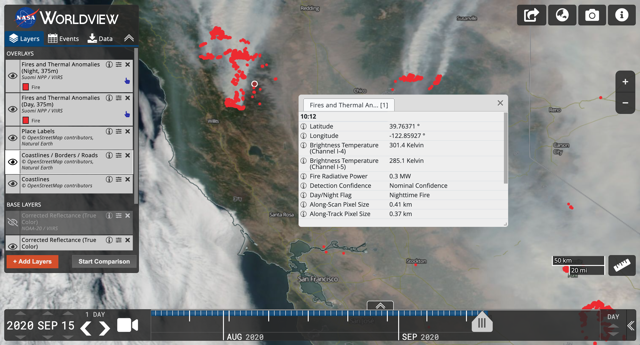
Go to Worldview and investigate the fire points in Northern California on 15 September 2020.
Developers and DIY-ers!
You may be thinking, I really just want to take these vectors and display them in my own client, so check out the GIBS API for Developers: Vector API documentation and visit the gibs-web-examples GitHub repo to find some live examples!
The Fires and Thermal Anomalies layers are also available via web services from the Fire Information for Resource Management System (FIRMS).
Overview
Content Tools