Page History
...
The following flags are used by Earthdata Search to trigger badges to display:
| Badge | Type | Flag | Description |
|---|---|---|---|
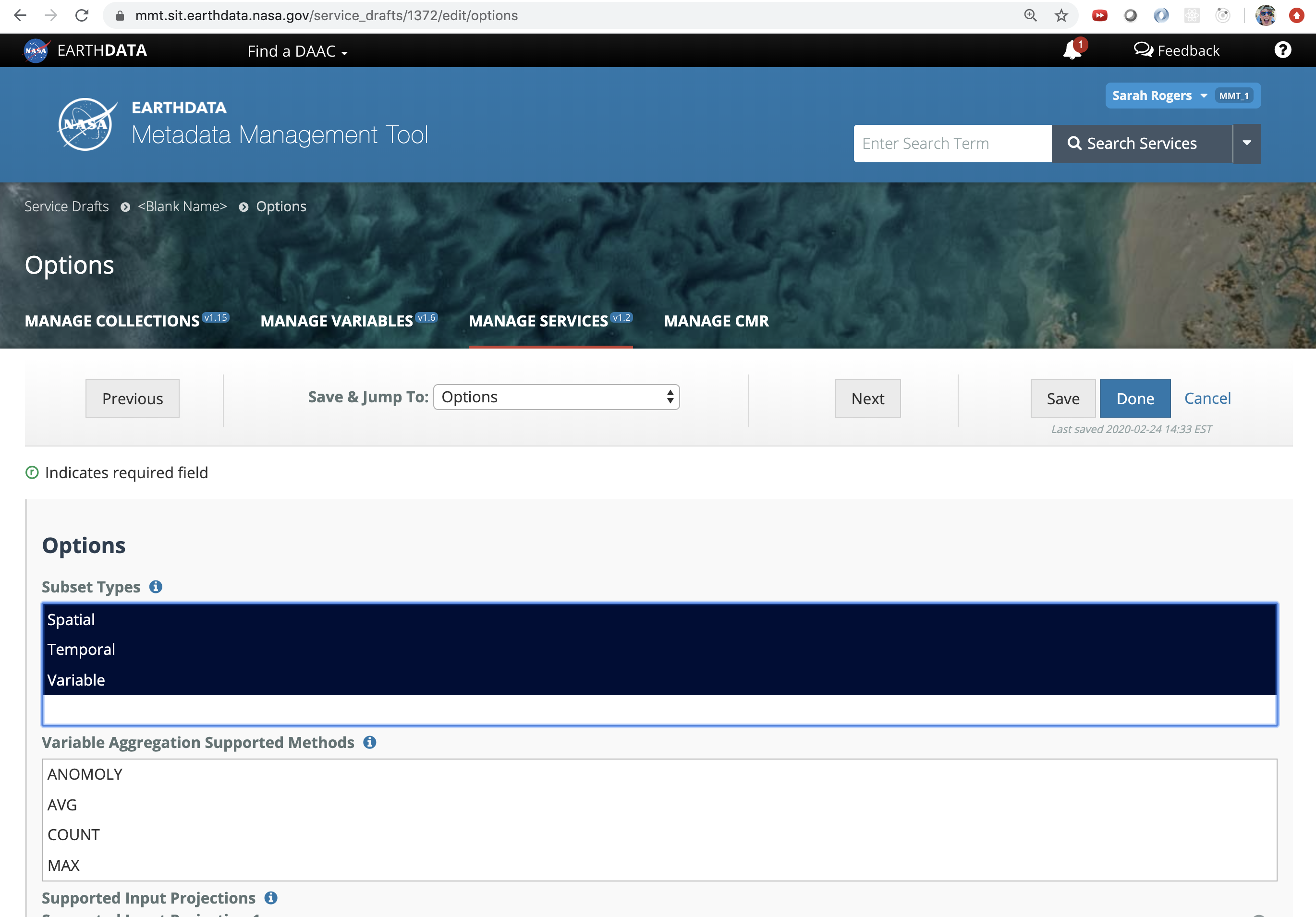
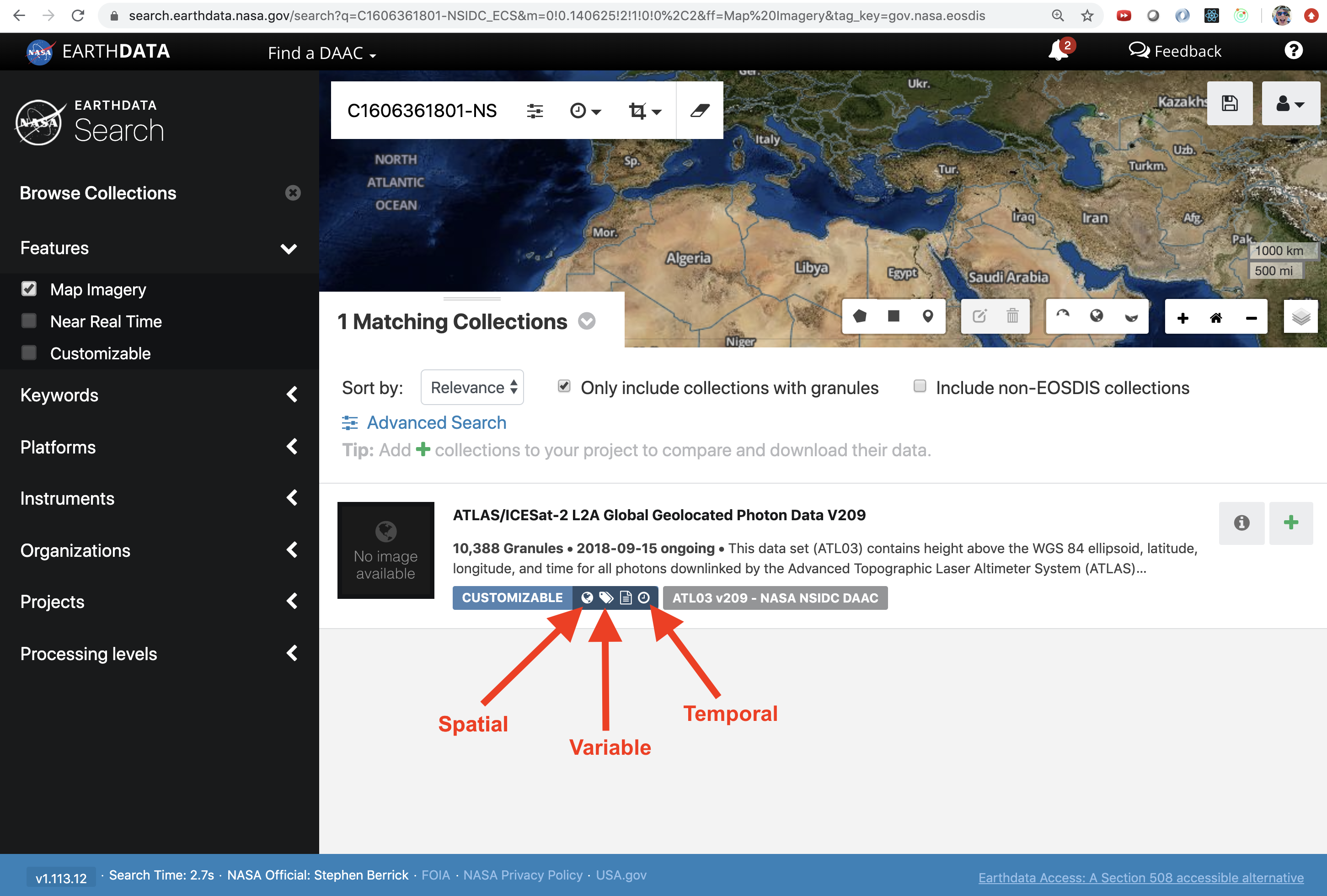
| Spatial | has_spatial_subsetting | Will be true if spatial subset types are associated with the collection. |
| Temporal | has_temporal_subsetting | Will be true if temporal subset types are associated with the collection. |
| Variable | has_variables | Will be true if there are variables associated with the collection. Will also be true if there are multiple UMM-V records associated with the collection without a UMM-S record. |
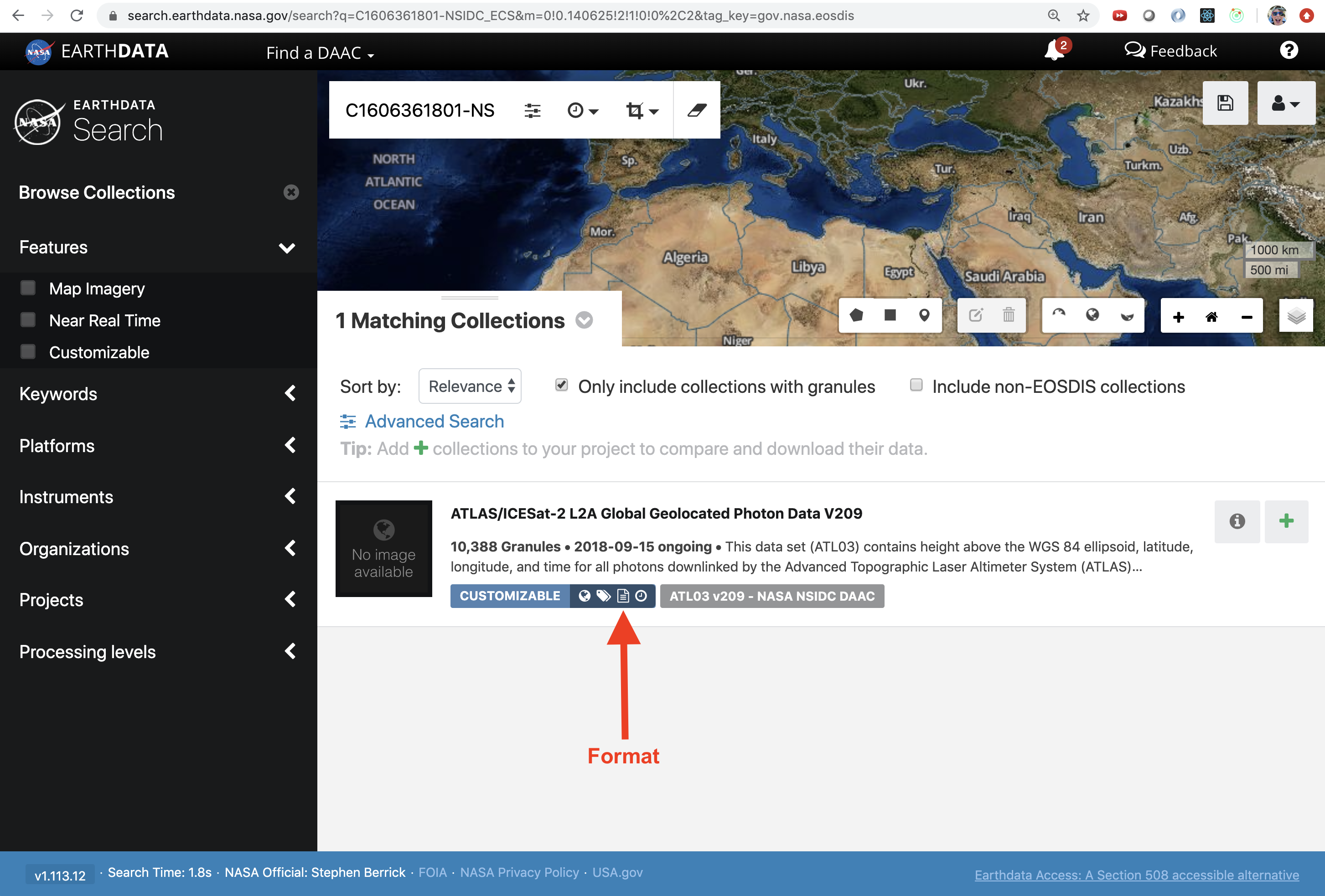
| Format | has_formats | Will be true if any of the collection's associated services has more than one "SupportedFormats" value. The collection's "has_formats" flag is false when none of its associated services has more than one "SupportedFormats" value. |
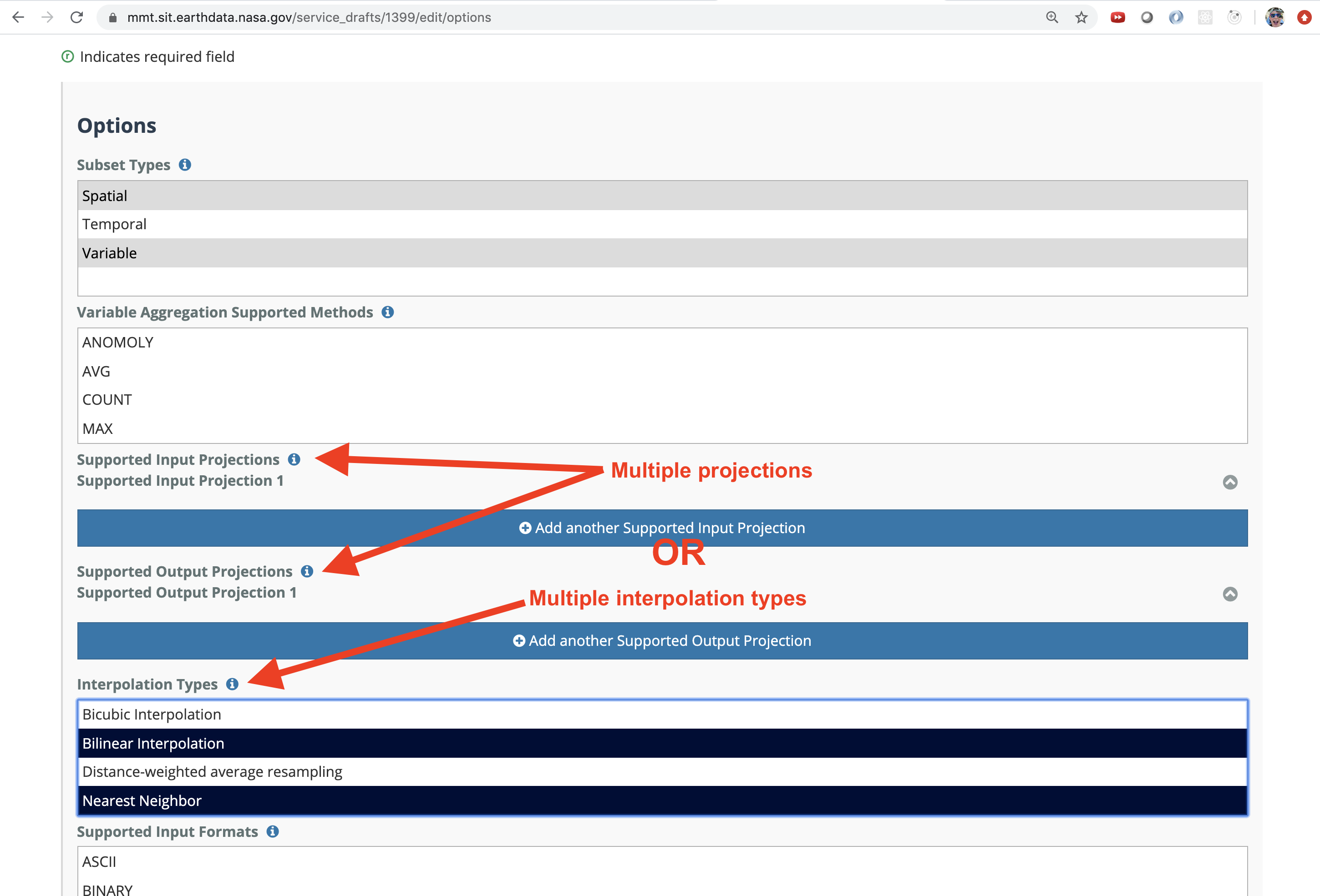
| Transform | has_transforms | Will be true if any of the collection's associated services has a defined “SubsetType” or “InterpolationType”, or multiple “SupportedProjections” values are defined within any of its associated services. A collection’s “has_transforms” flag will only be false if none of its associated services has a defined “SubsetType” or “InterpolationType”, and none of its associated services has more than one “SupportedProjections” value. |


| UI Text Box | ||
|---|---|---|
| ||
| If some of the collections that your DAAC provides do not offer the same capabilities as other collections, you will need a separate UMM-S record that describes the services offered by those collections. For example, If you have 10 collections that offer spatial subsetting, variable subsetting, and reformatting, and 5 collections that offer only spatial subsetting and reformatting, then you will need 2 UMM-S records. One record would be associated with the first 10 and the other with the second set of 5. |
STEP-BY-STEP INSTRUCTIONS
| UI Steps | |||||||||||||||||||||||
|---|---|---|---|---|---|---|---|---|---|---|---|---|---|---|---|---|---|---|---|---|---|---|---|
| |||||||||||||||||||||||
|


...
Overview
Content Tools