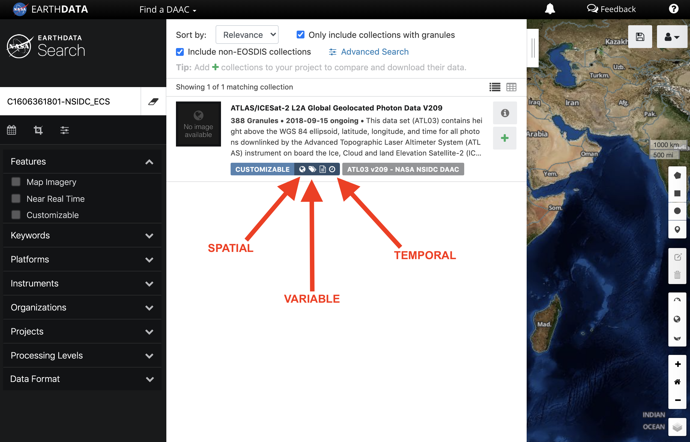
Earthdata Search provides badging with capability icons for datasets that support customizations. Currently, Earthdata Search supports EOSDIS Service Interface (ESI), OPeNDAP, and Harmony customization. If configured correctly, a UMM-S record will trigger the appropriate icon to be displayed on the associated collection in the Earthdata Search interface, allowing a user to better understand what is available to them.
The following flags are used by Earthdata Search to trigger badges to display:
| Badge | Type | Flag | Description |
|---|---|---|---|
| Spatial | has_spatial_subsetting | Will be true if spatial subset types are associated with the collection. |
| Temporal | has_temporal_subsetting | Will be true if temporal subset types are associated with the collection. |
| Variable | has_variables | Will be true if there are variables associated with the collection. Will also be true if there are multiple UMM-V records associated with the collection without a UMM-S record. |
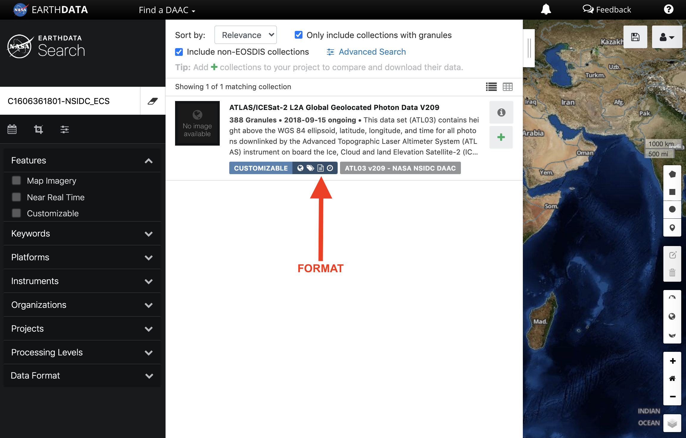
| Format | has_formats | Will be true if any of the collection's associated services has more than one "SupportedFormats" value. The collection's "has_formats" flag is false when none of its associated services has more than one "SupportedFormats" value. |
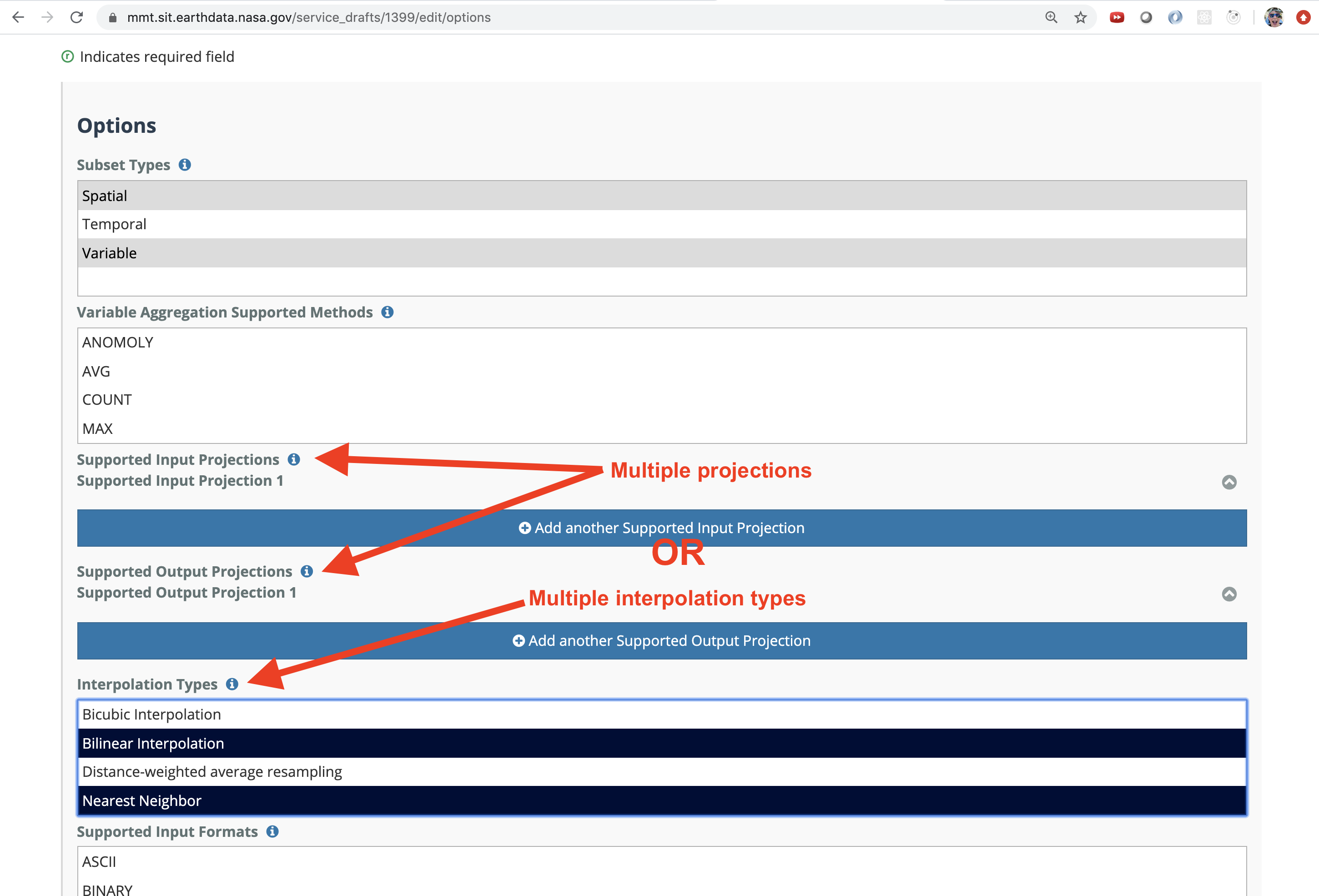
| Transform | has_transforms | Will be true if any of the collection's associated services has a defined “SubsetType” or “InterpolationType”, or multiple “SupportedProjections” values are defined within any of its associated services. A collection’s “has_transforms” flag will only be false if none of its associated services has a defined “SubsetType” or “InterpolationType”, and none of its associated services has more than one “SupportedProjections” value. |


If some of the collections that your DAAC provides do not offer the same capabilities as other collections, you will need a separate UMM-S record that describes the services offered by those collections. For example, If you have 10 collections that offer spatial subsetting, variable subsetting, and reformatting, and 5 collections that offer only spatial subsetting and reformatting, then you will need 2 UMM-S records. One record would be associated with the first 10 and the other with the second set of 5.
STEP-BY-STEP INSTRUCTIONS
Using MMT, create a UMM-S record to describe the service capabilities of your collection. For detailed instructions on that process, please refer to the MMT User Guide.
When creating the UMM-S record, on the "Service Information" page the type must be either ESI, OPeNDAP, or Harmony for a customizable badge to appear.
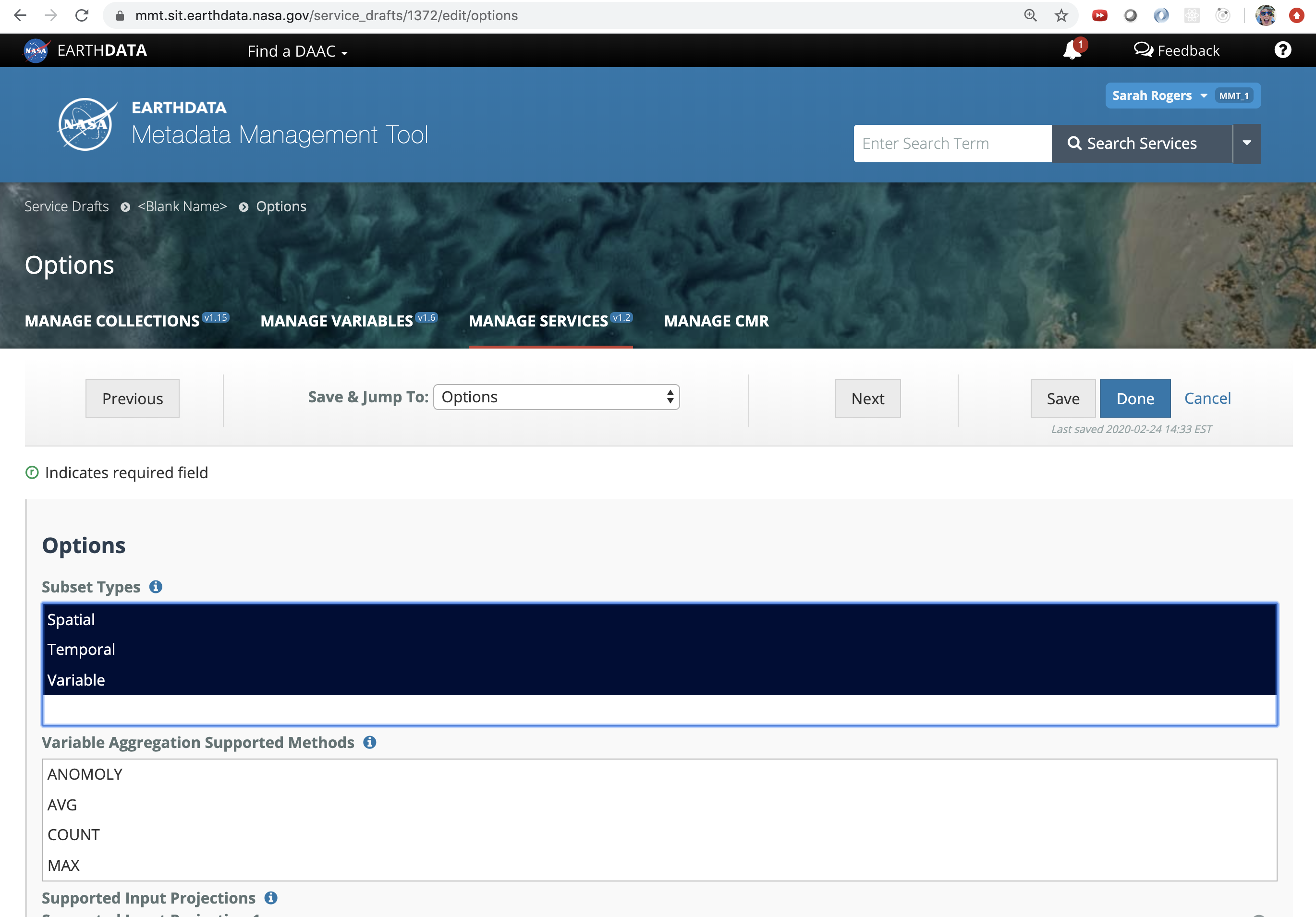
When creating the UMM-S record, pay special attention to the "Options" page. On that page there are 2 fields that will trigger icons for EDSC to display: "Subset Types" and "Supported Output Formats".
If the Spatial, Temporal, or Variable subset types are selected, the respective badge(s) will be displayed for the associated collection(s) in Earthdata Search.
If a collection has multiple supported outputs selected, the format badge will be displayed for the associated collection(s) in Earthdata Search.

If multiple projections or multiple interpolation types are selected/entered, the transform badge will be displayed for the associated collection(s) in Earthdata Search.

Once you are finished creating or updating your UMM-S record and have published those changes, the icons should be reflected appropriately in Earthdata Search.
For ESI collections, metadata contained in the tags created by background jobs may also impact the display of the badges. If your collections are showing something other than what you believe should be showing, please contact the EDSC team to investigate.
Related articles
Overview
Content Tools