Blog from November, 2022
search
attachments
weblink
advanced
Overview
Content Tools
Have you ever wondered what paths storms have taken in the past year? Or where icebergs have originated and moved since they calved from glaciers? Worldview now provides the ability to view multiple event tracks on the map, specifically for "Severe Storm" and "Sea and Lake Ice" events. Natural Events, Hazards, and Disasters are shown in NASA's Worldview via the EONET (NASA Earth Observatory's Natural Event Tracker) API. EONET provides a curated list of natural events occurring around the world. Events go back to 1 January 2000, though not all event types/categories have events populated back to 1 January 2000.

2022 Atlantic Hurricane Season thus far ( 1 June - 1 Nov 2022) - Image above shows Worldview displaying severe storm tracks gleaned from the EONET API (View in Worldview).
The season officially begins on 1 June and ends 22 November 2022. The criteria for displaying "Severe Storms" as defined by EONET is as follows:
Tropical cyclones are added to EONET when they first achieve tropical storm designation—wind speeds of at least 34 knots (39 mph or 17.5 m/s).
Cyclonic events are closed after 5 days of inactivity (i.e., since the last reported location from our sources).
Sources
Try it out!
- Go to https://worldview.earthdata.nasa.gov.
- Click on the “Events” tab.
- Click on the blue filter/funnel icon to the right of the date. This opens the “Filter Events” menu.
- Check the box for “Show tracks for all events”. You may also want to check the box for "Only list events in the current map view" to further filter the events. Event tracks are only available for "Severe Storms" and "Sea and Lake Ice" events.
- Pick the date range of interest.
- Click the Apply button and you’ll see all of your requested event tracks!
Worldview has been working to increase the usability and visibility of its features to help users accomplish their goals!
- Wind Speed for Severe Storms and Surface Area for Iceberg Events now Available
- Orbit Tracks now Available as Vectors
- Take an Image Snapshot with Predefined Coordinates
- Right-Click Context Menu
- Global Settings Panel
- Progressive Web Application (PWA)
Wind Speed for Severe Storms and Surface Area for Iceberg Events now Available
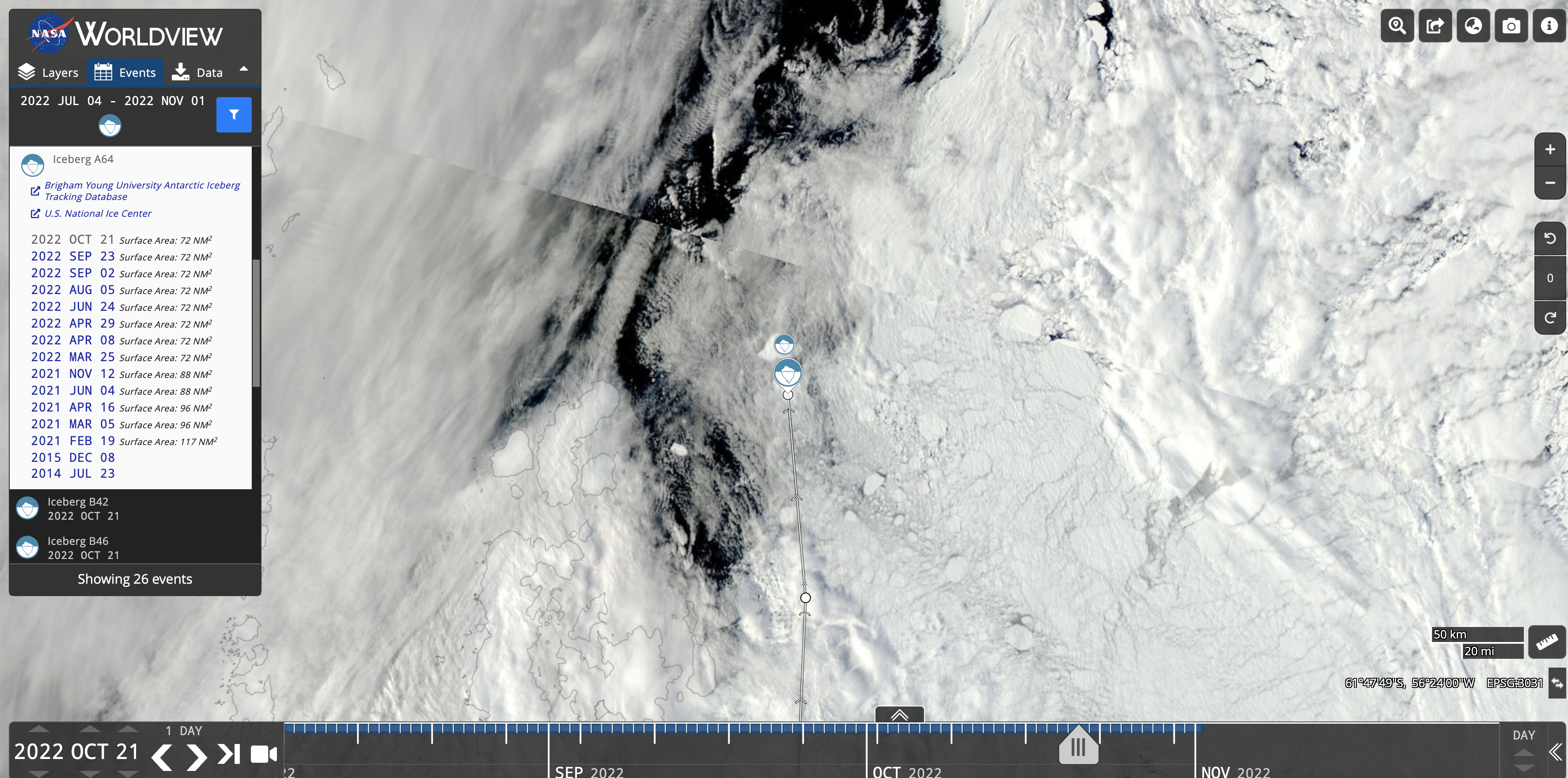
The wind speed of tropical storms and the surface area of icebergs are now displayed in the Events tab. A listing of Iceberg A64's surface area is shown above using data from the US National Ice Center (view in Worldview).
Orbit Tracks now Available as Vectors
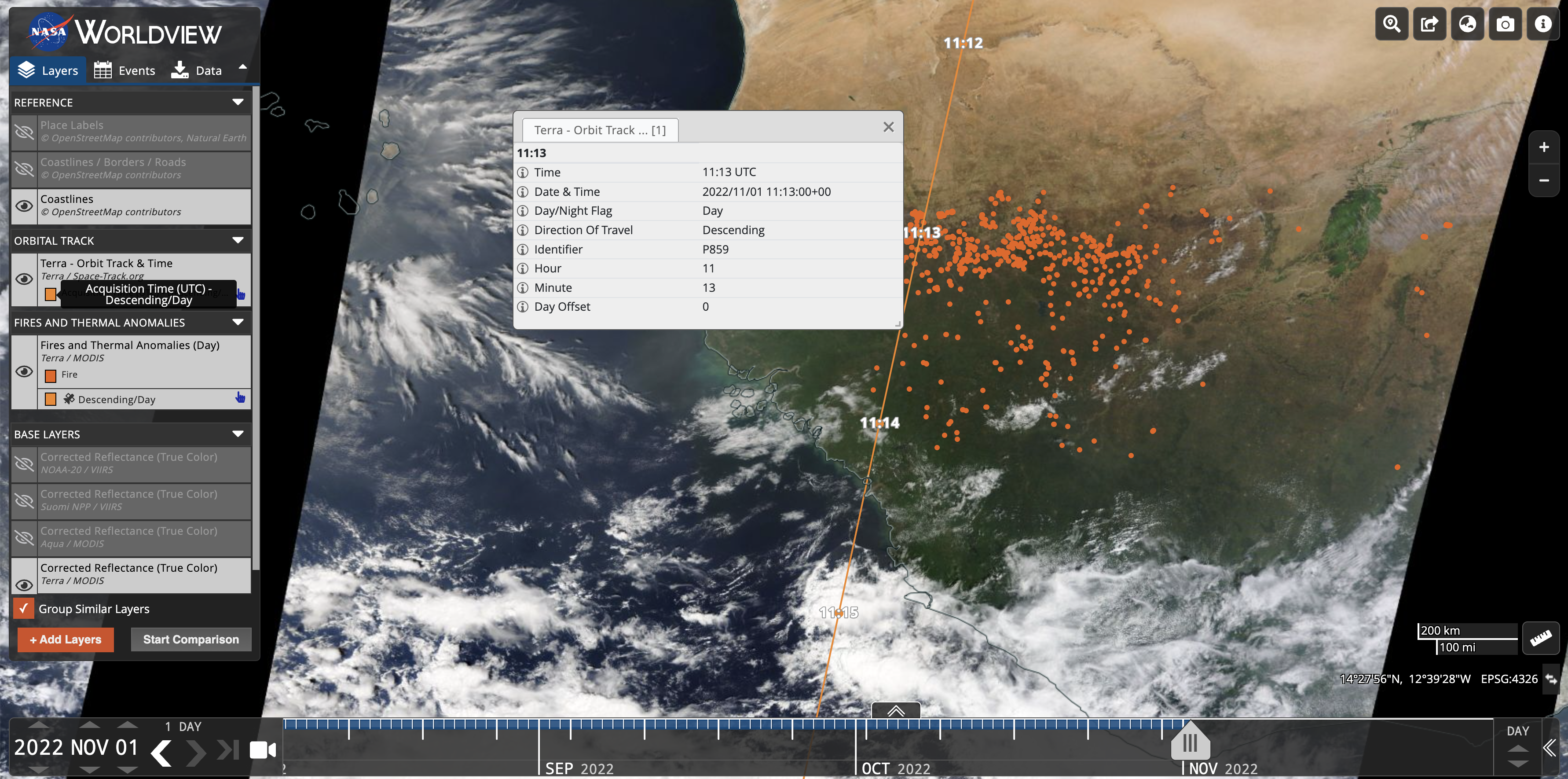
Orbit Tracks are now also available as vectors. When you zoom in far enough, you can click on each point on the orbit track to retrieve information like the day/night flag, direction of travel, date and time.
Take an Image Snapshot with Predefined Coordinates

Previously you could only draw a box on the map to take an image snapshot, now we've provided the ability for a user to enter their own bounding box coordinates or a user can "Select Entire Globe".
Right-Click Context Menu

We have made some of the tools that are available around the map interface more easily accessible from the right-click context menu. These include displaying map coordinates (and if you click on the coordinates, they'll be copied to the clipboard), adding multiple place markers, measuring distance, measuring area, and changing the distance/area units between miles and kilometers.
Global Settings Panel
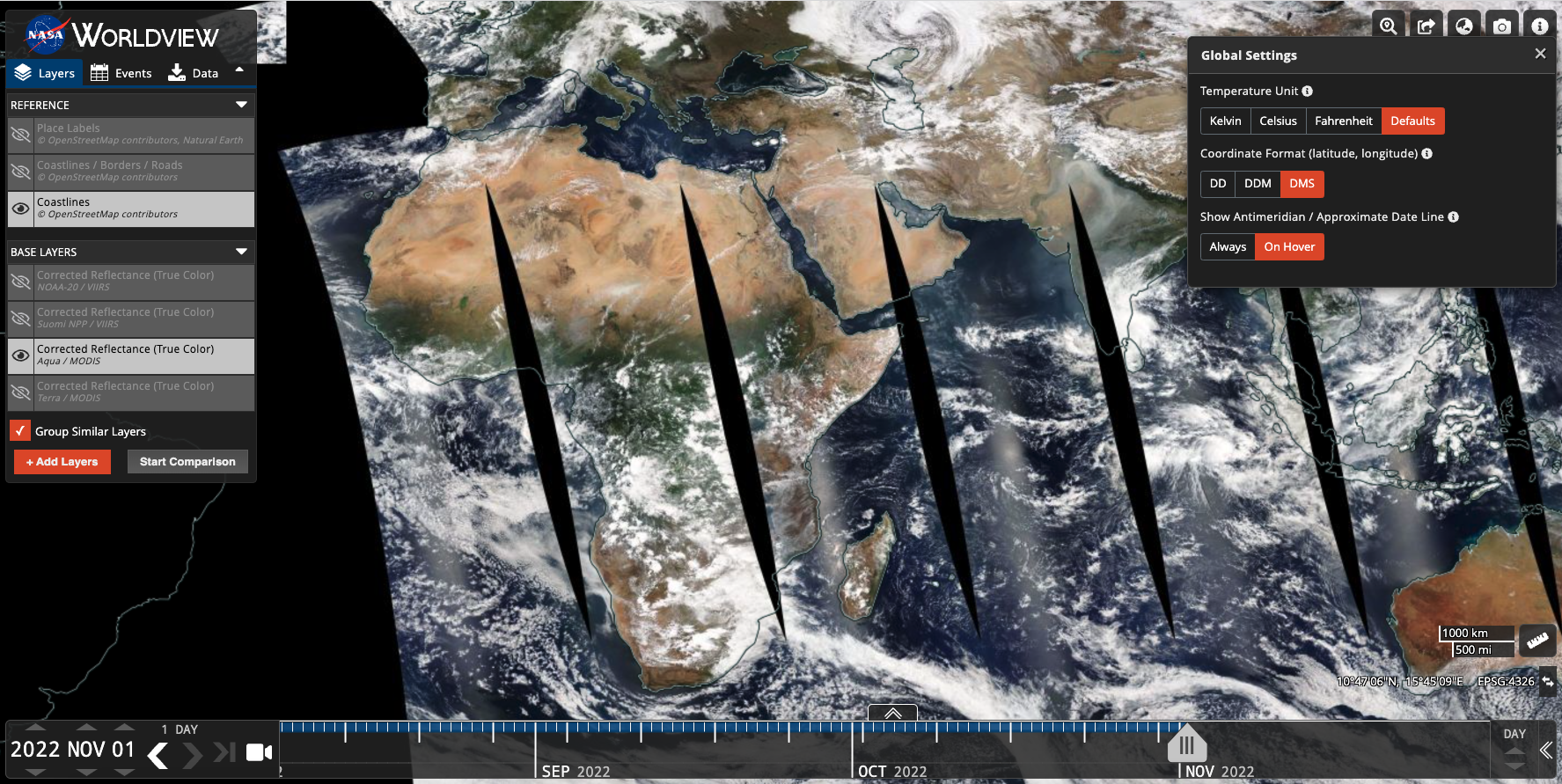
The Global Settings/App-wide Settings Panel now has additional settings that can be configured. In addition to being able to change the Temperature Units for relevant layers, users can also change the coordinate format between 1) Decimal Degrees, 2) Decimal Degree Minutes, and 3) Degrees, Minutes, Seconds. This panel also allows a user to show the antimeridian / approximate date line either on hover or "always on".
Progressive Web Application (PWA)
Worldview is now a Progressive Web App which includes the ability to use it in full screen mode on phones, to launch from your home screen, and to use local caching for faster load times. It's also generally a good compromise to building a native app.
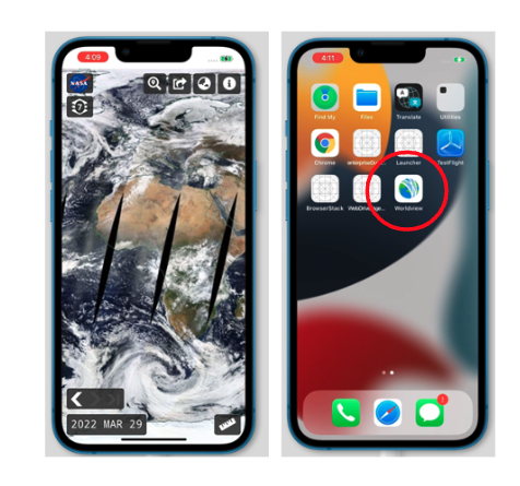
You can also save it as a PWA on your computer desktop as well. In Google Chrome, click the "Install" icon in the URL bar (instructions here) to install Worldview locally.
