| Name
|
Size
|
Creator |
Creation Date
|
Last Modification Date
|
Labels |
Attached To |
|
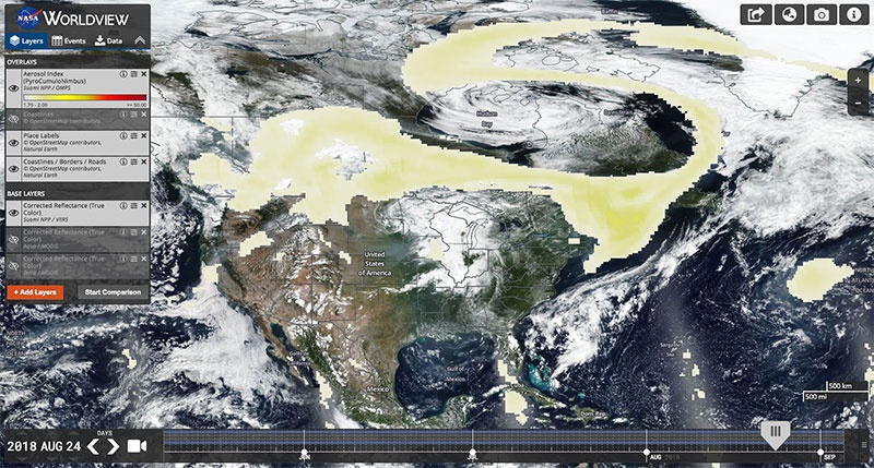
JPEG File AI_PyroCumuloNimbus_WV1.jpg |
137 kB |
Minnie Wong |
Mar 11, 2019 09:50 |
Mar 11, 2019 09:51 |
|
Blog: New Tour and Imagery Roundup
|
|
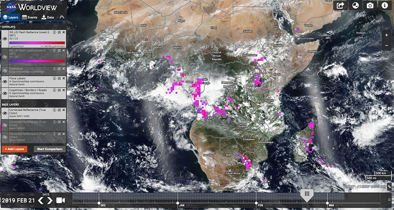
JPEG File ISS-LIS_WV1.jpg |
144 kB |
Minnie Wong |
Mar 11, 2019 09:50 |
Mar 11, 2019 09:51 |
|
Blog: New Tour and Imagery Roundup
|
|
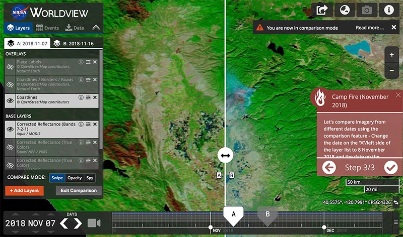
JPEG File WVour_CampFireexample1.jpg |
137 kB |
Minnie Wong |
Mar 11, 2019 09:48 |
Mar 11, 2019 09:51 |
|
Blog: New Tour and Imagery Roundup
|
|
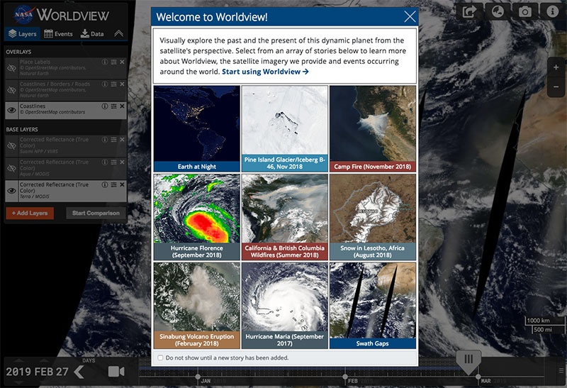
JPEG File WVTour1.jpg |
135 kB |
Minnie Wong |
Mar 11, 2019 09:48 |
Mar 11, 2019 09:51 |
|
Blog: New Tour and Imagery Roundup
|
|
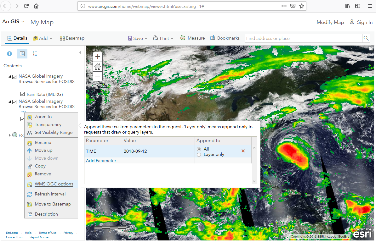
PNG File AGOL-TimeAdjust2.png |
946 kB |
Ryan Boller |
Mar 05, 2019 20:34 |
Mar 05, 2019 20:34 |
|
Page: Geographic Information System (GIS) Usage
|
|
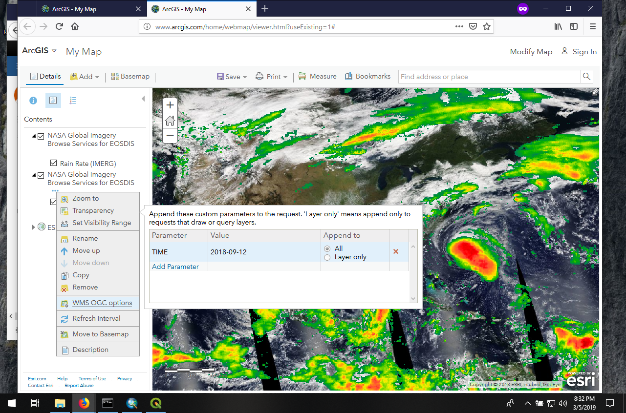
PNG File AGOL-TimeAdjust.png |
1.00 MB |
Ryan Boller |
Mar 05, 2019 20:33 |
Mar 05, 2019 20:33 |
|
Page: Geographic Information System (GIS) Usage
|
|
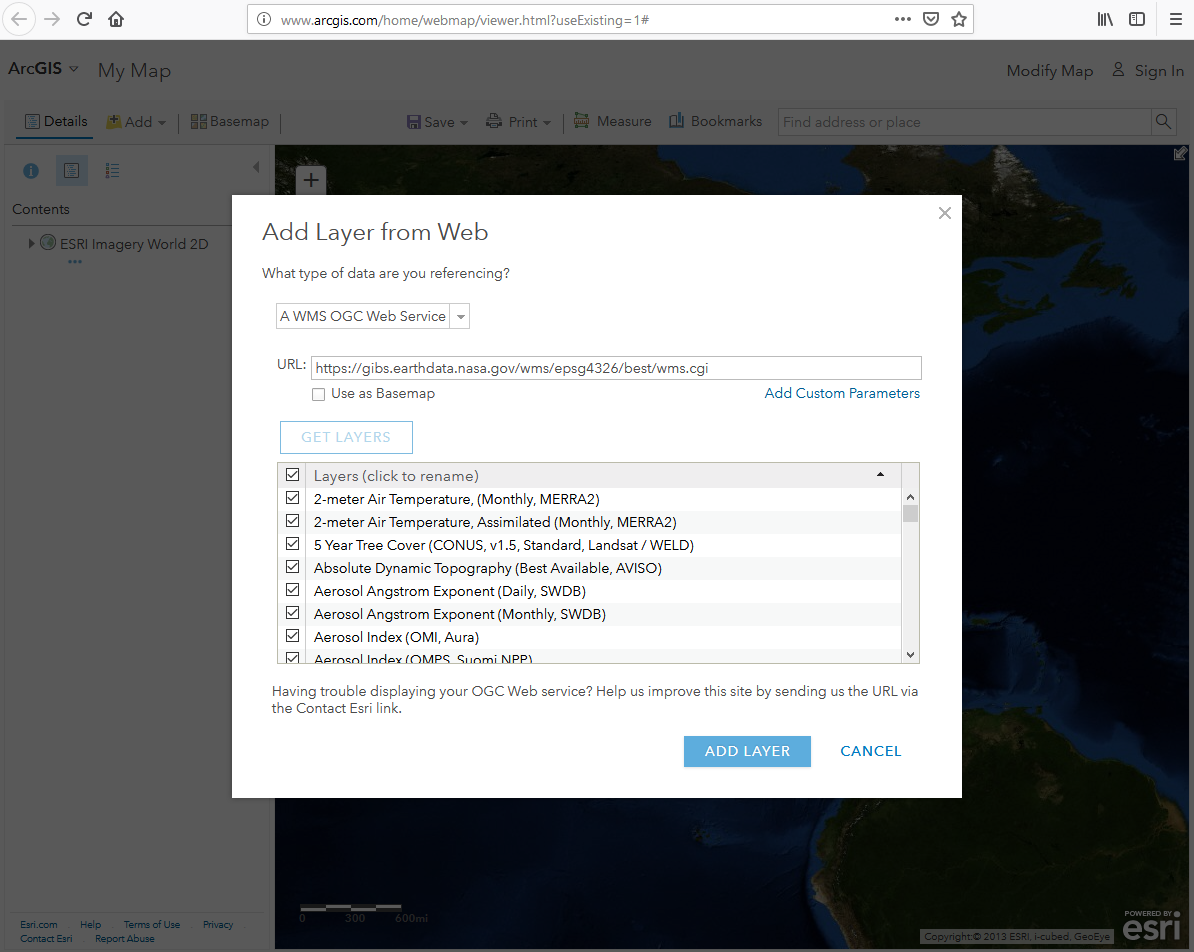
PNG File AGOL-AddLayer2.png |
438 kB |
Ryan Boller |
Mar 05, 2019 20:30 |
Mar 05, 2019 20:30 |
|
Page: Geographic Information System (GIS) Usage
|
|
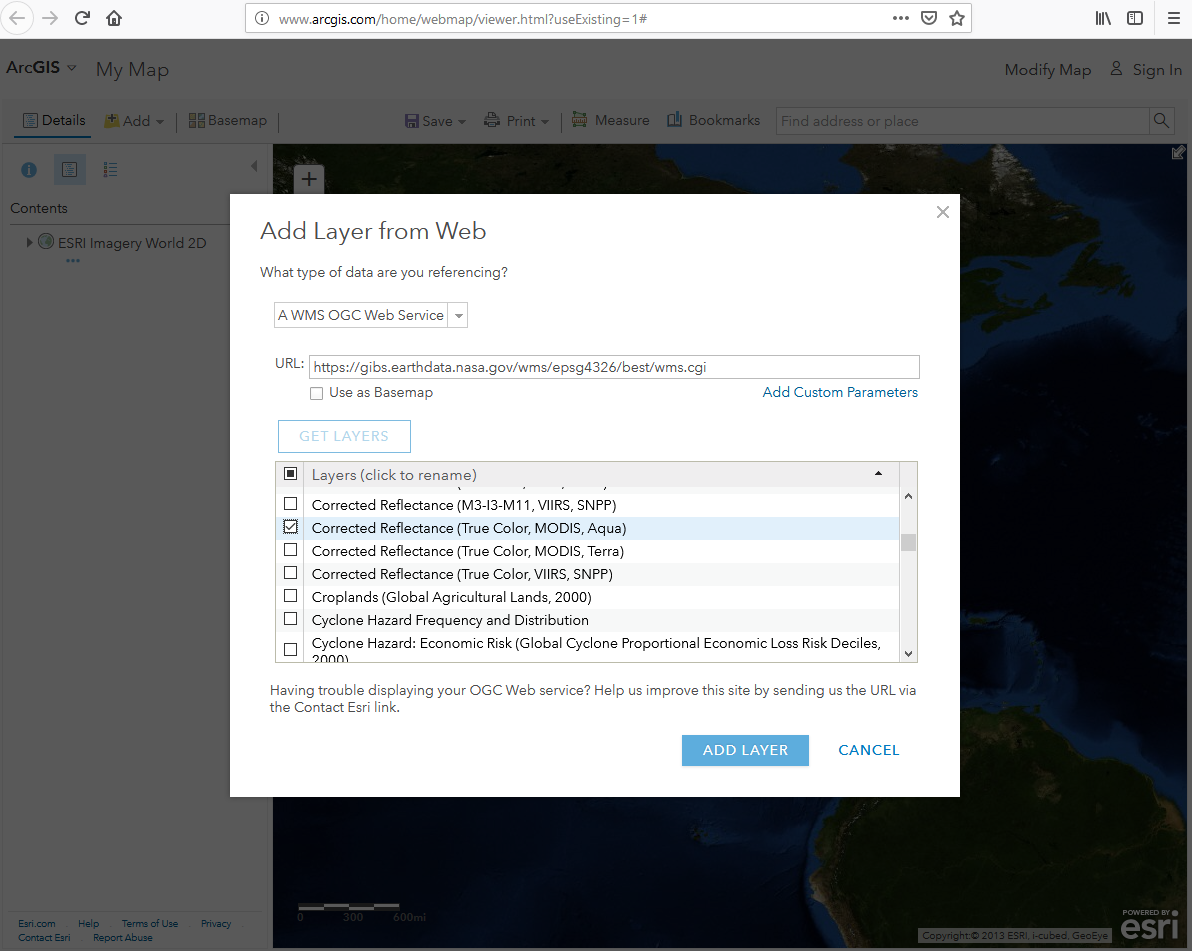
PNG File AGOL-AddLayerDialog.png |
443 kB |
Ryan Boller |
Mar 05, 2019 20:22 |
Mar 05, 2019 20:22 |
|
Page: Geographic Information System (GIS) Usage
|
|
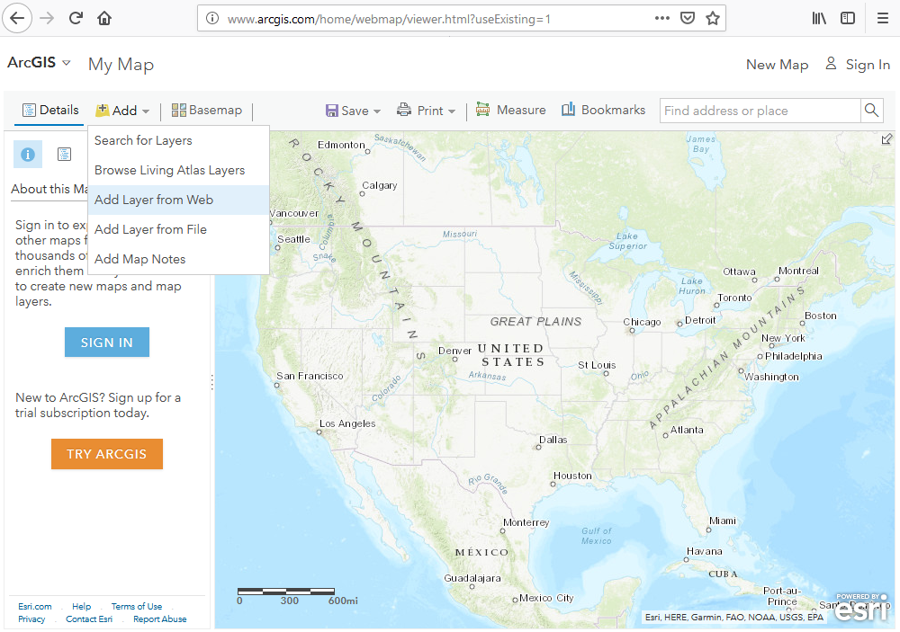
PNG File AGOL-AddLayer.png |
711 kB |
Ryan Boller |
Mar 05, 2019 20:20 |
Mar 05, 2019 20:20 |
|
Page: Geographic Information System (GIS) Usage
|
|
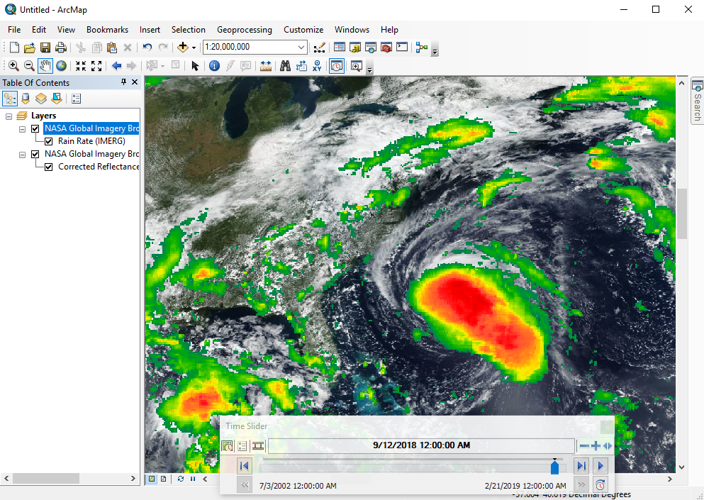
PNG File ArcMap-TimePanel.png |
788 kB |
Ryan Boller |
Mar 05, 2019 19:37 |
Mar 05, 2019 19:37 |
|
Page: Geographic Information System (GIS) Usage
|
|
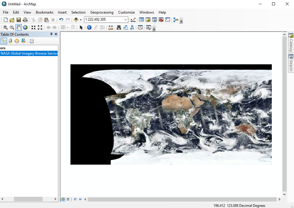
PNG File ArcMap-VIIRS-CR.png |
393 kB |
Ryan Boller |
Mar 05, 2019 19:35 |
Mar 05, 2019 19:35 |
|
Page: Geographic Information System (GIS) Usage
|
|
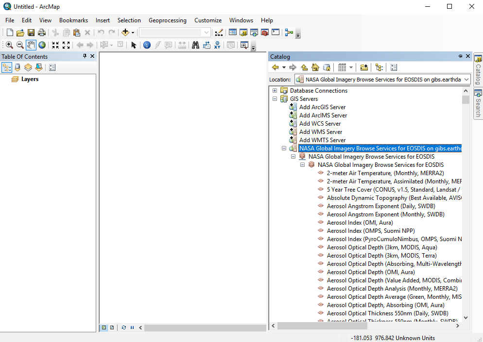
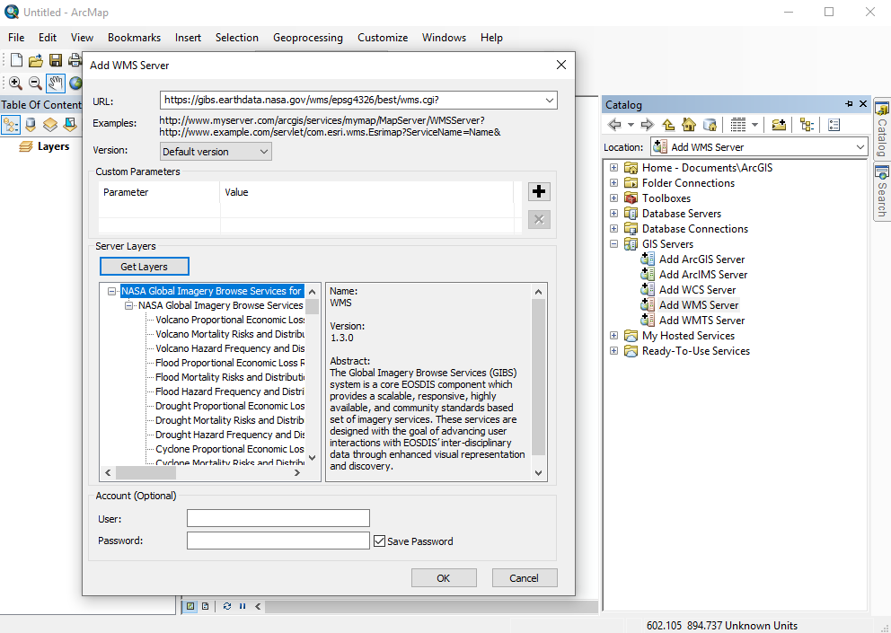
PNG File ArcMap-GIBS-Catalog.png |
122 kB |
Ryan Boller |
Mar 05, 2019 19:32 |
Mar 05, 2019 19:32 |
|
Page: Geographic Information System (GIS) Usage
|
|
PNG File ArcMap-CatWindow.png |
124 kB |
Ryan Boller |
Mar 05, 2019 19:29 |
Mar 05, 2019 19:29 |
|
Page: Geographic Information System (GIS) Usage
|
|
PNG File GoogleEarth-WorldviewKMZ.png |
2.04 MB |
Ryan Boller |
Mar 01, 2019 18:46 |
Mar 01, 2019 18:46 |
|
Page: Geographic Information System (GIS) Usage
|
|
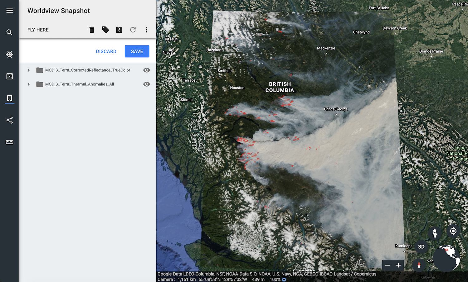
PNG File Worldview-snapshot.png |
1.87 MB |
Ryan Boller |
Mar 01, 2019 18:39 |
Mar 01, 2019 18:39 |
|
Page: Geographic Information System (GIS) Usage
|
|
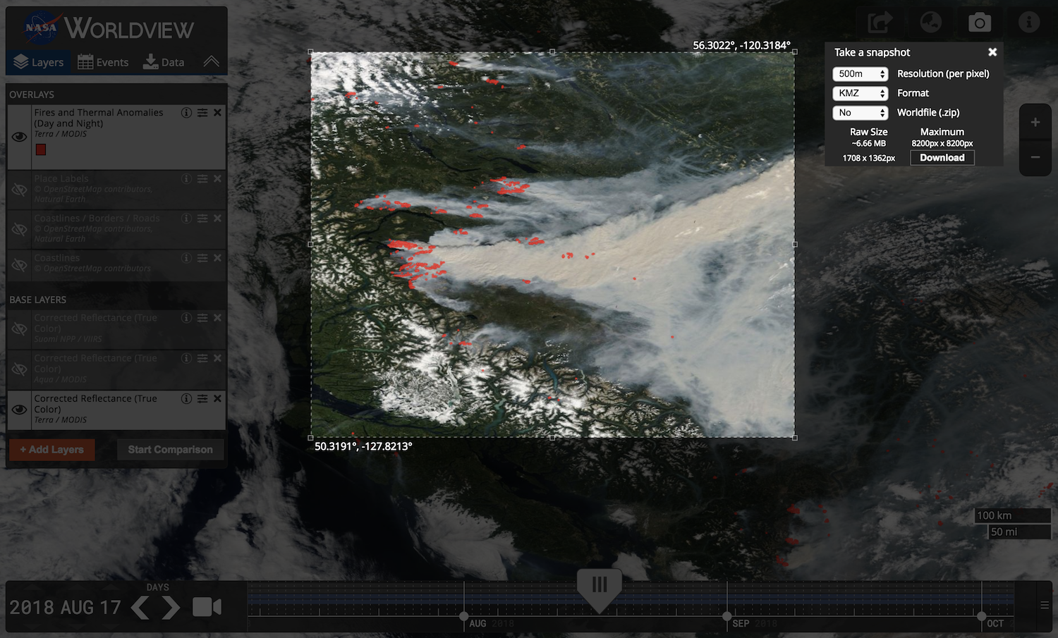
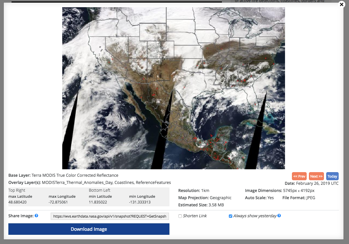
PNG File Screen Shot 2019-02-27 at 12.34.04 PM.png |
526 kB |
Minnie Wong |
Feb 28, 2019 11:40 |
Feb 28, 2019 11:41 |
|
Blog: New Tool for Low-Bandwidth Access to Satellite Imagery: Worldview Snapshots
|
|
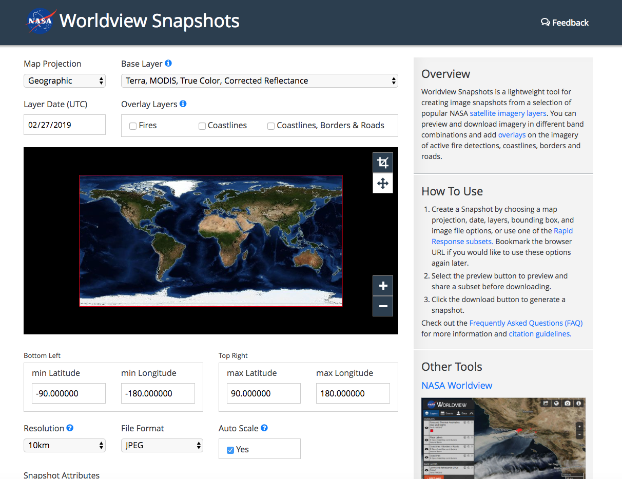
PNG File Screen Shot 2019-02-27 at 12.33.17 PM.png |
880 kB |
Minnie Wong |
Feb 28, 2019 11:40 |
Feb 28, 2019 11:41 |
|
Blog: New Tool for Low-Bandwidth Access to Satellite Imagery: Worldview Snapshots
|
|
PNG File Screen Shot 2019-02-27 at 12.31.42 PM.png |
592 kB |
Minnie Wong |
Feb 28, 2019 11:40 |
Feb 28, 2019 11:41 |
|
Blog: New Tool for Low-Bandwidth Access to Satellite Imagery: Worldview Snapshots
|
|
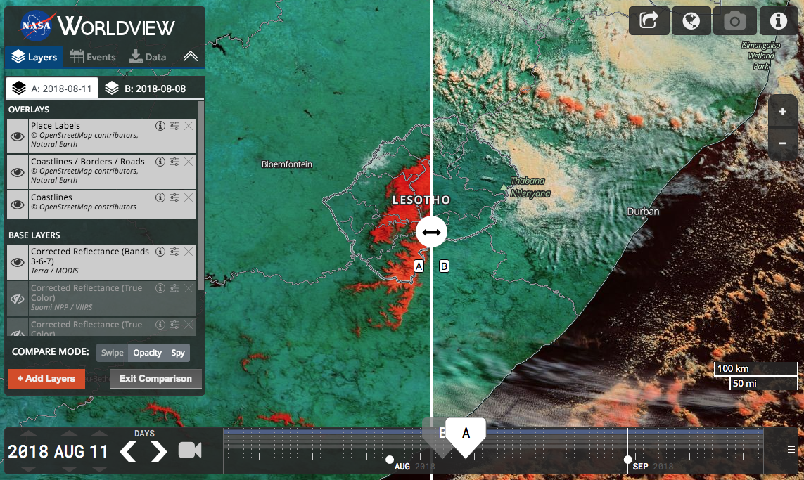
PNG File Leotho_Aug2018_Compare_Swipe.png |
1.44 MB |
Minnie Wong |
Oct 04, 2018 09:31 |
Oct 04, 2018 09:31 |
|
Blog: Introducing Worldview's Comparison Feature!
|
|
GIF File WorldviewComparison-opacity.gif |
6.75 MB |
Minnie Wong |
Oct 04, 2018 09:31 |
Oct 04, 2018 09:31 |
|
Blog: Introducing Worldview's Comparison Feature!
|