| ) | | |
| Aqua |
| Platform | Instrument | Imagery Layer | Imagery Resolution [1] | Sensor Resolution [2] | Format | Projection(s) [4] | Temporal Range | Data Product | SDS |
|---|
| Terra | MODIS | Water Vapor (Day)  Image Modified Image Modified MODIS_ | TerraAqua_Water_Vapor_5km_Day | 2km | 1km | png | Geographic, Web Mercator | 2012/05/08 -> Present (NRT) | | |
| TerraAqua | MODIS | Water Vapor (Night) Image Modified MODIS_ | TerraAqua_Water_Vapor_5km_Night | 2km | 1km | png | Geographic, Web Mercator | 2012/05/08 -> Present (NRT) | | |
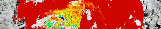
| AquaAura | MODISMLS | Water Vapor (H2O) at 46 hPa (Day) Image Modified MODISMLS_ Aqua_Water_Vapor_5kmH2O_46hPa_Day | 2km | 1km5km | png | Geographic, Web Mercator | 20122013/05/08 09 -> Present (NRT) | ML2H20_NRT v003 | |
| AquaAura | MODISMLS | Water Vapor (H2O) at 46 hPa (Night) Image Modified MODISMLS_ Aqua_Water_Vapor_5kmH2O_46hPa_Night | 2km | 1km5km | png | Geographic, Web Mercator | 20122013/05/08 09 -> Present (NRT) | ML2H20_NRT v003 | | Aura | MLS |
| GCOM-W1 | AMSR2 | AMSR2_Columnar_Water_Vapor_Day Image Added Water Vapor (H2O) at 46 hPa (Day) Image Removed MLS_H2O_46hPa_Day | 2km | 5km | png | Geographic, Web Mercator | 20132015/0506/09 07 -> Present (NRT) | ML2H20_NRT v003A2RnOcn_WV_LL_A | Aura |
| GCOM-W1 | MLSAMSR2 | AMSR2_Columnar_Water Vapor (H2O) at 46 hPa (Night) Image Removed MLS_H2O_46hPa_Night _Vapor_Night Image Added | 2km | 5km | png | Geographic, Web Mercator | 20132015/0506/09 07 -> Present (NRT) | ML2H20_NRT v003A2RnOcn_WV_LL_D | |