Page History
...
- LANCE UWG request
- LANCE Flood mapping - current and near real-time solution.png
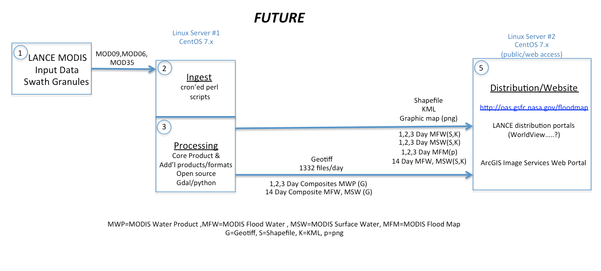
- LANCE Flood mapping - future solution. png
- LANCE Transition Architecture Outline (by Dan Slayback)
- ZenithAngles_v2.txt
- Presentations to LANCE UWG June 2023:
- Updated PGE159 documentation from David Landis
Flood Process Summary
PGE 152: Water detection, from MOD09 swath granules.
PGE 155: Map swath granules to output grid (lat/lon, 10x10° tiles, “heavy”).
PGE 170: Select and retain best within-swath pixel (“lite”: contains one layer for every swath overpass, for a given pixel).
PGE 159: (Level-3) Composites (over time), applies thresholding, masks, and compares to reference water to identify flood.
1,2,and 3-day composites
MCDWD implementation includes data from all overlapping swaths
...
Overview
Content Tools