| Notes for meeting on 19th March 2018 |
|---|
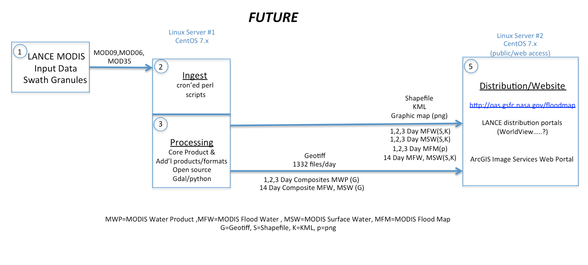
Dan Slayback Fritz Pollicelli Ed Masuoka Diane Davies | - Current Status: Step 1 is complete. The initial swath based water product is running as a PGE and Dan has checked the out put product and is happy with it.
Next steps - Greg is going to amend the PGE to include a cloud shadow mask. Dan and Greg are discussion whether to use the existing cloud shadow mask (likely) or whether to use a different one.
- Dan needs to provide Greg with the code for the existing cloud shadow mask that uses MOD35.
- the current code Dan uses has IDL operators. this will need to be re-written.
- Diane and Dan to meet with Greg this week to discuss next steps this.
- Dan to provide an outline for code to composite and tile the initial product. Dan to work with Greg who will write the code.
- Terrain shadow filter (monthly product computed as part of this process) is to be applied to the tiled product
- HAND (Height Above Nearest Drainage) filter, which identifies areas where flood water should not be present, will also be applied to the tiled product.
|
|
|
| Notes for meeting on 22 February 2018 |
Dan Slayback Greg Ederer Diane Davies | - Greg amended PGE code and has completed step 1. Dan happy with the product
- Discussion on how to implement the cloud mask.
- looking at options
- this should be done as part of the PGE running in step 1
- Diane to contact Eric Vermote to see if there was an improved cloud shadow mask. He said
- "There is a cloud cloud shadow mask in the MOD09 product (at 1km resolution), at this resolution it is very difficult to evaluate cloud shadow mask and I am not sure about the performance.
Cloud shadow masks are currently being evaluated for Landsat 8 and Sentinel 2 data (using an operator derived validation mask) we can probably gain a lot of experience from this and then transition the “best” algorithm to MODIS the best way we can. That will not be right away unfortunately but more like in a year timeframe, As far as terrain shadow it is an interesting problem quite feasible if you have a good Digital Terrain Model but could be computationally expensive because my guess is that you have to do it at a finer spatial resolution than what your actual resolution but that can be studied too once again with Landsat 8/Sentinel 2 data.
|
|
|