Page History
The COG data format builds on the established GeoTIFF format that has been accepted as a ESCO standard. Similar to how GeoTIFF built off the existing standard TIFF images by adding geo-referencing information, COG builds off of GeoTIFF to add features needed to optimize data use in a cloud based environment.
Cloud Optimized GeoTIFF relies on two complementary pieces of technology.
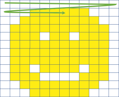
The first is the ability of a GeoTIFF to not only store the raw pixels of the image, but to also organize those pixels in ways that are more efficient for cloud storage and retrieval.
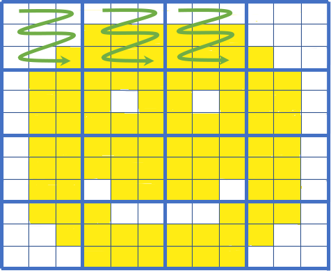
Traditional row by row organization COG tile organization
 .
. 
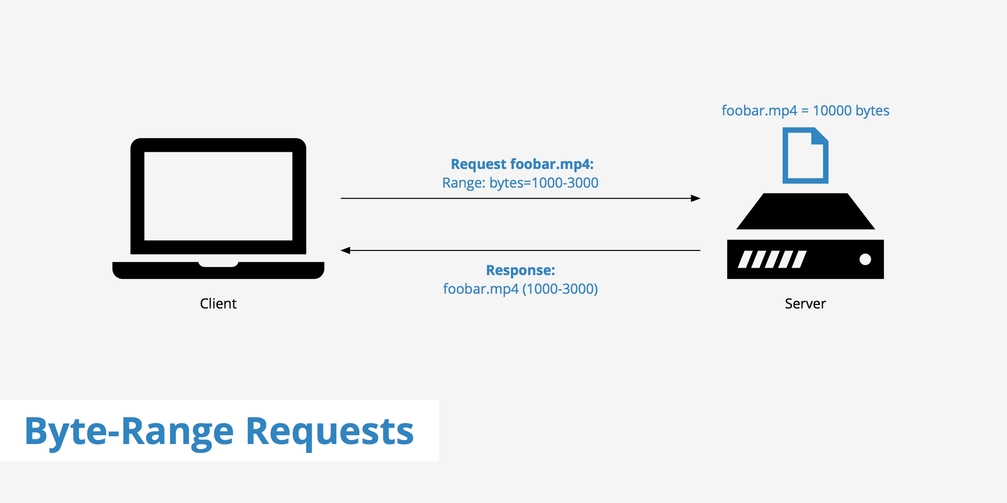
The second is HTTP GET range requests, that let clients ask for just the portions of a file that they need. Together these enable fully online processing of data by COG-aware clients, as they can stream the right parts of the GeoTIFF as they need it, instead of having to download the whole file.
Traditional row by row organization COG tile organization
.
COG is currently a OGC draft candidate (http://docs.ogc.org/DRAFTS/21-026.html).
...
QGIS: An open source desktop Geographic Information System (GIS). QGIS can support streaming COG files directly from their online location without having to download the files first. An example of this can be seen in this tutorial.
GDAL: An open source data translator library for raster and vector formats. Offers built-in COG data driver. Allows software developers to build applications from the read and write support that is available for COG.
Strengths
Efficient Imagery Data Access
...
Traditional GIS software is able to treat Cloud Optimized GeoTIFF’s just like normal GeoTIFF’s, so data providers need only produce one format
Weakness
Cloud Optimized GeoTIFF does not scale indefinitely. It is useful for small to medium-sized rasters, larger national sized rasters would not be well suited to storage in a COG.
Applicability
Limitations
COG skips the need for an API by allowing direct access to the raster data. While this makes things simple for COG file access, it is not flexible and means that data stored in vector or another raster format would have to be retrieved by the client in another manner. Making the overall solution less interoperable.
Overview
Content Tools