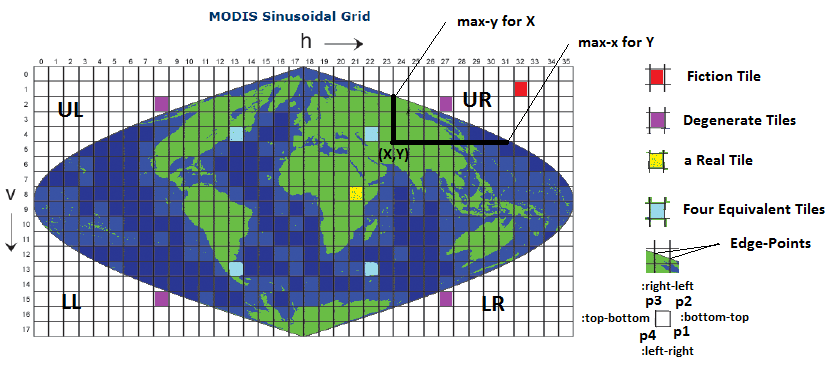
The computation of a MODIS tile geometry follows the following steps:
- Map the tile to an equivalent tile in the upper-right quadrant(UR).
- Find if the tile is a fictional tile or a real tile or a degenerate tile. Ignore fictional and degenerate tiles. Degenerate tiles have only one vertex which is a real point. All remaining points of the tile are fictional points
- Find the coordinates of the four vertices of the rectangle corresponding to the tile.
- Densify each of the four segments of the tile.
- Remove fictional points on each of the edges if there are any.
- Add the edge-points if the edge has fictional points on one side and real points on another.
- Map the densified points back to its original quadrant.
- Convert the points from planar coordinates back to geodetic coordinates. Convert from radians to degrees.
