We're pleased to announce the open source release of the GIBS tiled imagery server and its underlying tile storage format on GitHub!
What is it?
The "OnEarth" software is used as the Global Imagery Browse Services (GIBS) primary imagery server for a highly responsive, highly scalable service which provides client access via Open Geospatial Consortium (OGC) Web Map Tile Service (WMTS), Tiled Web Map Service (TWMS), and Google Earth KML methods along with scripted access via GDAL. It also supports time-varying access to individual layers which has been a necessity for this project in dealing with long-running, daily satellite imagery.
Also included in this release is an optimized image tile storage format called Meta Raster Format, or MRF, and scripts to generate them. It's designed to reduce file system overhead by combining all tiles for a given layer into a single file similar to MapBox MBTiles. It supports arbitrary map projections and is currently being used by GIBS for storing its geographic, Web Mercator, Arctic, and Antarctic tiles. As a plugin for GDAL, MRFs can also be read by GDAL-based applications such as MapServer.
Battle Tested
While this release is new, the software itself has a long heritage at NASA's Jet Propulsion Laboratory. Along its travels, it has had the distinction of serving the largest image in the world at the time (a Landsat mosaic of the US circa 1998), the Earth imagery server for planetarium shows at the American Museum of Natural History (2003-present), the first 15m global Landsat mosaic of the world (2004), the original imagery and terrain server for NASA World Wind (2004), and a Martian and Lunar imagery server (2008?-present). Since 2011, it has been a collaborative project between NASA/Goddard and NASA/JPL as the primary Earth imagery server for GIBS.
Future Plans
Updates this spring will include some long-awaited fixes to improve WMTS compatibility (e.g., case insensitivity, flexible key-value pair ordering, improved error handling). Features we are considering for the future include native REST support for WMTS, dynamic band combinations, low-bandwidth pre-composited images, and on-the-fly palette updating. We look forward to engaging with the FOSS community in making these features a reality.
Bonus
We've also posted sample web clients and their code which use OpenLayers and Leaflet to interactively browse imagery from GIBS. Give them a fork and let us know what you build!
https://github.com/nasa-gibs/gibs-web-examples
We hope that the public release of this software will encourage further armchair exploration of the Earth and other planets through interactive geospatial mapping.
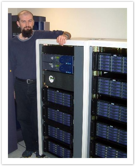
40TB of OnEarth imagery storage in 2003
https://github.com/nasa-gibs/onearth
Contact us at support@earthdata.nasa.gov with questions or comments.
