Happy New Year everyone - It's been a few months since we've posted an update, but never fear, we are still always striving to make improvements and add new features to Worldview.
Temperature Unit Conversion
Temperature unit conversions are now available for relevant temperature layers.
We've also added twelve new Land Surface Temperature (LST) layers for you to convert units to your heart's desire! These include the MOD/MYD21 Land Surface Temperature Day | Night, Daily, 8-Day and Monthly layers.
The MOD/MYD21 Temperature/Emissivity Separation (TES) algorithm is a physics-based algorithm used to dynamically retrieve both LST and spectral emissivity simultaneously from the MODIS thermal infrared (TIR) bands 29, 31, and 32. The TES algorithm is combined with an improved Water Vapor Scaling (WVS) atmospheric correction scheme to stabilize the retrieval during warm and humid conditions. The MOD/MYD21 LST&E algorithm differs from the MOD11/MYD11 L2 algorithm in that the MOD21/MYD21 algorithm is based on the ASTER TES technique, whereas the MOD11/MYD11 L2 products uses a generalized split-window (GSW) technique. Learn more about MOD/MYD21 in its User Guide.
- Terra/MODIS LST Day | Night, Daily, 8-Day and Monthly layers: https://go.nasa.gov/3KnArVa
- Aqua/MODIS LST Day | Night, Daily, 8-Day and Monthly layers: https://go.nasa.gov/3KpmhTe
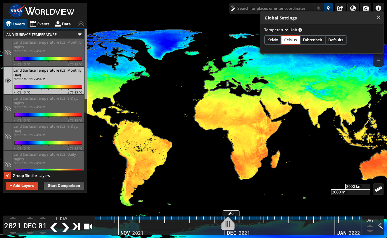
Settings Panel to convert temperature units can be accessed from the "i" menu in the upper right corner. Keep your eyes peeled for other settings that can be changed from this panel in the future!
DAAC/SIPS Facet
The Layer Picker has a new facet for DAAC/SIPS (that is Distributed Active Archive Centers/Science Investigator-led Processing Systems) who have provided the imagery visualizations.
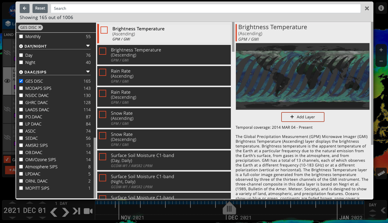
Click on the orange "+ Add Layers" in the Layer List, then the orange Filter icon in the upper left corner to filter the imagery by facets.
Tour Stories
- A new tour story about the Geostationary imagery layers we have from GOES-East, GOES-West and Himawari-8.
- The Satellite Detections of Fire (2021 update) tour story was updated with new events and imagery.
- There's also a new Introduction to Worldview tour story that walks you through all the elements of Worldview.
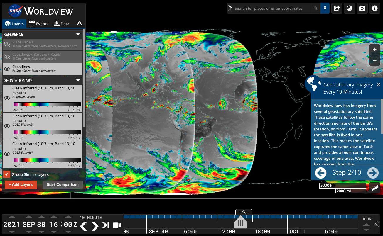
Screenshot of the second step of the Geostationary Imagery Tour Story.
Moving to the Cloud
- The Global Imagery Browse Services (GIBS) is in the process of migrating its imagery visualization archive into the cloud. Current status:
- 5% of total imagery layers (20% by volume) are actively being forward processed in the cloud.
- 5% of ingest "handlers" are available for cloud use; “handlers” are the code used to pull imagery from SIPS/DAACs.
- 80% of the on-premises imagery archive has been transferred to the cloud.
- The system is expected to be 100% in the cloud in Fall 2022.
- This transition should be transparent to users as all existing imagery and URLs will continue to work (but please let us know if you notice any problems support@earthdata.nasa.gov).
- Once fully migrated, we'll be able to more easily scale out the system and provide new features for more flexible visualizations.
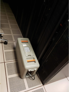
AWS Snowball getting loaded up with data from our on-premises servers to its future home in the cloud!
Coming soon...
- Worldview will soon be a progressive web app (PWA), making it "installable" on mobile devices so that more of the map will be visible to the user.
- We're going to add a right-click context menu to the map to access features like copy coordinates to clipboard, start a measurement, and add a place marker.
Overview
Content Tools