Page History
...
In comparison to VIIRS and MODIS, the Operational Land Imager (OLI) onboard both Landsat 8 and Landsat 9 provides active fire detections at relatively finer spatial resolution (30 meters) (please see the related NASA FIRMS blog entry that introduces the Landsat active fire product). Unlike VIIRS and MODIS, OLI has a much narrower swath width of 185 kilometers. The swath of OLI is less than 1/10th the width of a MODIS swath and provides much lower temporal resolution/sampling by comparison (Fig 1).
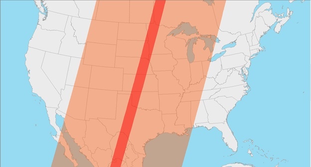 Figure 1 - Example of a 185 km Landsat 9 OLI swath (red) compared to a 2,330 km Terra MODIS swath (orange). Terra MODIS can easily image the entire continental US daily in three consecutive orbits. However, Landsat 8 and Landsat 9 OLI each require multiple orbits over 16 days to provide the same coverage.
How do these characteristics affect the daily availability of active fire data?
The relatively large swath widths of VIIRS and MODIS sensors provide comprehensive satellite observations and derived active fire detection data for the entire globe on a daily basis. Additionally, both sensors provide multiple observations daily within a relatively short period of time where consecutive swaths may overlap, more so at higher latitudes (Fig 2).
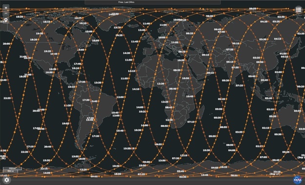 Figure 2 - Example of MODIS and VIIRS orbit tracks showing overlap between tracks, especially at higher latitudes.
Conversely, each Landsat OLI sensor requires 16 days to completely image the surface of the Earth. So, OLI cannot fully image large geographic areas in one day, such as the continental United States, and can only provide partial coverage. However, since the orbits of the two Landsat satellites are 8 days out of phase, the combined temporal resolution of the two OLI sensors enables complete coverage once every 8 days (Fig 3).
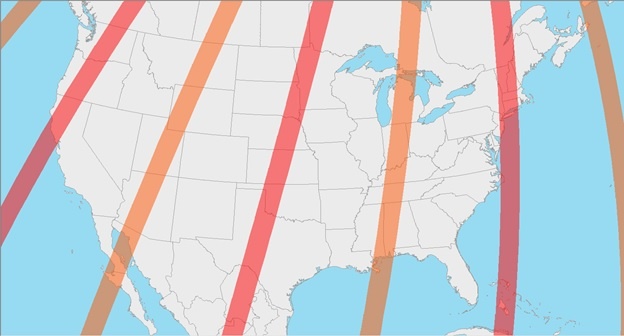
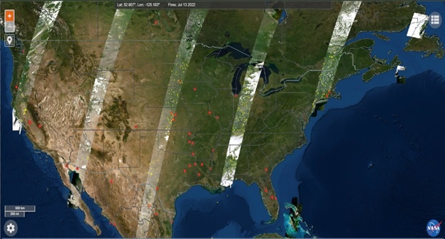
Figure 3 – The top graphic provides an example of the swath coverage for the continental US by OLI onboard Landsat 8 (orange) and Landsat 9 (red) on July 13, 2022. Orbits for each satellite move to the east and west daily and complete a full cycle of coverage every 16 days. The bottom graphic displays the HLS imagery product in FIRMS for July 13, 2022, which contains the acquired Landsat 8 and Landsat 9 imagery over land. Areas along each swath that exceed the predetermined cloud cover threshold are excluded from HLS product in FIRMS. The combined daily coverage of OLI on both Landsat satellites can image the entire continental US, and the globe, every 8 days.
When viewing daily active fire detection data in FIRMS, users should be aware of the high temporal resolution characteristics of VIIRS and MODIS versus Landsat. In Figure 4, active fires detected by Terra MODIS and Landsat on September 10, 2022, for the Pacific Northwest are provided. Landsat active fire detection data, displayed as yellow points, is only available within the 185-kilometer OLI swath. However, MODIS active fire detection data, displayed as red points, is available for the entire region within and outside of the OLI swath. Consequently, updates to the finer resolution Landsat active fire detection data for the entire Earth cannot be provided daily.
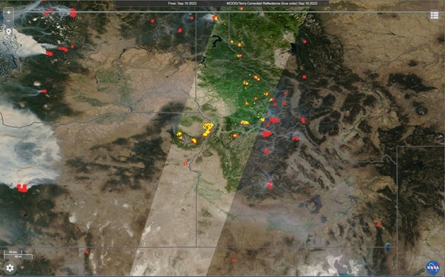
Figure 4 - Active fires detected in the Pacific Northwest on September 10, 2022. 1 kilometer MODIS active fire detections (red) are available for the entire region while 30-meter Landsat 9 active fire detections (yellow) are limited to the 185-kilometer swath (WRS-2 Path 42) acquired on this date.
Overview
Content Tools