...
The HLS layers are only available in Advanced Mode (basic mode has reduced functionality to minimize the complexity of the interface).
• Go to https://firms.modaps.eosdis.nasa.gov/usfs/map/ or https://firms.modaps.eosdis.nasa.gov/map/
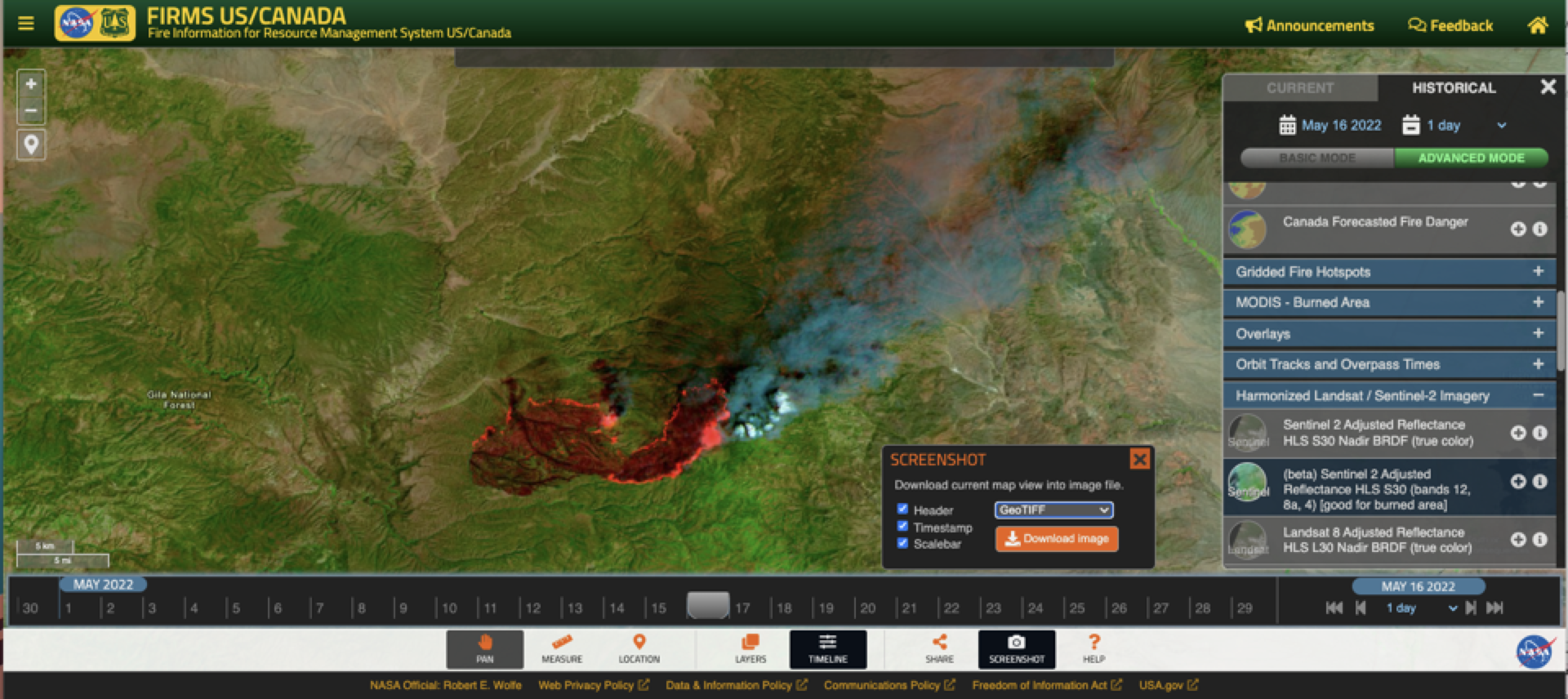
• Toggle the “Advanced Mode” button in the upper right .
• Toggle the “Historical” button in the upper right.
• The HLS Landsat and Sentinel 2 imagery are in the “Harmonized Landsat/Sentinel-2” grouping in the table of contents.
• Use the tools/prompts to access and view the imagery.
• Toggle on the True Color imagery first to get a good idea of where the FCC data can be expected on a given day.
Use the screenshot tool to create a GeoTIFF of the image to enable the image to be imported in to a GIS.
Some things to note:
• The HLS imagery is not near real-time data. It is currently available about 2 -4 days after acquisition.
• The reach back on this service goes back to March 15, 2022.
• As the FCC is dynamically generated, it may take slightly longer to display than the True Color imagery through GIBS. We are monitoring the performance of the HLS FCC imagery and welcome feedback.
• Zoom scale to display the false color composite data is currently set to 11 through 14, but true color can be viewed at smaller scales. The zoom level is indicated at the very end of the URL (e.g., 11z).
• Orbit tracks for Landsat 8 and Sentinel 2A and 2B are available as layers in the table of contents.
• Landsat 9 data is anticipated to be incorporated into the HLS product in late April. At that time, or soon thereafter, it will be part of the HLS service in FIRMS.
...