Get information and zoom to extent of wildland fires
The new FIRMS US/Canada fire map includes the location and details of wildland and prescribed fires. Locations of currently/recently active incidents larger than 100 acres (40.5 hectares) are displayed as fire icons when you open the US & Canada Fire Map. Click USA Active Fires and Canada Active Fires layers to toggle them off.
Click on a fire location to view the name, discovery date/time and current size of the fire. This information is routinely updated and maintained in systems of record managed by US and Canadian wildland fire management agencies. Clicking the View Situation Report link spawns a national situation report which may contain specific reporting information about the fire of interest. Additionally, by clicking the ZOOM TO LOCATION button, your map extent will automatically zoom to the extent of that fire.
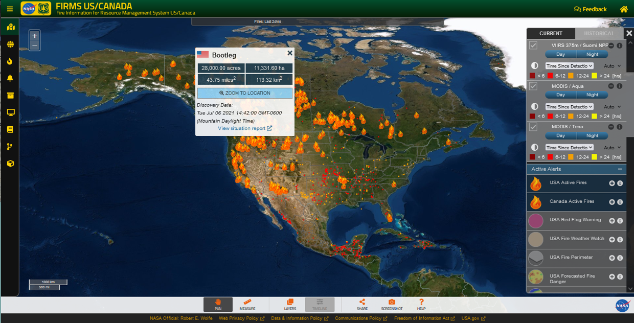 Clicking on a fire location provides information about the fire and the option to zoom to the map extent of the selected fire.
Perimeters for current US wildland fires
For wildland fires currently occurring in the US larger than 100 acres in size, fire perimeters are provided for context. These data are typically compiled by federal, state and local fire management agencies on a routine basis during the life of an incident, however, they may not be available for all incidents. These data are typically updated daily from multiple sources and indicate the current extent of the fire and containment lines. Click on USA Fire Perimeter layer to display the fire perimeter data in the FIRMS US/Canada Fire Map.
When using perimeters in the context of satellite active fire detection data, this can indicate where a fire is active within the perimeter and if it is growing outside of it. Additionally, if the fire perimeter is not fully covered by cumulative active fire detections, gaps in that coverage may indicate where the fire has grown in between observations by polar-orbiting satellite sensors like MODIS and VIIRS, cloud cover at the time of satellite overpass occluded observations when the fire was actively burning, or fire activity was smaller and/or less intense at the time of satellite overpass or was not detectable under the vegetation canopy. Isolated active fire detection pixels outside of the perimeter can be indicative of detections occuring towards the edge of a swath which results geolocational errors due to the increasingly distorted field of view in the scan track direction, particularly for MODIS.
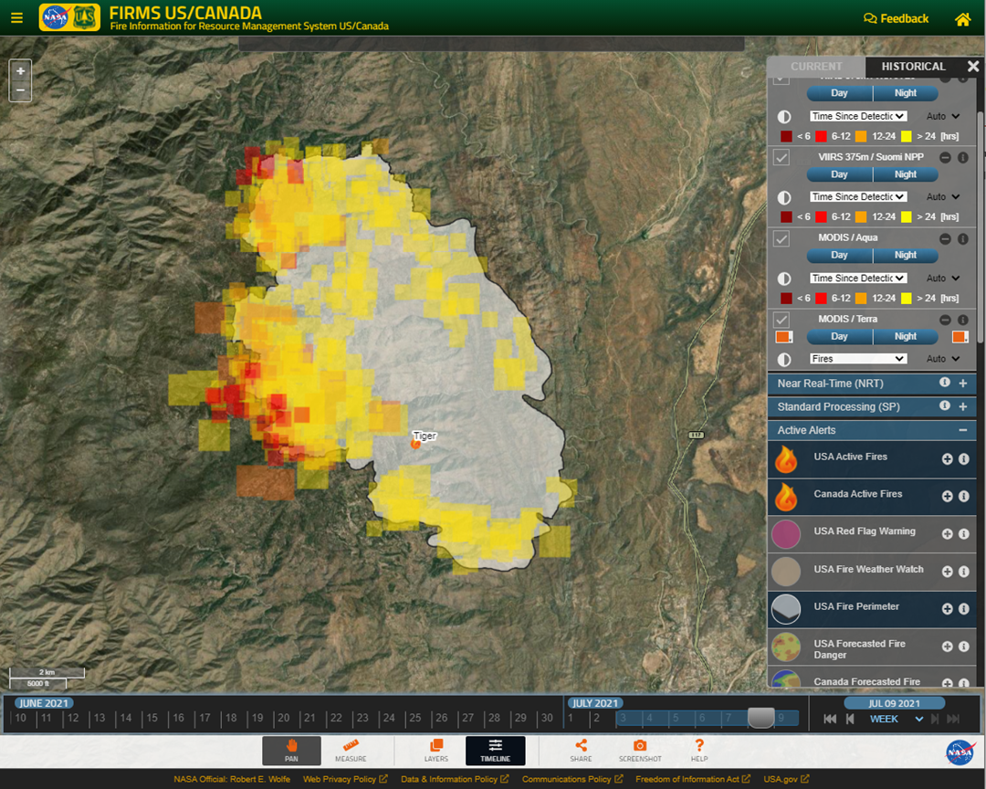 Visualization of MODIS and VIIRS active fire detection data in the context of a current perimeter for a wildland fire.