Page History
New Imagery in GIBS and Worldview
GIBS and Worldview continues to expand their offerings of imagery - we have incorporated a whole bunch of new imagery for you to use and interact with!
| UI Expand | ||
|---|---|---|
| ||
Daily
Monthly
Other time periods
Polar layers
|
| UI Expand | ||
|---|---|---|
| ||
|
Worldview 1.4.0 release - New features galore!
Worldview has incorporated some exciting new features to help you explore the planet! In addition to the features mentioned below, we have also included an auto-disable function which prevents a layer from being turned on if there is no imagery available for that date.
Continuous view of the Pacific Ocean
Imagery layers like the MODIS or VIIRS Corrected Reflectance and some other daytime layers can now be viewed over the dateline/antimeridian for the day prior to and after the current date displayed. This allows for an unbroken view of the Pacific Ocean as observed by the satellites.
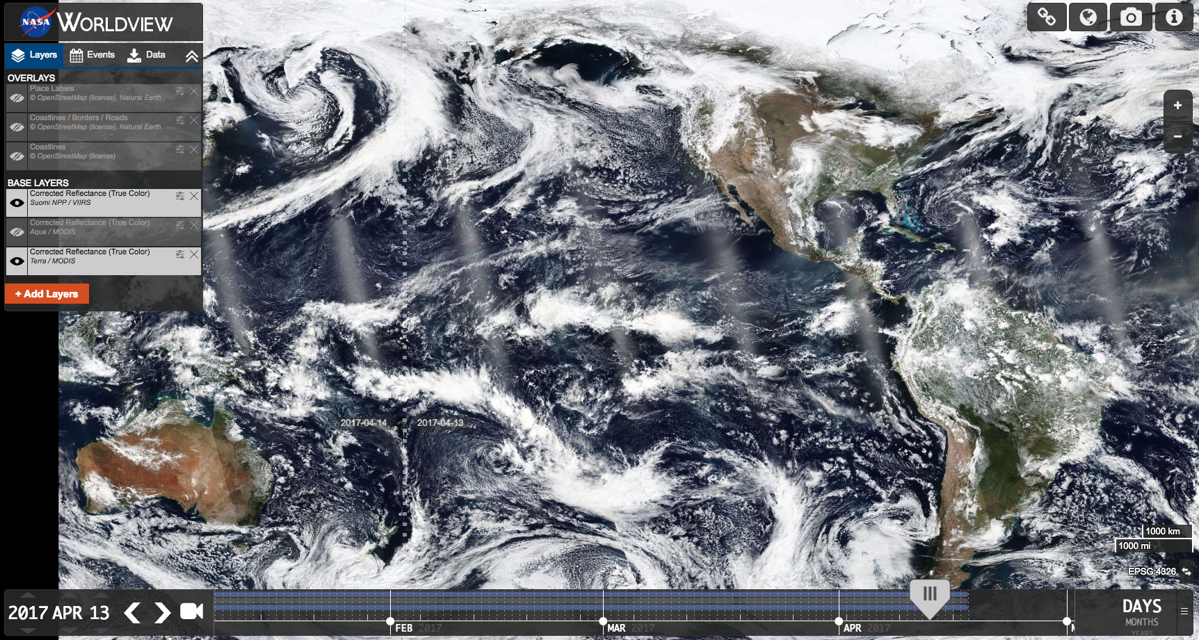
It is now possible to view the Pacific Ocean in a continuous, unbroken view in Worldview. Imagery to the left of the dateline/antimeridian displays April 14 while the imagery to the right of the dateline/antimeridian is April 13.
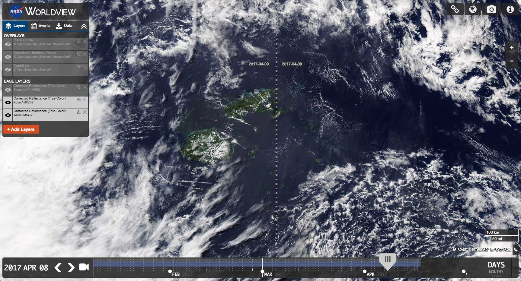
Fiji is an archipelagic country comprised of 300+ islands. Worldview’s new feature allows you to view the entire country since imagery is now displayed across the dateline/antimeridian. Imagery on the left is for April 9 and imagery on the right is for April 8.
Find the information that you’re interested in
Users can now view the data value under the cursor in the respective layer's legend/color bar for relevant discrete/continuous data visualization layers.
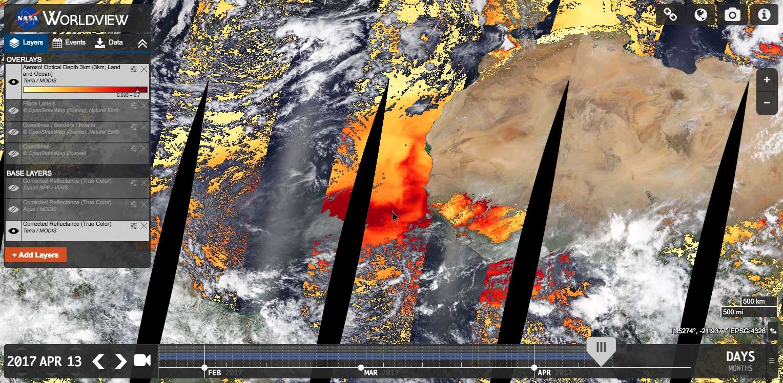
Hover over any location on a layer with a legend/color bar. You will be able to see the corresponding value to that color in the legend. Hovering over the location off the coast of West Africa, where a dust storm is occurring shows an Aerosol Optical Depth of 0.695 – 0.7.
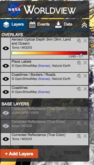
Close up of the legend showing the corresponding image data value.
Updates to the Natural Events Feed – Easier to find events and distinguish between events
A marker or bounding box has been added to illustrate an event’s location shown in the Events feed.
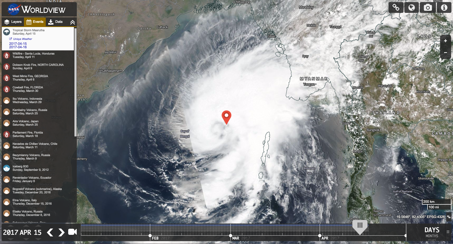
Marker showing the location of Tropical Storm Maarutha on April 15, 2017
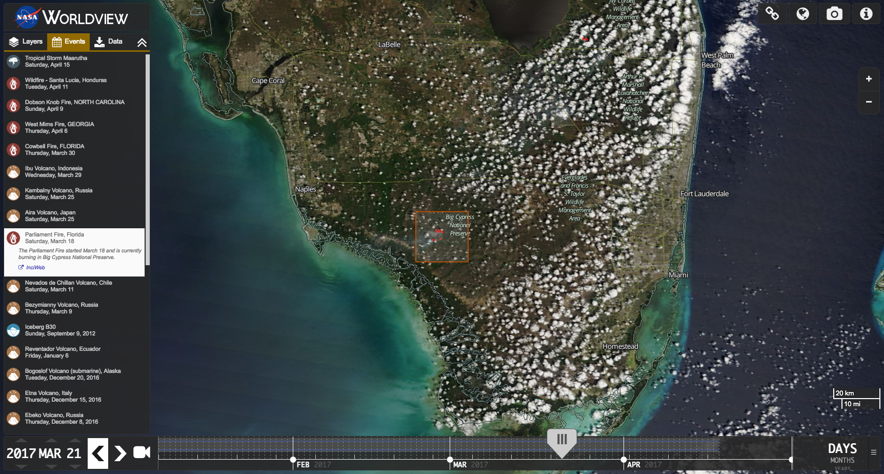
Bounding box showing the location of the Parliament Fire in Florida on March 21, 2017
Icons have been added to differentiate between natural event categories in the Events feed.
![]()
Natural events icons – Many thanks to our newest contributor, CodeMacabre, for developing these beautiful icons!
Overview
Content Tools