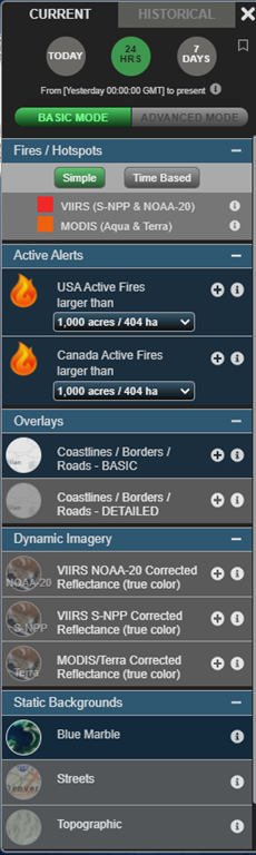
Basic Mode
FIRMS provides a comprehensive array of near real-time NASA Earth observations and derived science data products to detect the location and extent of fire activity and its effects on the land and atmosphere. FIRMS has recently implemented a scalable user interface to better meet the needs and use cases of various users. When initiating the fire map for either FIRMS Global or FIRMS US/Canada FIRMS, the user interface to the right of the map window defaults to BASIC MODE. In this mode, a focused list of commonly used layers is presented to the user for display. This list includes MODIS and VIIRS active fire detection data, locations of current US and Canada large wildland fires, true color MODIS and VIIRS satellite imagery and particular background and overlay layers.
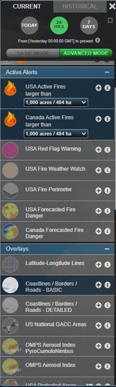
By simply selecting the button, users can choose to toggle to ADVANCED MODE. In this mode, all available FIRMS layers are provided for users to access and display. This includes false color MODIS and VIIRS satellite imagery, MODIS and VIIRS land and atmosphere science data products, additional sources of satellite imagery, contextual layers for wildland fire management, and several overlay and background layers.
As with other user-applied customizations to the fire map, when a bookmark is created, the map will retain the applied mode when you return to the map using that referenced bookmark.
FIRMS is continuing to add relevant sources of Earth observation data and science data products. Please stay tuned as we continue to introduce these additional sources of data and associated tools and utilities.
Advanced Mode