Page History
Worldview
recently released new imagery in version 3.9.
Location Search allows users to type in a location name, or coordinates and a marker will be placed on the map. Conversely, a marker can be placed on the map to retrieve the coordinates and place name (if available). Location Search is in the upper right corner of Worldview.
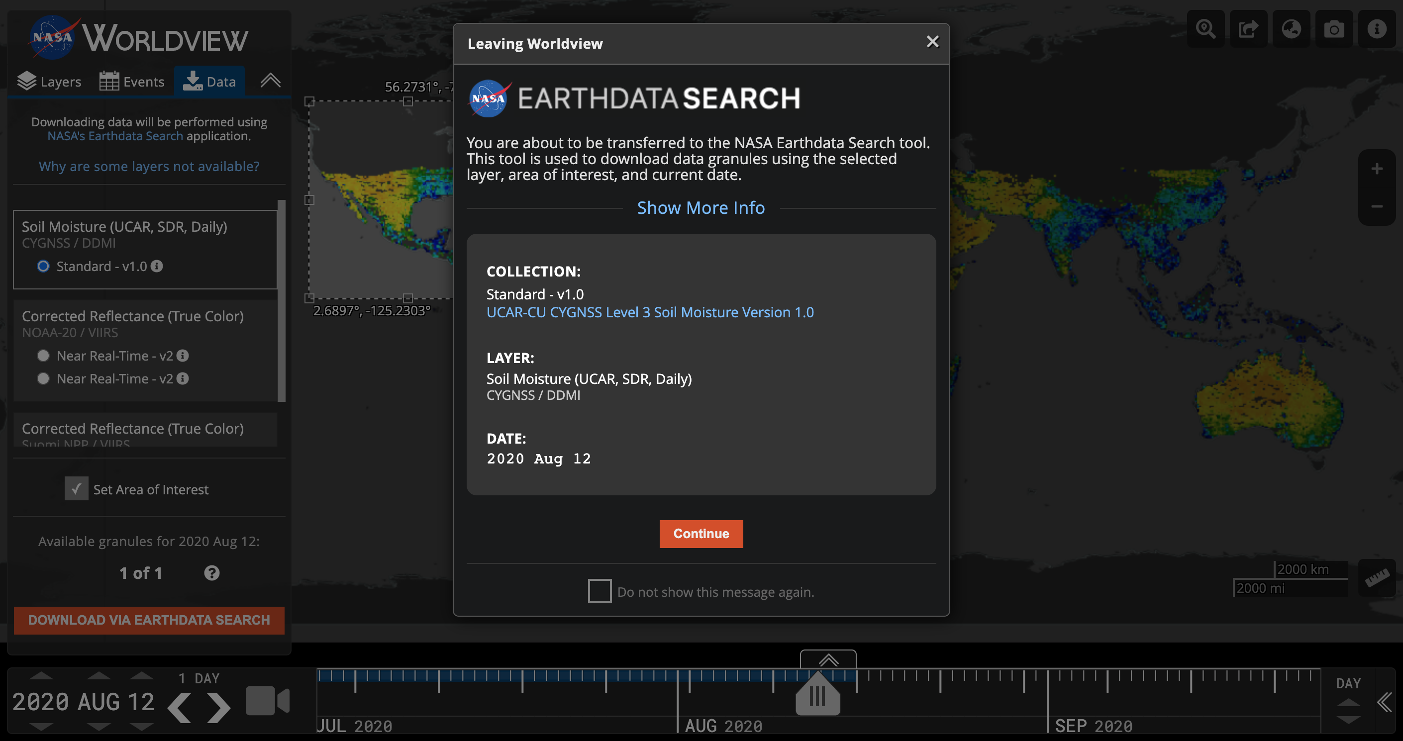
Data Download via Earthdata Search: While Worldview has had a data download capability before, in the past it had been limited to only about a third of the layers. We have now extended this capability to almost all of the layers available in Worldview and provided provided a more robust method of getting users into Earthdata Search, EOSDIS' data discovery and access tool.
Layer Grouping: Layers in the Layer List can now be grouped to more effectively place similar layer visualization types together in the same category making it easier to manipulate a group than individual layers.
Read more about these updates in the Earthdata article, "EOSDIS Worldview Version 3.9.0 Makes Finding, Viewing, and Downloading NASA Earth Data Easier than Ever".
1 including MODIS Flood Product, and CYGNSS Soil Moisture.
The beta version of the Moderate Resolution Imaging Spectroradiometer (MODIS) Near Real-Time (NRT) Global Flood Product (MCDWD) provides a daily global map of flooding. It is derived from the NRT MODIS Surface Reflectance (MOD09) datasets from both the Terra and Aqua satellites. The Flood Product is available for 3 compositing periods: 1-day, 2-day, and 3-day. A pixel is marked as water when water detections from all observations from Terra/MODIS and Aqua/MODIS are gathered for each compositing period, with the 3-day window accumulating 3 days worth of observations thereby most likely to include the least number of false positive detections. (Note: 1-day product not yet available in Worldview). Users are advised to compare the flood product against the contributing MODIS reflectance imagery (such as 7-2-1 Corrected Reflectance; search for “721” after clicking “+ Add Layers”) for the compositing period to ensure reported flood areas do not correspond to areas of cloud shadow and other obscurations. Imagery is available starting 1 January 2021. Learn more about the MODIS Flood Product in the User Guide and the FAQs.

Image of flooding in a river flood plain in northwestern Australia as highlighted by the Flood 3-Day Window layer in red. Visit Worldview to interact with the layers: https://go.nasa.gov/2Qm9dq7
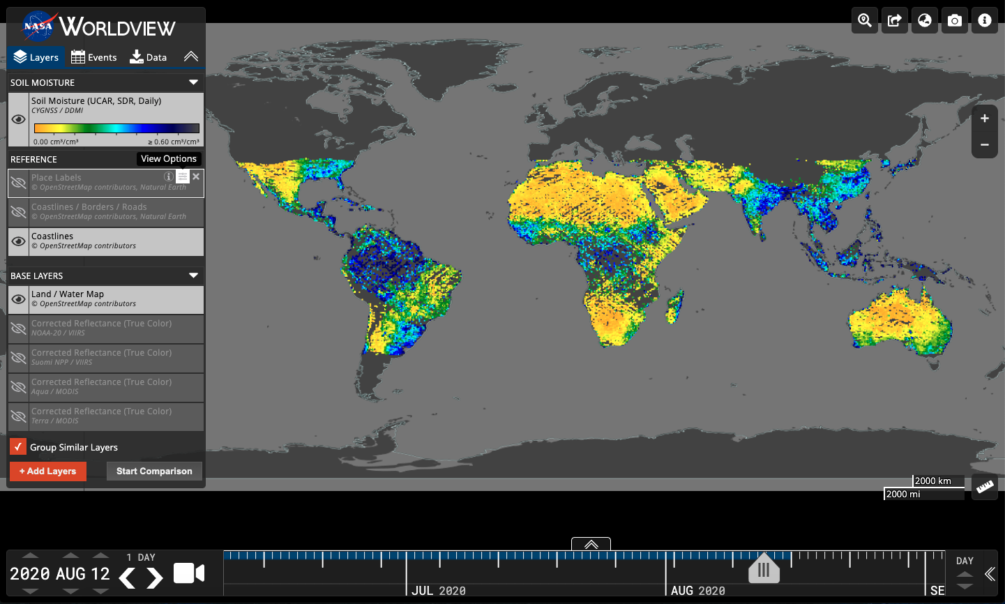
CYGNSS Soil Moisture layer in Worldview: https://go.nasa.gov/3a4RDxT
Worldview also added the Cyclone Global Navigation Satellite System (CYGNSS) Soil Moisture layer which provides volumetric water content estimates for soils between 0-5 cm depth in units of cm3/cm3 for most of the subtropics. The data were produced by CYGNSS investigators at the University Corporation for Atmospheric Research (UCAR) and the University of Colorado at Boulder (CU), and derived from version 2.1 of the CYGNSS L1 Science Data Record (SDR). The soil moisture algorithm uses collocated soil moisture retrievals from Soil Moisture Active Passive (SMAP) satellite to calibrate CYGNSS observations from the same day. For a given location, a linear relationship between the SMAP soil moisture and CYGNSS reflectivity is determined and used to transform the CYGNSS observations into soil moisture. The spatial resolution is 36km and temporal resolution is daily. The temporal coverage is 18 March 2017 - 16 August 2020. Dataset doi: 10.5067/CYGNU-L3SM1
As always, more exciting updates are coming soon including updated and higher resolution reference labels, coastlines, borders and roads that will work well with the 30 meter resolution Harmonized Landsat Sentinel 2 imagery!
Overview
Content Tools