Page History
...
QE_CoverageResult provides a means to document the quality associated with coverages (as defined by MD_Format).
| Expand | ||||
|---|---|---|---|---|
|
LE_Lineage
LE_Lineage adds additional lineage/quality information relating to:
- Processing and process steps
- Algorithms
- Source(s)
- Geospatial relationships between pixels (nominal resolution)
| Expand |
|---|
|

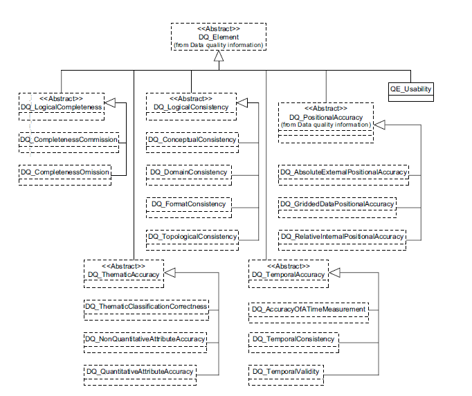
QE_Usability
QE_Usability provides a means to documents the utility of a data entity relative to a user's requirements.
| Expand | ||||||||||
|---|---|---|---|---|---|---|---|---|---|---|
|
Spatial Extensions to ISO 19115-2
...
MI_Georectified (includes information to allow for the geolocational validation of gridded data), MI_Georeferenceable (extends the 19115 class to include information that can be used to geolocate raster imagery) and the associated classes comprise extensions required to specify the spatial representation for imagery and gridded data.
| Expand |
|---|
|

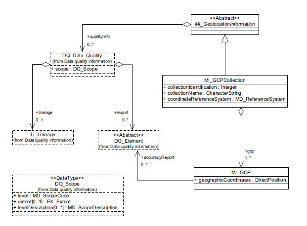
Ground Control Point Quality
Provides information relevant to the quality of GCPs.
| Expand |
|---|
|
Content Information
19115-2 provides extensions to allow for description of the content of imagery and gridded data datasets.
| Expand |
|---|
|

Acquisition Information
Acquisition Overview
Acquisition Overview pertains to the metadata classes required to define the acquisition of imagery and gridded datasets.
| Expand | ||||
|---|---|---|---|---|
|
Acquisition Details
Acquisition Details contains means to document the specific acquisition of imagery and gridded datasets.

...
| Expand |
|---|
|
Overview
Content Tools