Versions Compared

Key

  • This line was added.
  • This line was removed.
  • Formatting was changed.
Comment: Overhauled ArcGIS Desktop section

Adding GIBS layers to ArcGIS Online as Several GIS and imagery viewing tools support access to NASA's Global Imagery Browse Services (GIBS) via OGC Web Map Service (WMS), Web Map Tile Service (WMTS) and Tiled Web Map Service (TWMS) protocols. Listed below is a set of these tools along with instructions and screen captures to help import imagery into them.

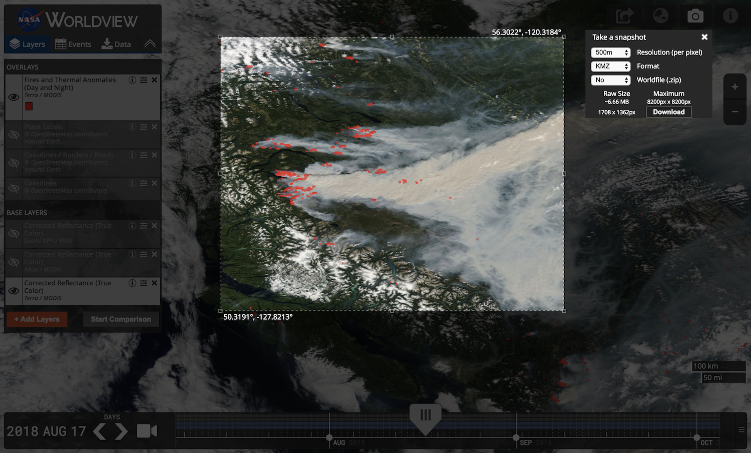
Please note: many existing GIS applications do not currently handle time-varying imagery layers, especially with WMTS sources.  The primary suggested method for access within GIS clients is through WMS as this protocol has better time support.  Alternatively, Worldview's "image capture" tool (camera icon in upper right) can be used to export imagery as a GeoTIFF which can then be imported into your application.


UI Expand
titleESRI ArcGIS/ArcMap

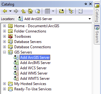
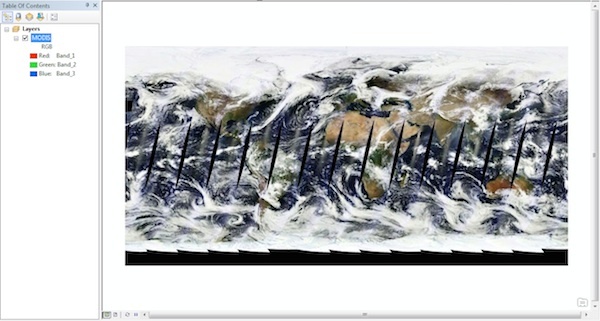
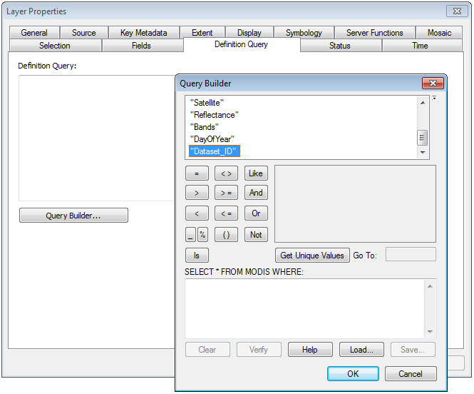
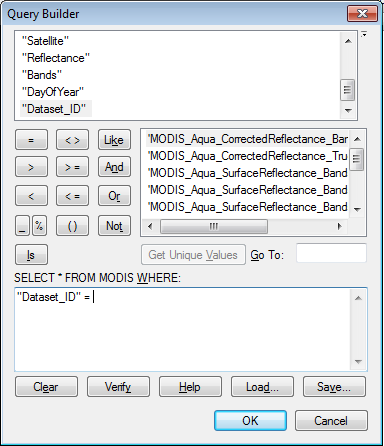
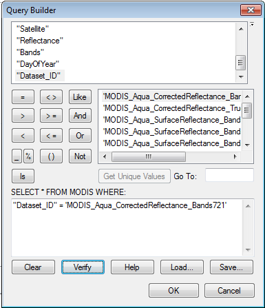
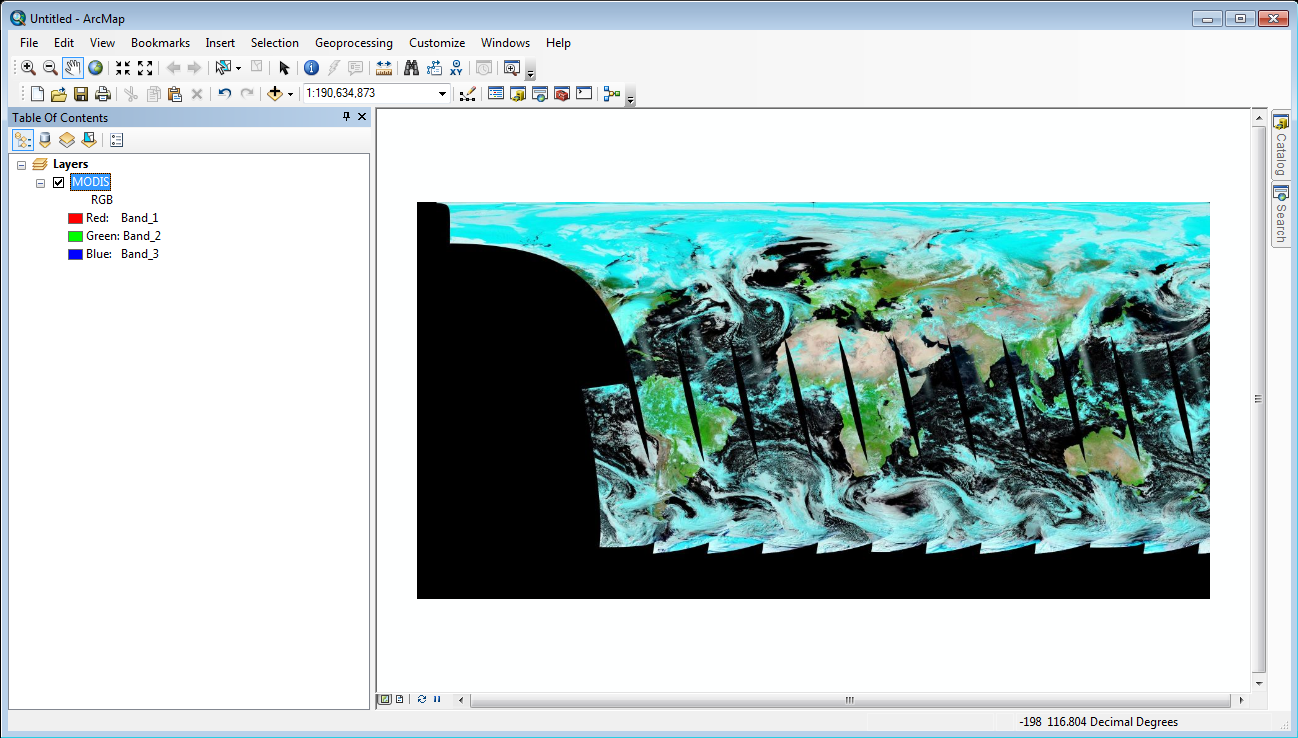
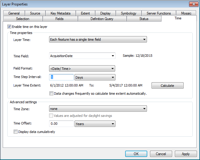
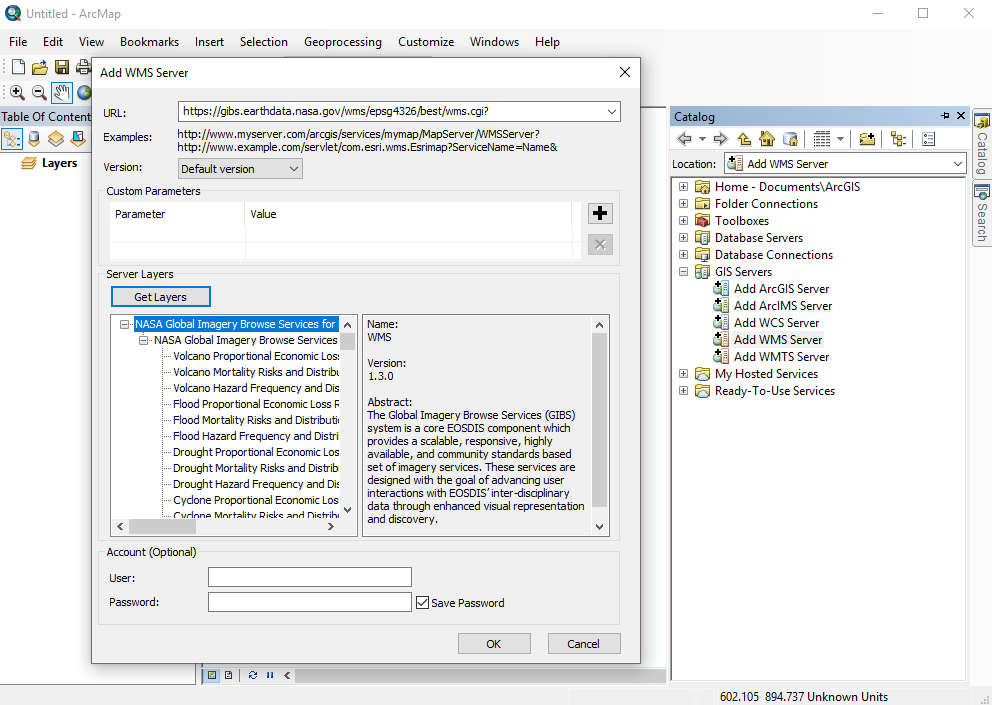
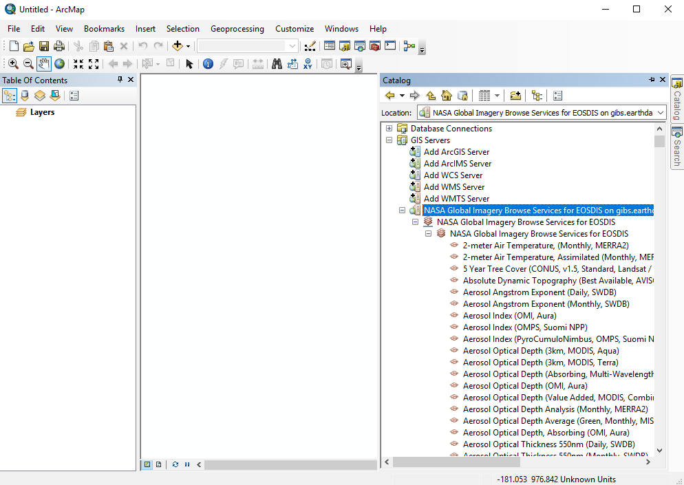
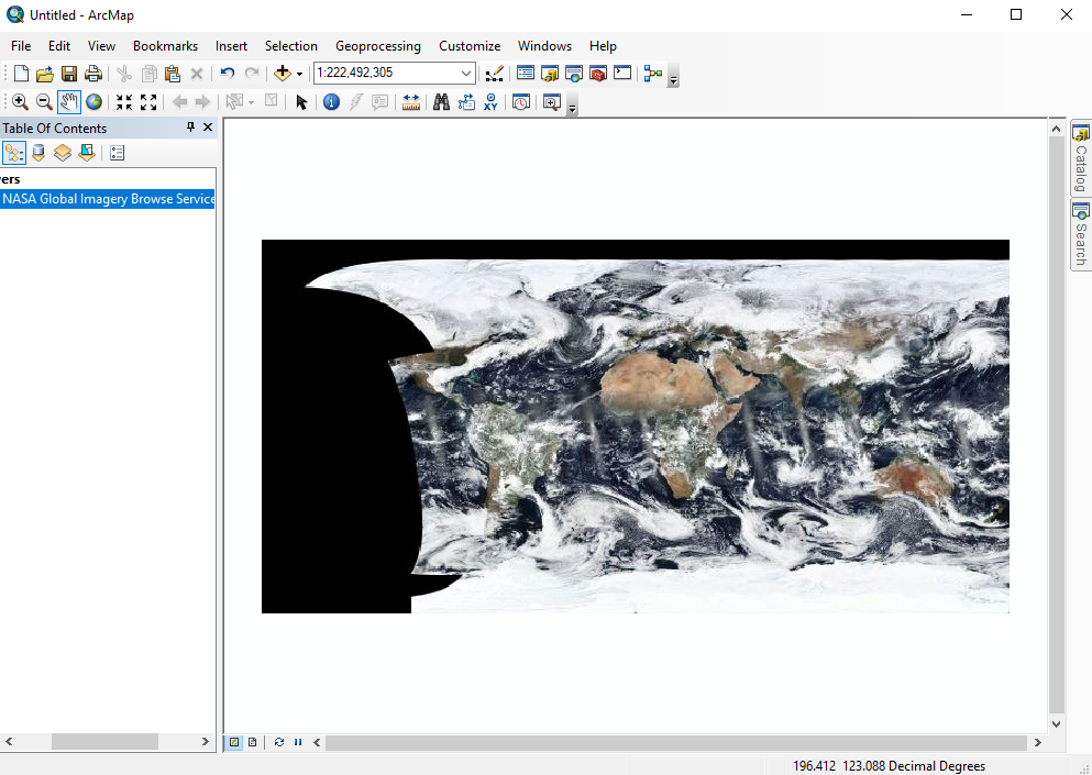
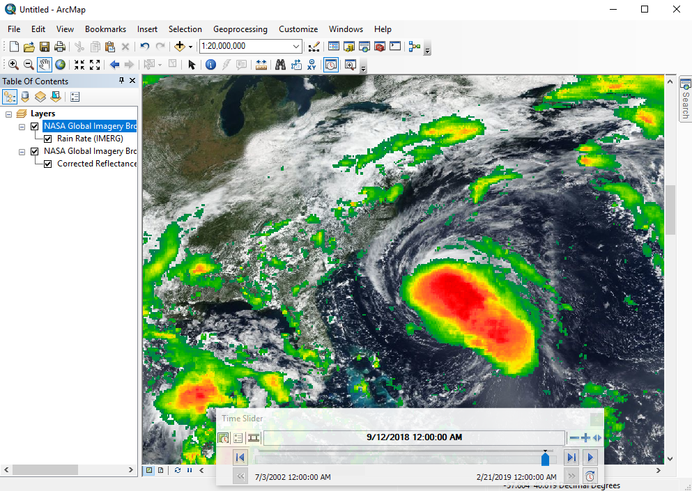
GIBS imagery layers can be directly imported into ESRI ArcGIS/ArcMap 10.2.1 or later . It uses an ESRI-run relay service which adds an ArcGIS Server interface layer in front of GIBSusing the WMS protocol.

Requirements

  • ESRI ArcGIS ArcMap 10.2.1 or later (earlier versions are untested, though possibly usable)

Instructions:

  • Open the "Catalog" window (far right pane) in ArcMap and select "Add ArcGIS WMS Server":

Image Removed

Image Removed

  • Drag that to your layer list:

Image Removed

  • To adjust the visible layer, right-click on "MODIS", then "Properties...".
  • Go to the "Definition Query" tab and click "Query Builder..."

Image Removed

  • Select "Dataset_ID" from the list at the top and then click the "Get Unique Values" button:

Image Removed

  • In the box below "SELECT * FROM MODIS WHERE:", enter "Dataset_ID" = as shown here:

Image Removed

  • Double-click one of the layers (e.g., "MODIS_Aqua_CorrectedReflectance_Bands721") to add it to the query box and click "Verify" to ensure it works properly

Image Removed

  • After clicking OK enough times, you should have imagery on your map for the current day!

Image Removed

  • To enable time controls, right-click on MODIS again from your layer panel and click "Properties..."
  • Click the "Time" tab and then "Enable time on this layer"
  • Change the "Time Step Interval" to 1 Days

Image Removed

  • You should then be able to enable the time widget and change the currently displayed date!

Image Removed

Note: while ArcMap currently supports OGC WMTS layers as does GIBS, the time-varying layers in GIBS are not compatible with ArcMap through WMTS due to the non-standard nature of the "time" parameter in many GIS applications and protocols. The above ESRI relay works around this problem.

Image Added

  • Expand the "NASA Global Imagery Browse Services for EOSDIS on gibs.earthdata.nasa.gov" entry in the catalog pane to reveal the list of available layers

    Image Added


  • Drag any layers of interest (VIIRS Corrected Reflectance in this case) into the layer pane at far left:

Image Added


  • Open the Time Slider panel from the toolbar and choose your date of interest

Image Added


  • Add any additional layers in a similar manner

Image Added

UI Expand
titleESRI ArcGIS Online

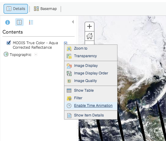
GIBS imagery layers can be imported into ESRI's ArcGIS Online in one of three ways: as a predefined layer, "a Tile Layer", or through an ESRI-run relay service which adds an ArcGIS Server interface layer in front of GIBS.

Adding GIBS layers from a list of ones predefined by ESRI


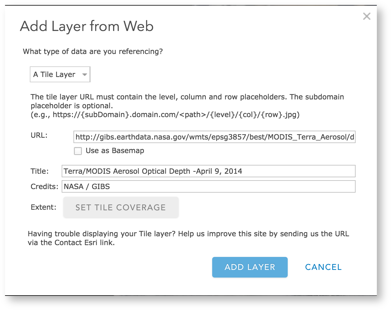
Adding GIBS layers to ArcGIS Online as "A Tile Layer"

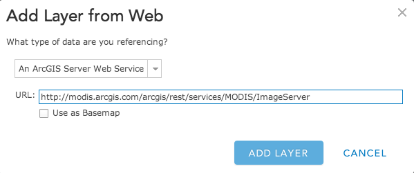
Adding GIBS layers to ArcGIS Online as "An ArcGIS Server Web Service"

  • Create a new map or open an existing one in ArcGIS Online
  • Click the "Modify Map" button in the upper right corner
  • Click the "Add" menu on the left, then "Add Layer from Web"
  • Change the service drop down menu to "An ArcGIS Server Web Service"
  • Add the following URL: http://modis.arcgis.com/arcgis/rest/services/MODIS/ImageServer and click "Add Layer"
  • The default layer is Terra/MODIS Corrected Reflectance and is... difficult to change to others. The time is adjustable at the bottom of the screen


UI Expand
titleGoogle Earth (Web)

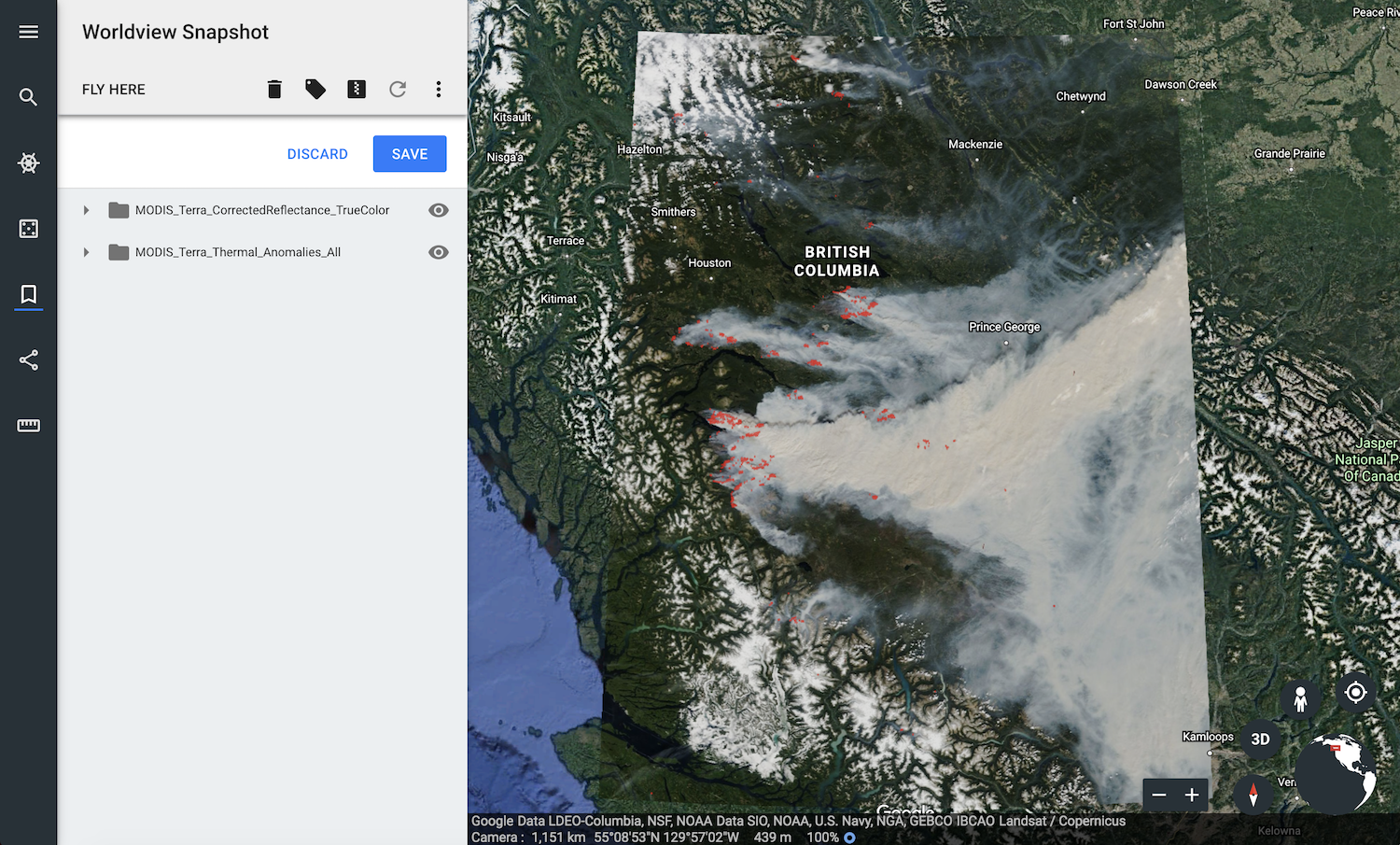
The web-based Google Earth experimentally supports loading of KML/KMZ files which allows you to import GIBS imagery via Worldview's KMZ download capability.

Usage (Generate/Download KMZ file)

  • Start in Worldview to find your imagery of interest.
    • Use Worldview's "camera tool" in the upper right corner to select an image to download and choose the "KMZ" format
    • Click "Download" and save the KMZ file to your computer

  • Open Google Earth
    • Click the "hamburger" button (three horizontal lines in the upper left), and go to Settings; turn on the "Enable KML File Import" setting
    • Click the "hamburger" button again, and go to "My Places"; click the "Import KML File" button and "Open File..."
    • Select the KMZ file that you just downloaded from Worldview


Limitations:

  • As of this writing, the KML files generated by GIBS aren't supported by the web-based version of Google Earth
UI Expand
titleGoogle Earth Pro (Desktop)

GIBS can generate KML files to be used with Google Earth Pro. Those KMLs include pointers to GIBS imagery via the NetworkLink keyword. Users have two options on loading KML files into Google Earth Pro as described below.

Requirements

Usage (Generate/Download KML file)

Using the information on generating KMLs, you can load that downloaded file from within Google Earth (File | Open) or usually by simply double-clicking on the KML file itself. The layer will show up in the "Temporary Places" within the "Places" window.

Usage (Load from within Google Earth Pro)

After launching Google Earth Pro, choose the "Network Link" item from the "Add" menu. Choose whatever Name you wish and in the "Link" field, insert the appropriate link (e.g., https://gibs.earthdata.nasa.gov/twms/epsg4326/best/kmlgen.cgi?layers=MODIS_Terra_CorrectedReflectance_TrueColor&time=2012-06-21). The list of available layers can be found here. For more details on how to compose a proper KML generation request from the GIBS server, see here.


Limitations (both methods):

  • Due to the way NetworkLink is handled in Google Earth Pro for global datasets, you may need to zoom out to a more "global" view before imagery begins loading.
  • When using a KML that contains multiple time steps, the time slider by default usually attempts to display the entire time range simultaneously; this can cause a Z-fighting problem where all time steps are fighting to be shown. To correct the problem, narrow the range of currently-shown time to a single day using the time widget.
UI Expand
titleSCISS Uniview

Use NASA imagery in your planetarium! The SCISS Uniview software supports access to GIBS imagery through the Tiled WMS service endpoint using the geographic projection (EPSG:4326). The list of available products can be found here.

Hide comments