As a long overdue announcement, source code to the EOSDIS Worldview satellite imagery browsing tool is available on GitHub as of April 22, 2014.
↓

https://github.com/nasa-gibs/worldview
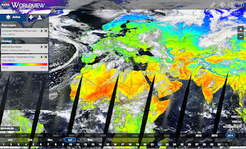
Worldview was originally created to be a reference client to "keep the Global Imagery Browse Services (GIBS) honest" by ensuring its services are usable for client developers. From a user perspective, it provides a mechanism to visually discover "interesting" phenomena within EOSDIS imagery, download that imagery, and also download the underlying data granules which generated the imagery.
We hope that the release of this source code will encourage other client developers to reuse and build upon this work for their own needs. Or if something simpler is needed to start with, there are always the barebones GIBS Web Examples for integrating GIBS imagery with Leaflet, OpenLayers, Google Maps, and Bing Maps.
For questions or comments, please contact us at support@earthdata.nasa.gov.
Overview
Content Tools